23 km | 30 km-effort
Aubrac - Neck de Belvezer
dussaux
User
Length
5.8 km
Max alt
1240 m
Uphill gradient
152 m
Km-Effort
7.9 km
Min alt
1090 m
Downhill gradient
152 m
Boucle
Yes
Creation date :
2017-08-19 00:00:00.0
Updated on :
2017-08-19 00:00:00.0
1h35
Difficulty : Very easy
FREE GPS app for hiking
About
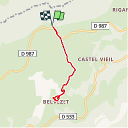
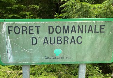
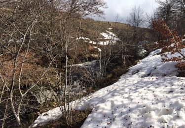
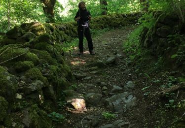
Trail Walking of 5.8 km to be discovered at Occitania, Aveyron, Saint-Chély-d'Aubrac. This trail is proposed by dussaux.
Description
2 h - 6 km
Positioning
Country:
France
Region :
Occitania
Department/Province :
Aveyron
Municipality :
Saint-Chély-d'Aubrac
Location:
Unknown
Start:(Dec)
Start:(UTM)
496148 ; 4940720 (31T) N.
Comments
Trails nearby
Aubrac - St Côme d'Olt - Chemin de St-Jacques de Compostelle
Walking
Very difficult
(1)
Saint-Chély-d'Aubrac,
Occitania,
Aveyron,
France
5h 0min
No
La voie romaine - Saint Chély d'Aubrac
Walking
Medium
(2)
Saint-Chély-d'Aubrac,
Occitania,
Aveyron,
France
19 km | 28 km-effort
5h 30min
Yes
Le Devez cascade et forêts
Walking
Easy
Curières,
Occitania,
Aveyron,
France
11 km | 15.4 km-effort
3h 22min
Yes
Saint Chely Espalion Avril 2018
Walking
Difficult
Saint-Chély-d'Aubrac,
Occitania,
Aveyron,
France
25 km | 34 km-effort
7h 26min
No
Compostelle / Chemin du Puy : de Aubrac à Bonneval
Walking
Difficult
Saint-Chély-d'Aubrac,
Occitania,
Aveyron,
France
33 km | 46 km-effort
11h 0min
No
Cascade du devèz et fosse à loup
Walking
Difficult
Curières,
Occitania,
Aveyron,
France
10.8 km | 15 km-effort
4h 7min
Yes
Mon plus bel Aubrac
Snowshoes
Medium
Curières,
Occitania,
Aveyron,
France
12.4 km | 15.7 km-effort
4h 52min
Yes
S’y chely
Walking
Difficult
Saint-Chély-d'Aubrac,
Occitania,
Aveyron,
France
22 km | 31 km-effort
6h 16min
Yes
St chely Aubrac
Walking
Difficult
Saint-Chély-d'Aubrac,
Occitania,
Aveyron,
France
21 km | 30 km-effort
6h 34min
Yes