25 km | 40 km-effort
Robi Mourre Negre
deloly
User
Length
25 km
Max alt
1102 m
Uphill gradient
912 m
Km-Effort
37 km
Min alt
341 m
Downhill gradient
918 m
Boucle
No
Creation date :
2018-04-16 23:34:50.832
Updated on :
2018-04-16 23:34:50.832
7h24
Difficulty : Unknown
FREE GPS app for hiking
About
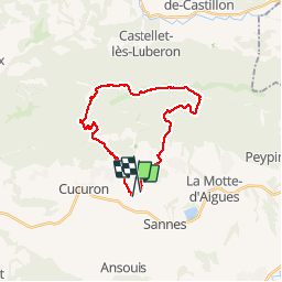
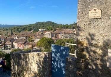
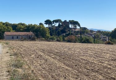
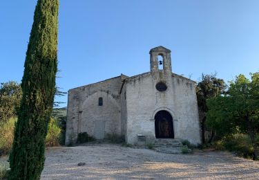
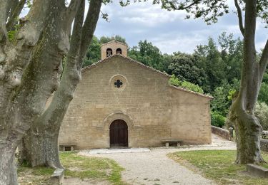
Trail Equestrian of 25 km to be discovered at Provence-Alpes-Côte d'Azur, Vaucluse, Cucuron. This trail is proposed by deloly.
Description
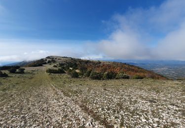
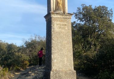
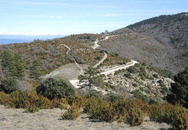
Grand parcours les crêtes du Luberon
Positioning
Country:
France
Region :
Provence-Alpes-Côte d'Azur
Department/Province :
Vaucluse
Municipality :
Cucuron
Location:
Unknown
Start:(Dec)
Start:(UTM)
698766 ; 4849250 (31T) N.
Comments
Trails nearby
Le Coteau des Gamates
Mountain bike
Very difficult
(1)
Cucuron,
Provence-Alpes-Côte d'Azur,
Vaucluse,
France
3h 10min
Yes
le Mourre Nègre
Walking
Medium
Cabrières-d'Aigues,
Provence-Alpes-Côte d'Azur,
Vaucluse,
France
15.7 km | 26 km-effort
6h 34min
Yes
Vaugines - roque rousse. - Vaugines
Walking
Medium
Vaugines,
Provence-Alpes-Côte d'Azur,
Vaucluse,
France
6 km | 9 km-effort
2h 3min
Yes
Cucuron. Vaugine. Cucuron
Walking
Medium
Cucuron,
Provence-Alpes-Côte d'Azur,
Vaucluse,
France
5.3 km | 6.5 km-effort
2h 8min
Yes
SityTrail - PF-Vaugines - Le Mourre Nègre à partir de Vaugines - Var
Walking
Very difficult
(1)
Vaugines,
Provence-Alpes-Côte d'Azur,
Vaucluse,
France
20 km | 32 km-effort
7h 14min
Yes
Cabrières d’Aigues 84
Walking
Very easy
Cabrières-d'Aigues,
Provence-Alpes-Côte d'Azur,
Vaucluse,
France
6.1 km | 7.8 km-effort
2h 14min
Yes
Cucuron Vaugines Cucuron
Walking
Very easy
Cucuron,
Provence-Alpes-Côte d'Azur,
Vaucluse,
France
6.3 km | 7.7 km-effort
2h 5min
Yes
Luberon Vaugines Cucuron
Walking
Easy
Vaugines,
Provence-Alpes-Côte d'Azur,
Vaucluse,
France
10.6 km | 14 km-effort
3h 11min
Yes
PF-Vaugines - Cucuron - l'Ermitage - Vaugines - 17.06.2021
Walking
Medium
(1)
Vaugines,
Provence-Alpes-Côte d'Azur,
Vaucluse,
France
8.3 km | 10.8 km-effort
2h 22min
Yes