Trail Cycle Montaren-et-Saint-Médiers - Mont bouquet Stéphane - Photo
 i20
i20

User

© OpenStreetMap contributors
Length
Length
56 km
Max alt
Max alt
604 m
Uphill gradient
Uphill gradient
991 m
Km-Effort
Km-Effort  
69 km
Min alt
Min alt
117 m
Downhill gradient
Downhill gradient
980 m
Boucle
Boucle
No
Creation date :
2014-12-10 00:00:00.0
Updated on :
2014-12-10 00:00:00.0

(1 Reviews)

Cycle
Cycle
--
Difficulty : Unknown

Scan this QR Code to open this trail in the SityTrail application

FREE GPS app for hiking

Logo SityTrail SityTrail

IGN / Geographical institutes

Download SityTrail from the App Store Download SityTrail from Google Play

Logo SityTrail SityTrail World

The world is yours!

Download SityTrail from the App Store Download SityTrail from Google Play Download SityTrail on Huawei AppGallery

About

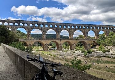
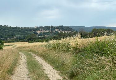
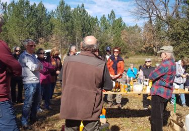
Trail Cycle of 56 km to be discovered at Occitania, Gard, Montaren-et-Saint-Médiers. This trail is proposed by i20.

Elevation profile

Positioning

Country:
France
Region :
Occitania
Department/Province :
Gard
Municipality :
Montaren-et-Saint-Médiers
Location:
Unknown
Start:(UTM)
610506 ; 4876091 (31T) N.

Comments

Please log in to post a review or rate the element


Trails nearby

Trail Walking Uzès - 2 Uzès par ch des amoureux Arpaillargues  - Photo
Walking
caroline116

Walking

Medium
(1)
Uzès, Occitania, Gard, France
8 km | 10 km-effort
1h 51min
Yes
Trail Walking Serviers-et-Labaume - servers labame 2012 - Photo
Walking
caroline116

Walking

Medium
(2)
Serviers-et-Labaume, Occitania, Gard, France
13.8 km | 16.7 km-effort
1h 55min
Yes
Trail Mountain bike Uzès - GARD VTT 2017 J3 - Photo
Mountain bike
Mariolebeno

Mountain bike

Medium
(2)
Uzès, Occitania, Gard, France
48 km | 60 km-effort
3h 53min
No
Trail Walking Serviers-et-Labaume - servers labame 2012 - Photo
Walking
caroline116

Walking

Medium
(2)
Serviers-et-Labaume, Occitania, Gard, France
7 km | 8.5 km-effort
1h 56min
Yes
Trail Electric bike Uzès - Balade au pont du Gard - Photo
Electric bike
verpoorten

Electric bike

Easy
Uzès, Occitania, Gard, France
29 km | 33 km-effort
2h 30min
Yes
Trail Mountain bike Arpaillargues-et-Aureillac - 20210628 Arpaillargues Saint Quentin Saint Siffret - Photo
Mountain bike
NanardPet

Mountain bike

Difficult
Arpaillargues-et-Aureillac, Occitania, Gard, France
38 km | 44 km-effort
2h 59min
Yes
Trail Walking Serviers-et-Labaume - serviers - Photo
Walking
poisson1103

Walking

Very easy
Serviers-et-Labaume, Occitania, Gard, France
12.5 km | 15.2 km-effort
5h 57min
Yes
Trail Other activity Aigaliers - aigaliers - Photo
Other activity
caroline116

Other activity

Very easy
(1)
Aigaliers, Occitania, Gard, France
6.7 km | 8.7 km-effort
1h 44min
Yes
Trail Mountain bike Saint-Quentin-la-Poterie - saintquentinlapoterie - Photo
Mountain bike
jpfrobert

Mountain bike

Medium
(1)
Saint-Quentin-la-Poterie, Occitania, Gard, France
27 km | 33 km-effort
2h 8min
Yes


Close
My subscriptions