Trail Walking Corcy - en forêt de Retz_58_le bois de Hautwison - Photo

en forêt de Retz_58_le bois de Hautwison

forêts de France

© OpenStreetMap contributors
Length
Length
15.9 km
Max alt
Max alt
177 m
Uphill gradient
Uphill gradient
279 m
Km-Effort
Km-Effort  
19.6 km
Min alt
Min alt
72 m
Downhill gradient
Downhill gradient
279 m
Boucle
Boucle
Yes
Creation date :
2018-04-17 11:00:56.866
Updated on :
2020-11-08 13:25:51.298

(0 Reviews)

Walking
Walking
4h45
Difficulty : Medium

Scan this QR Code to open this trail in the SityTrail application

FREE GPS app for hiking

Logo SityTrail SityTrail

IGN / Geographical institutes

Download SityTrail from the App Store Download SityTrail from Google Play

Logo SityTrail SityTrail World

The world is yours!

Download SityTrail from the App Store Download SityTrail from Google Play Download SityTrail on Huawei AppGallery

About

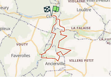
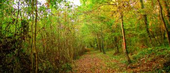
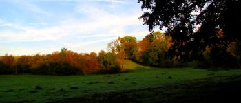
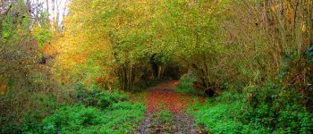
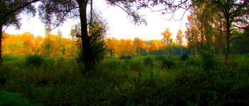
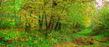
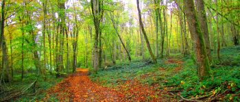
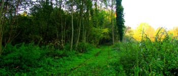
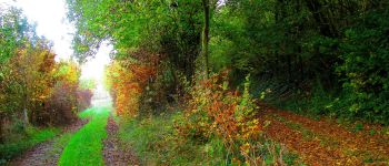
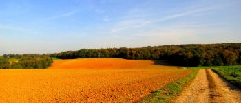
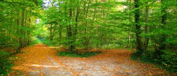
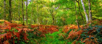
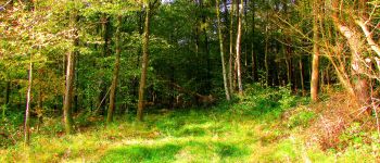
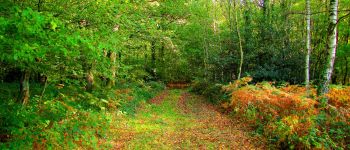
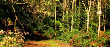
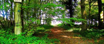
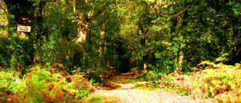
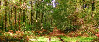
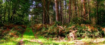
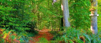
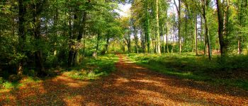
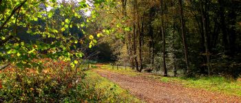
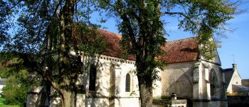
Trail Walking of 15.9 km to be discovered at Hauts-de-France, Aisne, Corcy. This trail is proposed by en forêt de Retz.

Description

voir aussi:
http://foret-de-retz.over-blog.com/
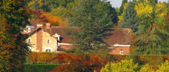
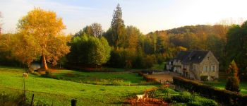
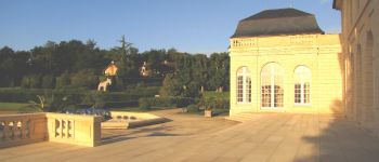
pour les photos du château de Maucreux, vu du parc, (visite privée), voir le lien suivant de mon blog:
http://foret-de-retz.over-blog.com/2017/10/le-domaine-du-chateau-de-maucreux.html

10/ 2017
batterie de recharge pour iphone indispensable

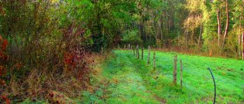
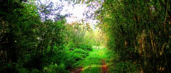
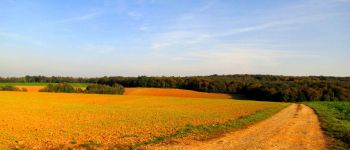
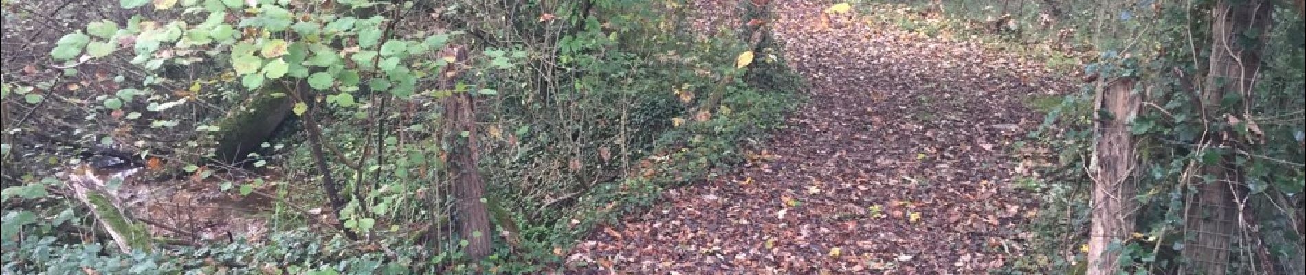
Au départ de l'église de Corcy, suivre la rue "des Prés à Regain" (D80) puis prendre le chemin "la tuilerie". Après avoir dépassé l'étang, continuer sur un sentier (pas de nom) jusqu'à un carrefour avec la route de la Chaussée. Prendre à gauche cette route jusqu'au carrefour suivant. Tourner à droite et suivre le sentier (pas de nom). Arrivé au-dessus de Hauquevesne, prendre à gauche un petit chemin et le suivre jusqu'à la D973. Continuer à gauche sur la D973 (vues du château de Maucreux) jusqu'au carrefour avec le GR11A. Le suivre à gauche jusqu'au bois de Hautwison (carrefour avec la route d'Ancienville, un chemin qui retourne vers Maucreux et la laie du Lapin). Suivre cette laie jusqu'au carrefour avec la laie de Lionval. Tourner à droite et suivre cette laie. Arrivé au carrefour avec la laie de la Loge, suivre à gauche cette laie jusqu'au carrefour de Villers-Petit. Prendre à gauche la route de Villers-Petit jusqu'au carrefour de Maucreux. Suivre à droite la route d'Ancienville jusqu'au carrefour de Javage. Prendre à droite la laie du Lièvre jusqu'au carrefour de la Couture. Suivre à gauche la route de la Chaussée jusqu'au carrefour des Chaussées. Prendre à droite le GR11A (route d'Ancienville) jusqu'au carrefour avec la D80. Suivre à gauche la D80 pour rejoindre Corcy.

Elevation profile

Photos

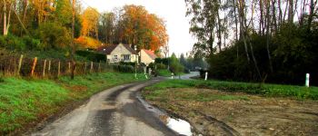
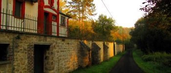
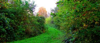
81 photos in total. Please click on a photo to see them all in the gallery.

Points of interest

Point of interest Corcy - Point 1 - Photo
JeanLucA4
CORCY 
Point of interest Corcy - Point 2 - Photo
JeanLucA4
CORCY 
Point of interest Corcy - Point 3 - Photo
JeanLucA4
CORCY 
Point of interest Corcy - Point 4 - Photo
JeanLucA4
CORCY 
Point of interest Corcy - Point 5 - Photo
JeanLucA4
CORCY 
Point of interest Corcy - Point 6 - Photo
JeanLucA4
CORCY 
Point of interest Chouy - Point 7 - Photo
JeanLucA4
CHOUY 
Point of interest Chouy - Point 8 - Photo
JeanLucA4
CHOUY 
Point of interest Chouy - Point 9 - Photo
JeanLucA4
CHOUY 
Point of interest Chouy - Point 10 - Photo
JeanLucA4
CHOUY 
Point of interest Ancienville - Point 11 - Photo
JeanLucA4
ANCIENVILLE 
Point of interest Ancienville - Point 12 - Photo
JeanLucA4
ANCIENVILLE 
Point of interest Ancienville - Point 14 - Photo
JeanLucA4
ANCIENVILLE 
Point of interest Ancienville - Point 17 - Photo
JeanLucA4
ANCIENVILLE 
Point of interest Ancienville - Point 18 - Photo
JeanLucA4
ANCIENVILLE 
Point of interest Ancienville - Point 19 - Photo
JeanLucA4
ANCIENVILLE 
Point of interest Ancienville - Point 20 - Photo
JeanLucA4
ANCIENVILLE 
Point of interest Chouy - Point 21 - Photo
JeanLucA4
CHOUY 
Point of interest Chouy - Point 22 - Photo
JeanLucA4
CHOUY 
Point of interest Chouy - Point 23 - Photo
JeanLucA4
CHOUY 
Point of interest Chouy - Point 24 - Photo
JeanLucA4
CHOUY 
Point of interest Chouy - Point 25 - Photo
JeanLucA4
CHOUY 
Point of interest Chouy - Point 26 - Photo
JeanLucA4
CHOUY 
Point of interest Chouy - Point 27 - Photo
JeanLucA4
CHOUY 
Point of interest Chouy - Point 28 - Photo
JeanLucA4
CHOUY 
Point of interest Chouy - Point 29 - Photo
JeanLucA4
CHOUY 
Point of interest Chouy - Point 30 - Photo
JeanLucA4
CHOUY 
Point of interest Chouy - Point 32 - Photo
JeanLucA4
CHOUY 
Point of interest Chouy - Point 33 - Photo
JeanLucA4
CHOUY 
Point of interest Faverolles - 15 - Photo
JeanLucA4
FAVEROLLES 
Point of interest Chouy - 31 - Photo
JeanLucA4
CHOUY 
Point of interest Corcy - Départ - Photo
JeanLucA4
CORCY 
Point of interest Corcy - Arrivée - Photo
JeanLucA4
CORCY 
Point of interest Faverolles - Point 16 - Photo
JeanLucA4
FAVEROLLES 

Positioning

Country:
France
Region :
Hauts-de-France
Department/Province :
Aisne
Municipality :
Corcy
Location:
Unknown
Start:(UTM)
515349 ; 5455559 (31U) N.

Trails nearby

Trail Walking Longpont - en forêt de Retz_19_Longpont_carrefour de Vauvaudran_AR - Photo
Walking

Walking

Medium
(1)
Longpont, Hauts-de-France, Aisne, France
17.5 km | 21 km-effort
4h 10min
Yes
Trail Walking Corcy - FLEURY .AISNE  - Photo
Walking
TURLUPIN2010

Walking

Medium
Corcy, Hauts-de-France, Aisne, France
5.7 km | 7.9 km-effort
1h 25min
Yes
Trail Walking Corcy - en forêt de Retz_91_04_2022_la Laie de la Belle Epine - Photo
Walking

Walking

Difficult
Corcy, Hauts-de-France, Aisne, France
10.6 km | 13.3 km-effort
3h 32min
Yes
Trail On foot Puiseux-en-Retz - Route du Faîte - Photo
On foot
PRO

On foot

Easy
Puiseux-en-Retz, Hauts-de-France, Aisne, France
5.8 km | 7.1 km-effort
1h 37min
No
Trail On foot Longpont - en forêt de Retz_22_Longpont_Rond d'Orléans_AR - Photo
On foot

On foot

Medium
Longpont, Hauts-de-France, Aisne, France
14.6 km | 17.5 km-effort
Unknown
Yes
Trail Walking Montgobert - en forêt de Retz_83_les Champs Mentard_le Fond d'Argent - Photo
Walking

Walking

Medium
Montgobert, Hauts-de-France, Aisne, France
13.6 km | 16.2 km-effort
3h 46min
Yes
Trail Walking Longpont - en forêt de Retz_77_Longpont_Puiseux en Retz_AR - Photo
Walking

Walking

Difficult
Longpont, Hauts-de-France, Aisne, France
22 km | 27 km-effort
6h 4min
Yes
Trail Walking Montgobert - en forêt de Retz_75_promenade familiale tout temps - Photo
Walking

Walking

Very easy
Montgobert, Hauts-de-France, Aisne, France
3.9 km | 4.7 km-effort
1h 25min
Yes
Trail Walking Longpont - en forêt de Retz_73_ballade (5) en toute saison - Photo
Walking

Walking

Easy
Longpont, Hauts-de-France, Aisne, France
9.1 km | 10.8 km-effort
2h 6min
Yes


Close
My subscriptions