Trail Walking Agos-Vidalos - Agos Vidalos les 7 villages du lavedan-fait - Photo

Agos Vidalos les 7 villages du lavedan-fait

convivialite, sport et fiesta

© OpenStreetMap contributors
Length
Length
18.5 km
Max alt
Max alt
650 m
Uphill gradient
Uphill gradient
505 m
Km-Effort
Km-Effort  
25 km
Min alt
Min alt
410 m
Downhill gradient
Downhill gradient
490 m
Boucle
Boucle
No
Signpost
Signpost
Creation date :
2019-04-29 08:27:14.283
Updated on :
2019-04-29 08:27:14.327

(0 Reviews)

Walking
Walking
5h19
Difficulty : Easy

Scan this QR Code to open this trail in the SityTrail application

FREE GPS app for hiking

Logo SityTrail SityTrail

IGN / Geographical institutes

Download SityTrail from the App Store Download SityTrail from Google Play

Logo SityTrail SityTrail World

The world is yours!

Download SityTrail from the App Store Download SityTrail from Google Play Download SityTrail on Huawei AppGallery

About

Trail Walking of 18.5 km to be discovered at Occitania, Hautespyrenees, Agos-Vidalos. This trail is proposed by Lous Passa camins.

Description

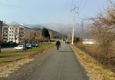
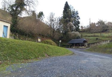
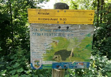
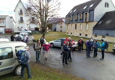
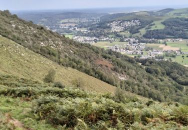
Départ parking des portes des gaves à Agos Vidalos. Une rando longue certes mais oh combien agréable. En montant en direction du fameux pibeste , vous irez visiter la tour de Vidalos, ensuite par les rives du gave , vous traverserez Argelez Gazost. On passe derrière le parc animalier vers la pierre du balandreau, on prendra a G vers Gez et son belvedere. Endroit idéal pour le PN. se diriger vers serres en lavedan, puis salles et Ouzous, ou l'on retrouvera  la voiture (si on a pris la précaution de la laisser à l'arrivée)

Elevation profile

Positioning

Country:
France
Region :
Occitania
Department/Province :
Hautespyrenees
Municipality :
Agos-Vidalos
Location:
Unknown
Start:(UTM)
738842 ; 4769435 (30T) N.

Trails nearby

Trail Walking Argelès-Gazost - Le Mont de Gez en circuit - Argelès Gazost - Photo
Walking
tracegps

Walking

Medium
(1)
Argelès-Gazost, Occitania, Hautespyrenees, France
11.8 km | 20 km-effort
4h 30min
Yes
Trail Electric bike Argelès-Gazost - CABALIROS 30 JUIN 2023 - Photo
Electric bike
GUIDE
harydh

Electric bike

Medium
Argelès-Gazost, Occitania, Hautespyrenees, France
39 km | 57 km-effort
4h 47min
Yes
Trail Walking Argelès-Gazost - ARGELES La boucle de l arrieulat - Photo
Walking
GUIDE
marmotte65

Walking

Difficult
Argelès-Gazost, Occitania, Hautespyrenees, France
10.3 km | 14.6 km-effort
3h 4min
Yes
Trail Walking Ousté - SAINT CRÉAC  le soum de Trémou reco - Photo
Walking
GUIDE
marmotte65

Walking

Difficult
Ousté, Occitania, Hautespyrenees, France
11.2 km | 18.8 km-effort
3h 41min
Yes
Trail Walking Argelès-Gazost - ARGELES-GAZOST chateau et lac d'Arcizans depuis l'Arieulat  faitG - Photo
Walking
GUIDE
marmotte65

Walking

Easy
Argelès-Gazost, Occitania, Hautespyrenees, France
7.9 km | 11.8 km-effort
4h 56min
Yes
Trail Walking Argelès-Gazost - ARGELES Mont de Gez G3 fait - Photo
Walking
GUIDE
marmotte65

Walking

Medium
Argelès-Gazost, Occitania, Hautespyrenees, France
10.2 km | 18.3 km-effort
5h 39min
Yes
Trail Walking Ouzous - Ouzous pibeste-fait - Photo
Walking

Walking

Medium
(1)
Ouzous, Occitania, Hautespyrenees, France
11.3 km | 22 km-effort
4h 29min
Yes
Trail Walking Ouzous - Pic du Pibeste  - Photo
Walking
DuMarsan

Walking

Medium
(1)
Ouzous, Occitania, Hautespyrenees, France
13 km | 25 km-effort
6h 9min
Yes
Trail Walking Lourdes - 65-lourdes-pic-jer-via-AYNE-14km-450m - Photo
Walking
SyMA

Walking

Medium
Lourdes, Occitania, Hautespyrenees, France
14.9 km | 23 km-effort
4h 37min
No


Close
My subscriptions