


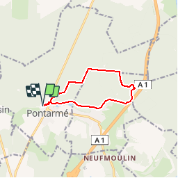


9.2 km | 11.2 km-effort

Randonner avec bonne humeur et convivialité. (Inscription réservée uniquement aux animateurs de GOËLE RANDO)


FREE GPS app for hiking
 SityTrail
IGN / Geographical institutes
SityTrail World
The world is yours!
Trail Walking of 8.6 km to be discovered at Hauts-de-France, Oise, Pontarmé. This trail is proposed by GOELE RANDO.
https://www.goelerando.fr/
DAMMARTIN en GOËLE 77
Départ: Parking face au Chateau de Pontarmé
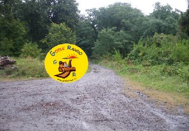
_8.6Km - Photo 1")

Walking

Walking
Walking

Walking

Walking

Walking
Walking

Walking

Walking