Trail Walking Oigny-en-Valois - en forêt de Retz_61_Oigny en Valois_les bordures de la route de Hauwison_AR - Photo

en forêt de Retz_61_Oigny en Valois_les bordures de la route de Hauwison_AR

forêts de France

© OpenStreetMap contributors
Length
Length
16.2 km
Max alt
Max alt
193 m
Uphill gradient
Uphill gradient
271 m
Km-Effort
Km-Effort  
19.9 km
Min alt
Min alt
121 m
Downhill gradient
Downhill gradient
298 m
Boucle
Boucle
No
Creation date :
2018-03-10 09:44:03.595
Updated on :
2020-11-08 13:28:05.806

(0 Reviews)

Walking
Walking
4h56
Difficulty : Very difficult

Scan this QR Code to open this trail in the SityTrail application

FREE GPS app for hiking

Logo SityTrail SityTrail

IGN / Geographical institutes

Download SityTrail from the App Store Download SityTrail from Google Play

Logo SityTrail SityTrail World

The world is yours!

Download SityTrail from the App Store Download SityTrail from Google Play Download SityTrail on Huawei AppGallery

About

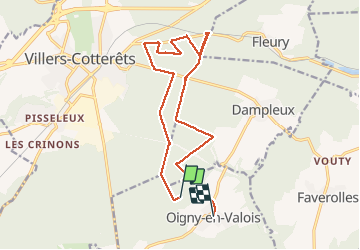
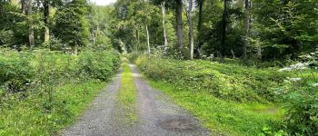
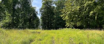
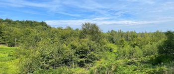
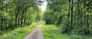
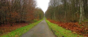
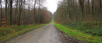
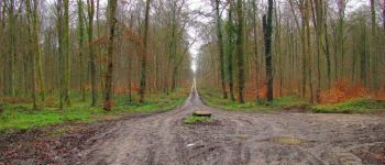
Trail Walking of 16.2 km to be discovered at Hauts-de-France, Aisne, Oigny-en-Valois. This trail is proposed by en forêt de Retz.

Description

01/ 2018
voir aussi mon blog:
http://foret-de-retz.over-blog.com/

batterie de recharge pour iphone indispensable.
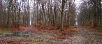
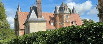
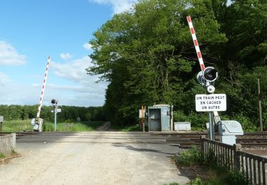
warning: je suis bien parti du château d'Oigny en Valois mais démarré sitytrail 800m après ... trop occupé à deviner la boue sur ma rando préchargée.
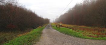
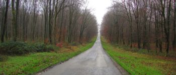
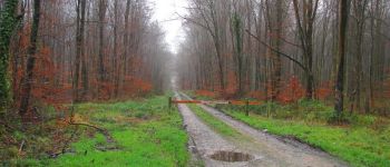
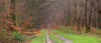
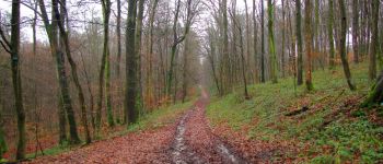
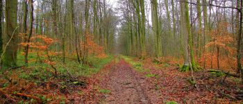
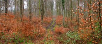
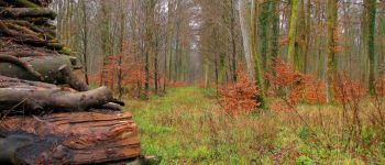
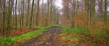
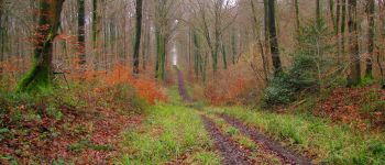
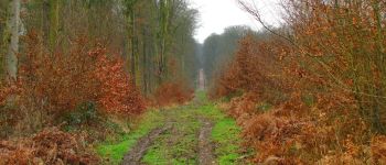
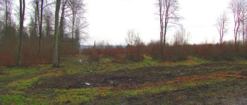
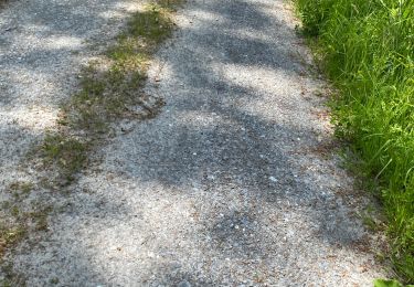
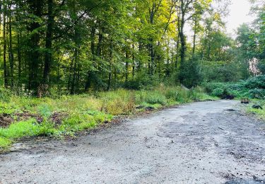
D'une façon générale, de la boue partout pour cette rando compte tenu de la pluie tombée depuis 2 mois.

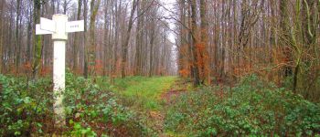
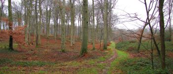
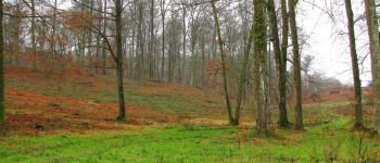
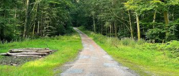
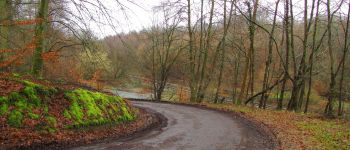
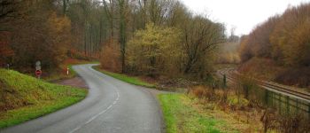
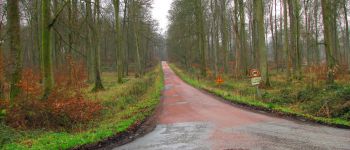
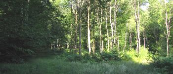
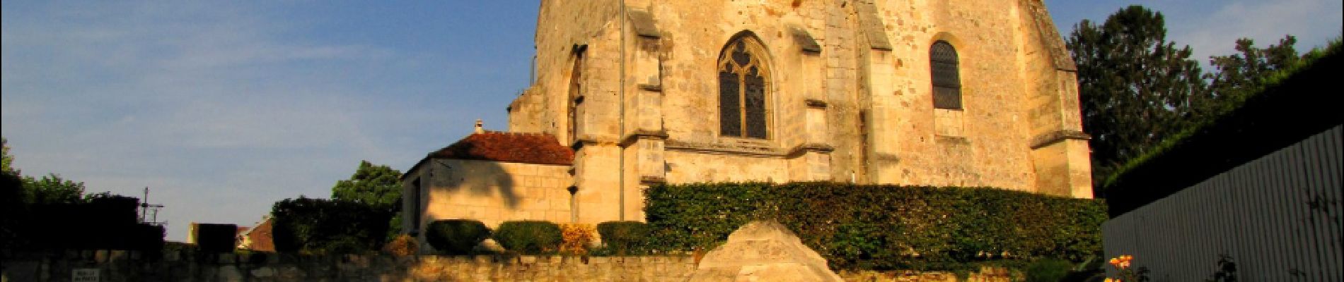
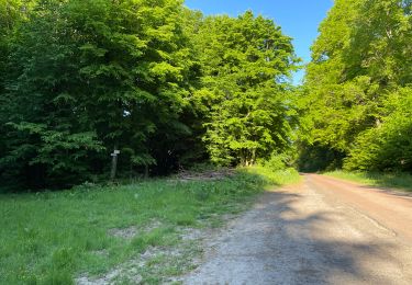
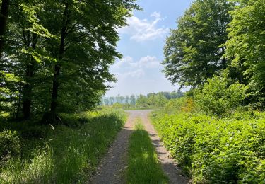
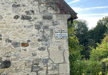
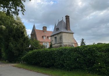
Au départ du château d'Oigny en Valois, rejoindre le GR11 et trouver sur la gauche  un chemin (pas sur cartes) qui conduit à la route Coquetière. La suivre jusqu'au carrefour du Rond de Chatillon. Prendre la route Chrétiennette et la suivre jusqu'au carrefour du Pavé Neuf. Suivre la route de Villers-Cotterêts jusqu'au carrefour du Puits des Sarrasins. Continuer dans la laie du Puits des Sarrasins jusqu'au carrefour Bouet. Tourner à gauche et suivre la D973 jusqu'au carrefour du Chêne Rivet. Prendre la laie de la Marmitte et aller jusqu'au carrefour de la Marmitte. Tourner à droite sur la D80 et continuer jusqu'au carrefour des Petites Ventes. Remonter à droite dans la route Tortue jusqu'au carrefour de la Grotte. Tourner à gauche dans la route de Hautwison et continuer jusq'au carrefour de la Sablonnière. Descendre à gauche dans la laie de la Sablonnière (très boueuse) jusqu'au carrefour des Carrières. Suivre à droite la D80 jusqu'au carrefour des Daims. Remonter à droite dans la laie des Bouquets de Fleury jusqu'au carrefour Maurice Loubet. Tourner à gauche dans la route Chrétiennette et continuer jusqu'au carrefour de Fleury. Remonter la route Chrétiennette jusqu'au carrefour des Dayancourts. Tourner à gauche dans la laie de la Matreuse et la suivre jusqu'au bout (champs). Prendre à droite la route Droite (très boueuse: je l'ai longée en forêt). Arrivé au carrefour des Tourneurs, prendre à gauche la route de Villers-Cotterêts (détour photos au carrefour Fossier) pour revenir au point de Départ.

Elevation profile

Photos

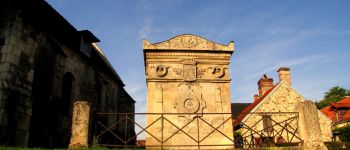
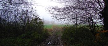
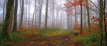
120 photos in total. Please click on a photo to see them all in the gallery.

Points of interest

Point of interest Oigny-en-Valois - Arrivée - Photo
JeanLucA4
OIGNY-EN-VALOIS 
Point of interest Oigny-en-Valois - Point 1 - Photo
JeanLucA4
OIGNY-EN-VALOIS 
Point of interest Oigny-en-Valois - Point 2 - Photo
JeanLucA4
OIGNY-EN-VALOIS 
Point of interest Oigny-en-Valois - Unnamed POI - Photo
JeanLucA4
OIGNY-EN-VALOIS 
Point of interest Oigny-en-Valois - Unnamed POI - Photo
JeanLucA4
OIGNY-EN-VALOIS 
Point of interest Villers-Cotterêts - Unnamed POI - Photo
JeanLucA4
VILLERS-COTTERÊTS 
Point of interest Villers-Cotterêts - Point 6 - Photo
JeanLucA4
VILLERS-COTTERÊTS 
Point of interest Dampleux - Point 7 - Photo
JeanLucA4
DAMPLEUX 
Point of interest Villers-Cotterêts - Point 8 - Photo
JeanLucA4
VILLERS-COTTERÊTS 
Point of interest Villers-Cotterêts - Point 9 - Photo
JeanLucA4
VILLERS-COTTERÊTS 
Point of interest Villers-Cotterêts - Point 10 - Photo
JeanLucA4
VILLERS-COTTERÊTS 
Point of interest Villers-Cotterêts - Point 11 - Photo
JeanLucA4
VILLERS-COTTERÊTS 
Point of interest Villers-Cotterêts - Point 12 - Photo
JeanLucA4
VILLERS-COTTERÊTS 
Point of interest Villers-Cotterêts - Point 13 - Photo
JeanLucA4
VILLERS-COTTERÊTS 
Point of interest Villers-Cotterêts - Point 14 - Photo
JeanLucA4
VILLERS-COTTERÊTS 
Point of interest Villers-Cotterêts - Point 15 - Photo
JeanLucA4
VILLERS-COTTERÊTS 
Point of interest Villers-Cotterêts - Point 16 - Photo
JeanLucA4
VILLERS-COTTERÊTS 
Point of interest Villers-Cotterêts - Point 17 - Photo
JeanLucA4
VILLERS-COTTERÊTS 
Point of interest Villers-Cotterêts - Point 18 - Photo
JeanLucA4
VILLERS-COTTERÊTS 
Point of interest Villers-Cotterêts - Point 19 - Photo
JeanLucA4
VILLERS-COTTERÊTS 
Point of interest Fleury - Unnamed POI - Photo
JeanLucA4
FLEURY 
Point of interest Villers-Cotterêts - Point 21 - Photo
JeanLucA4
VILLERS-COTTERÊTS 
Point of interest Villers-Cotterêts - Point 22 - Photo
JeanLucA4
VILLERS-COTTERÊTS 
Point of interest Dampleux - Unnamed POI - Photo
JeanLucA4
DAMPLEUX 
Point of interest Dampleux - Point 24 - Photo
JeanLucA4
DAMPLEUX 
Point of interest Dampleux - Point 25 - Photo
JeanLucA4
DAMPLEUX 
Point of interest Dampleux - Point 26 - Photo
JeanLucA4
DAMPLEUX 
Point of interest Dampleux - Point 27 - Photo
JeanLucA4
DAMPLEUX 
Point of interest Dampleux - Point 28 - Photo
JeanLucA4
DAMPLEUX 
Point of interest Dampleux - Point 29 - Photo
JeanLucA4
DAMPLEUX 
Point of interest Dampleux - Point 30 - Photo
JeanLucA4
DAMPLEUX 
Point of interest Dampleux - Unnamed POI - Photo
JeanLucA4
DAMPLEUX 
Point of interest Dampleux - Unnamed POI - Photo
JeanLucA4
DAMPLEUX 
Point of interest Oigny-en-Valois - Unnamed POI - Photo
JeanLucA4
OIGNY-EN-VALOIS 

Positioning

Country:
France
Region :
Hauts-de-France
Department/Province :
Aisne
Municipality :
Oigny-en-Valois
Location:
Unknown
Start:(UTM)
509154 ; 5452332 (31U) N.

Trails nearby

Trail Walking Villers-Cotterêts - maison forestière de mortefert > (vers) billemont > (vers) villers cotteret - (vers) baisemont > maison forestière de mortefert - Photo
Walking
DA FT

Walking

Medium
Villers-Cotterêts, Hauts-de-France, Aisne, France
16.8 km | 20 km-effort
4h 36min
Yes
Trail Walking Corcy - FLEURY .AISNE  - Photo
Walking
TURLUPIN2010

Walking

Medium
Corcy, Hauts-de-France, Aisne, France
5.7 km | 7.9 km-effort
1h 25min
Yes
Trail Walking Fleury - en Forêt de Retz_92_05_2022_Rond d'Orléans_Chapeau des Cordeliers_la Laie des étangs de Longpont - Photo
Walking

Walking

Medium
Fleury, Hauts-de-France, Aisne, France
9.2 km | 10.9 km-effort
2h 46min
Yes
Trail Walking Noroy-sur-Ourcq - en Forêt de Retz_93_05_2022_le Bois de Cresnes - Photo
Walking

Walking

Easy
Noroy-sur-Ourcq, Hauts-de-France, Aisne, France
4.2 km | 5.3 km-effort
1h 17min
Yes
Trail Walking Corcy - en forêt de Retz_91_04_2022_la Laie de la Belle Epine - Photo
Walking

Walking

Difficult
Corcy, Hauts-de-France, Aisne, France
10.6 km | 13.3 km-effort
3h 32min
Yes
Trail Walking Largny-sur-Automne - en Forêt de Retz_90_09_2021_la Selve - Photo
Walking

Walking

Medium
Largny-sur-Automne, Hauts-de-France, Aisne, France
6.2 km | 7.8 km-effort
1h 52min
Yes
Trail Walking Villers-Cotterêts - Domaine de Coyolles - Photo
Walking
TURLUPIN2010

Walking

Medium
Villers-Cotterêts, Hauts-de-France, Aisne, France
14.3 km | 16.3 km-effort
3h 0min
Yes
Trail Walking Villers-Cotterêts - en forêt de Retz_87_la Laie des Masures par la Route Chrétiennette - Photo
Walking

Walking

Very difficult
Villers-Cotterêts, Hauts-de-France, Aisne, France
12 km | 15 km-effort
3h 57min
Yes
Trail Walking Oigny-en-Valois - en forêt de Retz_86_les Laies de la Poudrerie et de la Fosse aux Demoiselles - Photo
Walking

Walking

Difficult
Oigny-en-Valois, Hauts-de-France, Aisne, France
12.3 km | 15.1 km-effort
3h 44min
Yes


Close
My subscriptions