Trail Walking Marlenheim - 67 Marlenheim  Willgottheim boucle - Photo

67 Marlenheim Willgottheim boucle

 LUTZMarc
LUTZMarc

User

© OpenStreetMap contributors
Length
Length
22 km
Max alt
Max alt
392 m
Uphill gradient
Uphill gradient
500 m
Km-Effort
Km-Effort  
29 km
Min alt
Min alt
182 m
Downhill gradient
Downhill gradient
507 m
Boucle
Boucle
Yes
Creation date :
2018-04-17 19:43:08.628
Updated on :
2018-04-17 19:43:08.628

(0 Reviews)

Walking
Walking
4h48
Difficulty : Easy

Scan this QR Code to open this trail in the SityTrail application

FREE GPS app for hiking

Logo SityTrail SityTrail

IGN / Geographical institutes

Download SityTrail from the App Store Download SityTrail from Google Play

Logo SityTrail SityTrail World

The world is yours!

Download SityTrail from the App Store Download SityTrail from Google Play Download SityTrail on Huawei AppGallery

About

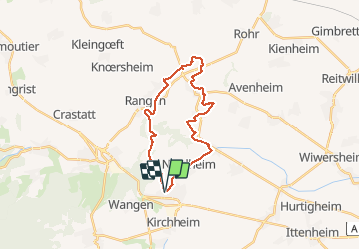
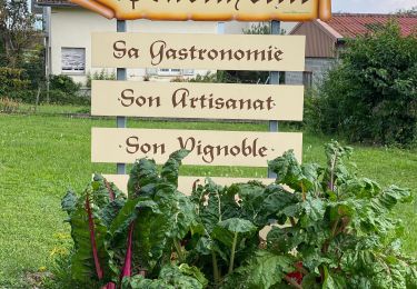
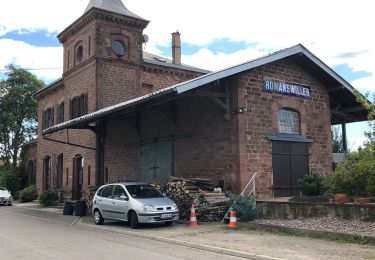
Trail Walking of 22 km to be discovered at Grand Est, Bas-Rhin, Marlenheim. This trail is proposed by LUTZMarc.

Description

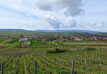
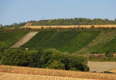
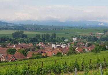
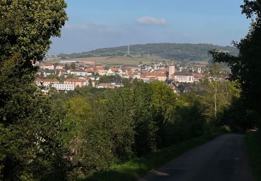
A travers les collines du Kochersberg.
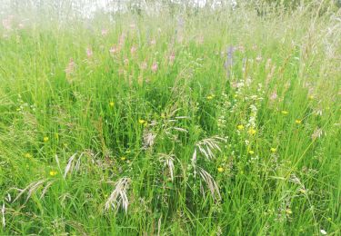
Privilégier une période de temps sec , la terre du Kochersberg est très collante.
Possibilité à 12,8km resto à  Willgottheim  "L'oie gourmande"

Elevation profile

Positioning

Country:
France
Region :
Grand Est
Department/Province :
Bas-Rhin
Municipality :
Marlenheim
Location:
Unknown
Start:(UTM)
388786 ; 5386772 (32U) N.

Trails nearby

Trail Horseback riding Westhoffen - 2023-04-23 Picnic CVA La Mercière depuis Westhoffen - Photo
Horseback riding
GUIDE
holtzv

Horseback riding

Medium
Westhoffen, Grand Est, Bas-Rhin, France
31 km | 43 km-effort
5h 28min
Yes
Trail On foot Kuttolsheim - Circuit des Trois Chapelles - Photo
On foot
PRO

On foot

Easy
Kuttolsheim, Grand Est, Bas-Rhin, France
9.6 km | 13.1 km-effort
2h 58min
No
Trail Walking Nordheim - Nordheim 20240224 - Photo
Walking
Michel 67170

Walking

Difficult
Nordheim, Grand Est, Bas-Rhin, France
11.1 km | 15 km-effort
2h 53min
Yes
Trail Nordic walking Nordheim - Nordheim 20220605 - Photo
Nordic walking
Michel 67

Nordic walking

Very easy
Nordheim, Grand Est, Bas-Rhin, France
26 km | 32 km-effort
3h 12min
No
Trail Electric bike Scharrachbergheim-Irmstett -  Schrrachbergheim - COL des Pandours - Photo
Electric bike
26051010

Electric bike

Medium
Scharrachbergheim-Irmstett, Grand Est, Bas-Rhin, France
76 km | 92 km-effort
4h 10min
No
Trail Electric bike Scharrachbergheim-Irmstett - Place des Pandours - Photo
Electric bike
26051010

Electric bike

Medium
Scharrachbergheim-Irmstett, Grand Est, Bas-Rhin, France
73 km | 90 km-effort
4h 0min
No
Trail Walking Wangen - , westhoffen - Photo
Walking
apa

Walking

Medium
Wangen, Grand Est, Bas-Rhin, France
9.9 km | 14.2 km-effort
2h 51min
Yes
Trail Mountain bike Scharrachbergheim-Irmstett - Lancaster-R F À.  - Photo
Mountain bike
26051010

Mountain bike

Easy
Scharrachbergheim-Irmstett, Grand Est, Bas-Rhin, France
75 km | 86 km-effort
3h 51min
No
Trail Mountain bike Balbronn - Endurance  - Photo
Mountain bike
26051010

Mountain bike

Difficult
Balbronn, Grand Est, Bas-Rhin, France
42 km | 58 km-effort
4h 18min
Yes


Close
My subscriptions