


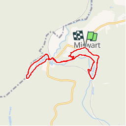

9.6 km | 11.9 km-effort

User


FREE GPS app for hiking
 SityTrail
IGN / Geographical institutes
SityTrail World
The world is yours!
Trail Walking of 6.5 km to be discovered at Wallonia, Luxembourg, Saint-Hubert. This trail is proposed by GerardBouche.
Petite balade sympa par l'étang St-Roch, l'ancienne glacière devenue refuge pour pipistrelles, la rive droite de la Lomme et les étangs de la pisciculture provinciale.
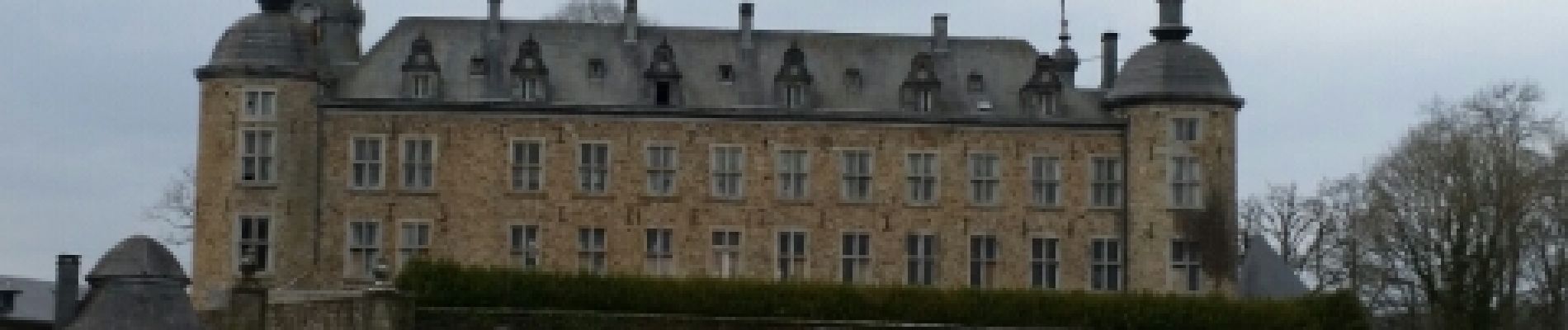
 - Photo 1")
 - Photo 2")
 - Photo 3")
 - Photo 4")
 - Photo 5")
 - Photo 6")
 - Photo 7")

Walking

Walking

Walking

Walking

Walking

Walking

Walking

On foot

Walking
Veel langer dan aangegeven. Je kunt wel een stuk afsnijden na het meer. Verder een prachtige wandeling.