Trail Walking Héry-sur-Alby - Les Hauts d'Héry - Photo
 HERRY
HERRY

User GUIDE

© OpenStreetMap contributors
Length
Length
6.5 km
Max alt
Max alt
702 m
Uphill gradient
Uphill gradient
146 m
Km-Effort
Km-Effort  
8.4 km
Min alt
Min alt
591 m
Downhill gradient
Downhill gradient
147 m
Boucle
Boucle
Yes
Creation date :
2018-06-26 13:21:54.186
Updated on :
2018-06-26 13:21:54.186

(0 Reviews)

Walking
Walking
1h31
Difficulty : Easy

Scan this QR Code to open this trail in the SityTrail application

FREE GPS app for hiking

Logo SityTrail SityTrail

IGN / Geographical institutes

Download SityTrail from the App Store Download SityTrail from Google Play

Logo SityTrail SityTrail World

The world is yours!

Download SityTrail from the App Store Download SityTrail from Google Play Download SityTrail on Huawei AppGallery

About

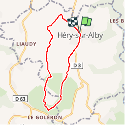
Trail Walking of 6.5 km to be discovered at Auvergne-Rhône-Alpes, Upper Savoy, Héry-sur-Alby. This trail is proposed by HERRY.

Description

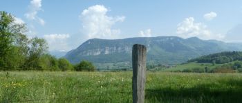
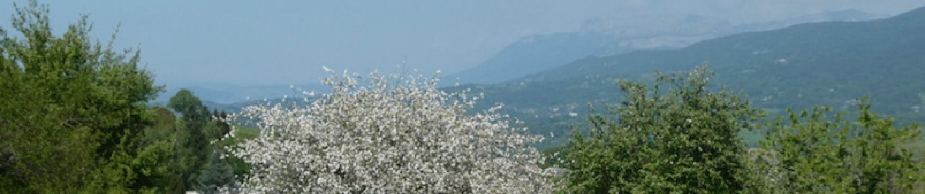
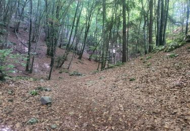
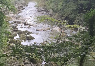
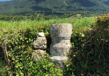
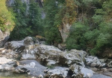
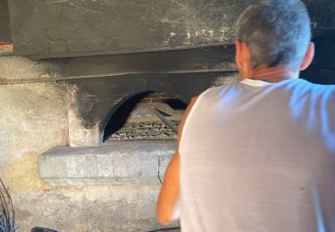
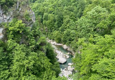
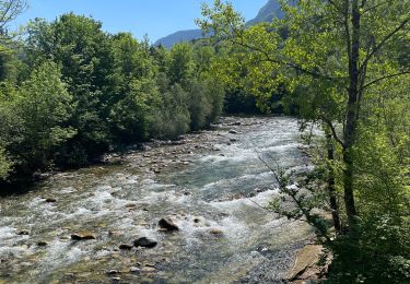
Marche sur les hauteurs d'héry où on peut apprécier les différents points de vue sur l'albanais et les bauges. Se garer à l'église puis suivre les panneaux en direction du cimetière.Au point 1 le panneau de signalisation est peu visible. Au point 2 laissez à gauche le retour vers le village et continuez sur la route jusqu'au point 3 où vous tournez légèrement à gauche.Descendre ensuite jusqu'au point 4 non balisé qui qui vous ramènera par les champs vers le village.

Elevation profile

Photos

Points of interest

Point of interest Héry-sur-Alby - Fontaine - Photo
HERRY
HÉRY-SUR-ALBY 
Point of interest Chainaz-les-Frasses - Les Bauges - Photo
HERRY
CHAINAZ-LES-FRASSES 
Point of interest Héry-sur-Alby - point_2 - Photo
HERRY
HÉRY-SUR-ALBY 
Point of interest Héry-sur-Alby - Point_1 - Photo
HERRY
HÉRY-SUR-ALBY 
Point of interest Héry-sur-Alby - point_3 - Photo
HERRY
HÉRY-SUR-ALBY 
Point of interest Chainaz-les-Frasses - point_4 - Photo
HERRY
CHAINAZ-LES-FRASSES 

Positioning

Country:
France
Region :
Auvergne-Rhône-Alpes
Department/Province :
Upper Savoy
Municipality :
Héry-sur-Alby
Location:
Unknown
Start:(UTM)
267848 ; 5075914 (32T) N.

Trails nearby

Trail Walking Cusy - 13-09-2022 La Grand-Raie au Col de la Cochette - Photo
Walking
GUIDE
Kargil

Walking

Very difficult
Cusy, Auvergne-Rhône-Alpes, Upper Savoy, France
18.2 km | 35 km-effort
5h 24min
Yes
Trail Walking Allèves - 06-09-2022 Tours Saint Jacques-Grottes de Bange  - Photo
Walking
GUIDE
Kargil

Walking

Difficult
(1)
Allèves, Auvergne-Rhône-Alpes, Upper Savoy, France
13.5 km | 27 km-effort
4h 24min
Yes
Trail Walking Cusy - Les chaos de Cheran - Photo
Walking
GUIDE
Kargil

Walking

Medium
Cusy, Auvergne-Rhône-Alpes, Upper Savoy, France
17.1 km | 25 km-effort
4h 21min
Yes
Trail Walking Viuz-la-Chiésaz - Circuit de Viuz La Chiesaz - Photo
Walking
GUIDE
HERRY

Walking

Viuz-la-Chiésaz, Auvergne-Rhône-Alpes, Upper Savoy, France
7.3 km | 9.7 km-effort
1h 46min
Yes
Trail Walking Cusy - Chaos. du Cheran - Photo
Walking
pandoudou

Walking

Very easy
(1)
Cusy, Auvergne-Rhône-Alpes, Upper Savoy, France
6.1 km | 9.7 km-effort
2h 34min
Yes
Trail Walking Cusy - 14-08-2022 Pont de Cusy - Pont de l'abîme  - Photo
Walking
GUIDE
Kargil

Walking

Easy
Cusy, Auvergne-Rhône-Alpes, Upper Savoy, France
5.9 km | 9.4 km-effort
1h 42min
Yes
Trail Walking Entrelacs - Ronde des fours Albens  - Photo
Walking
Belphime

Walking

Very difficult
Entrelacs, Auvergne-Rhône-Alpes, Savoy, France
14.9 km | 20 km-effort
4h 1min
Yes
Trail Walking Cusy - Grosse balade du cheran - Photo
Walking
Belphime

Walking

Medium
Cusy, Auvergne-Rhône-Alpes, Upper Savoy, France
7.4 km | 10.6 km-effort
1h 51min
Yes
Trail Walking Cusy - Vers le cheran - Photo
Walking
Belphime

Walking

Easy
Cusy, Auvergne-Rhône-Alpes, Upper Savoy, France
4.1 km | 5.8 km-effort
1h 16min
Yes


Close
My subscriptions