Trail Walking Vallon-Pont-d'Arc - 180628 EnCours - Photo
 randodan
randodan

User

© OpenStreetMap contributors
Length
Length
10.5 km
Max alt
Max alt
330 m
Uphill gradient
Uphill gradient
474 m
Km-Effort
Km-Effort  
16.3 km
Min alt
Min alt
78 m
Downhill gradient
Downhill gradient
292 m
Boucle
Boucle
No
Creation date :
2019-01-15 12:13:31.23
Updated on :
2019-01-15 12:13:31.23

(0 Reviews)

Walking
Walking
4h30
Difficulty : Unknown

Scan this QR Code to open this trail in the SityTrail application

FREE GPS app for hiking

Logo SityTrail SityTrail

IGN / Geographical institutes

Download SityTrail from the App Store Download SityTrail from Google Play

Logo SityTrail SityTrail World

The world is yours!

Download SityTrail from the App Store Download SityTrail from Google Play Download SityTrail on Huawei AppGallery

About

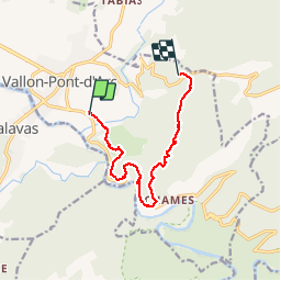
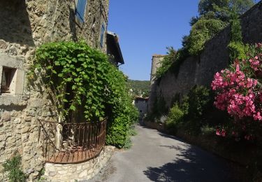
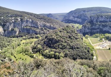
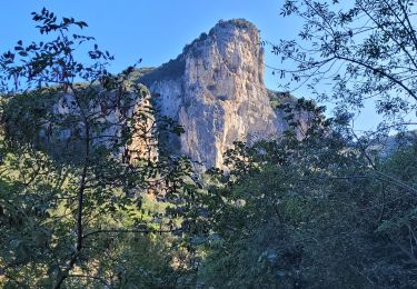
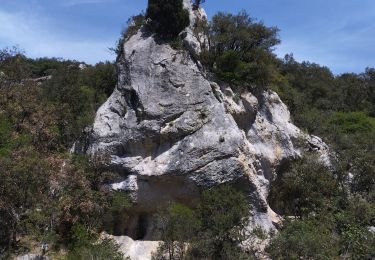
Trail Walking of 10.5 km to be discovered at Auvergne-Rhône-Alpes, Ardèche, Vallon-Pont-d'Arc. This trail is proposed by randodan.

Description

En cours
calculs ok, brouillon txt ok

Elevation profile

Photos

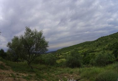
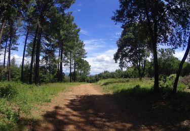
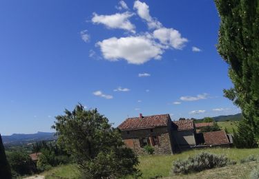
26 photos in total. Please click on a photo to see them all in the gallery.

Positioning

Country:
France
Region :
Auvergne-Rhône-Alpes
Department/Province :
Ardèche
Municipality :
Vallon-Pont-d'Arc
Location:
Unknown
Start:(UTM)
611684 ; 4916955 (31T) N.

Trails nearby

Trail Walking Vallon-Pont-d'Arc - vallon-chastelas - Photo
Walking
GUIDE
HERRY

Walking

Easy
(2)
Vallon-Pont-d'Arc, Auvergne-Rhône-Alpes, Ardèche, France
4.5 km | 6.2 km-effort
1h 19min
Yes
Trail Mountain bike Vallon-Pont-d'Arc - Vallon_Pont_d'Arc_20210712_092148 - Photo
Mountain bike
GUIDE
pascalou73

Mountain bike

Very easy
Vallon-Pont-d'Arc, Auvergne-Rhône-Alpes, Ardèche, France
27 km | 34 km-effort
Unknown
Yes
Trail Mountain bike Vallon-Pont-d'Arc - SityTrail - 2433385 - vtt-vallon-pont-arc-xpont-romain-et-dolmen-25-km - Photo
Mountain bike
GUIDE
pascalou73

Mountain bike

Difficult
Vallon-Pont-d'Arc, Auvergne-Rhône-Alpes, Ardèche, France
24 km | 33 km-effort
Unknown
No
Trail Mountain bike Vallon-Pont-d'Arc - vallon pont arc au col de la cize - Photo
Mountain bike
GUIDE
pascalou73

Mountain bike

Difficult
Vallon-Pont-d'Arc, Auvergne-Rhône-Alpes, Ardèche, France
27 km | 36 km-effort
Unknown
No
Trail Mountain bike Vallon-Pont-d'Arc - VTT des bois des bruyères - Photo
Mountain bike
GUIDE
pascalou73

Mountain bike

Medium
(1)
Vallon-Pont-d'Arc, Auvergne-Rhône-Alpes, Ardèche, France
15.5 km | 20 km-effort
1h 21min
No
Trail Walking Vallon-Pont-d'Arc - 07_Pont_d'Arc_14km515 - Photo
Walking
SyMA

Walking

Medium
Vallon-Pont-d'Arc, Auvergne-Rhône-Alpes, Ardèche, France
14.4 km | 21 km-effort
5h 7min
Yes
Trail Walking Labastide-de-Virac - les gorges de l'Ardèche  - Photo
Walking
loca.yves

Walking

Medium
Labastide-de-Virac, Auvergne-Rhône-Alpes, Ardèche, France
8.9 km | 14.1 km-effort
5h 14min
Yes
Trail Road bike Vallon-Pont-d'Arc - 2023-05-30_20h05m07_corniches_de_lardeche-16881544-1685463110-624 - Photo
Road bike
GuySimonin

Road bike

Very difficult
(1)
Vallon-Pont-d'Arc, Auvergne-Rhône-Alpes, Ardèche, France
74 km | 92 km-effort
5h 35min
Yes
Trail Walking Vallon-Pont-d'Arc - Vallon pont d'arc au bivouac du gournier  - Photo
Walking
nadd73

Walking

Medium
Vallon-Pont-d'Arc, Auvergne-Rhône-Alpes, Ardèche, France
18.8 km | 31 km-effort
3h 45min
No


Close
My subscriptions