tracegps

Offline

Trails

Trail Walking Campan - Pène de Bédout - Campan - Photo
Walking
tracegps

Walking

Difficult
Campan, Occitania, Hautespyrenees, France
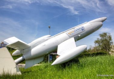
9.2 km | 21 km-effort
6h 0min
Yes
Trail Walking Rentières - Rentières en Cézalier - Photo
Walking
tracegps

Walking

Difficult
Rentières, Auvergne-Rhône-Alpes, Puy-de-Dôme, France
19.6 km | 27 km-effort
6h 0min
Yes
Trail Walking Villenauxe-la-Grande - Val de Noxe - Villenauxe la Grande - Photo
Walking
tracegps

Walking

Medium
Villenauxe-la-Grande, Grand Est, Aube, France
33 km | 39 km-effort
6h 30min
Yes
Trail Walking Saint-Mamet - Fonds de Burbe - Saint Mamet - Photo
Walking
tracegps

Walking

Difficult
(1)
Saint-Mamet, Occitania, Haute-Garonne, France
15.6 km | 27 km-effort
4h 0min
Yes
Trail Walking Sailly-lez-Lannoy - Circuit de Robigeux - Sailly lez Lannoy - Photo
Walking
tracegps

Walking

Medium
(3)
Sailly-lez-Lannoy, Hauts-de-France, Nord, France
11.3 km | 12.3 km-effort
2h 49min
Yes
Trail Mountain bike Saintes-Maries-de-la-Mer - Etang du Galabert et phare de la Gacholle - Sainte Marie de la Mer - Photo
Mountain bike
tracegps

Mountain bike

Easy
(1)
Saintes-Maries-de-la-Mer, Provence-Alpes-Côte d'Azur, Bouches-du-Rhône, France
19.7 km | 20 km-effort
1h 45min
Yes
Trail Walking Saintes-Maries-de-la-Mer - Etang du Galabert et phare de la Gacholle - Sainte Marie de la Mer - Photo
Walking
tracegps

Walking

Easy
Saintes-Maries-de-la-Mer, Provence-Alpes-Côte d'Azur, Bouches-du-Rhône, France
19.7 km | 20 km-effort
4h 15min
Yes
Trail Walking Cambrin - Marais de Cambrin - Photo
Walking
tracegps

Walking

Easy
Cambrin, Hauts-de-France, Pas-de-Calais, France
1.7 km | 1.8 km-effort
30min
Yes
Trail Walking La Penne-sur-l'Ouvèze - Arrête du mont Bluye - Pierrelongue - Photo
Walking
tracegps

Walking

Difficult
La Penne-sur-l'Ouvèze, Auvergne-Rhône-Alpes, Drôme, France
17.3 km | 29 km-effort
4h 30min
Yes
Trail Running La Tuilière - La Croix de l'Epinat (circuit N°14) - La Tuilière - Photo
Running
tracegps

Running

Difficult
La Tuilière, Auvergne-Rhône-Alpes, Loire, France
16 km | 22 km-effort
2h 15min
Yes
Trail Mountain bike La Tuilière - La Croix de l'Epinat (circuit N°14) - La Tuilière - Photo
Mountain bike
tracegps

Mountain bike

Medium
La Tuilière, Auvergne-Rhône-Alpes, Loire, France
16 km | 22 km-effort
1h 30min
Yes
Trail Walking La Tuilière - La Croix de l'Epinat (circuit N°14) - La Tuilière - Photo
Walking
tracegps

Walking

Difficult
La Tuilière, Auvergne-Rhône-Alpes, Loire, France
16 km | 22 km-effort
4h 15min
Yes
Trail Walking Les Eyzies - Boucle de Manaurie via Fleurac - Photo
Walking
tracegps

Walking

Difficult
(1)
Les Eyzies, New Aquitaine, Dordogne, France
19.4 km | 26 km-effort
6h 0min
Yes
Trail Mountain bike Ouches - La Ouchoise (2014-VTT-66km) - Ouches - Photo
Mountain bike
tracegps

Mountain bike

Very difficult
Ouches, Auvergne-Rhône-Alpes, Loire, France
66 km | 90 km-effort
5h 15min
Yes
Trail Mountain bike Valloire-sur-Cisse - Vignoble et Cisse - Chouzy sur Cisse - Photo
Mountain bike
tracegps

Mountain bike

Medium
(2)
Valloire-sur-Cisse, Centre-Loire Valley, Loir-et-Cher, France
18.8 km | 21 km-effort
1h 30min
Yes
Trail Walking Cénac - Circuit des sources autour de la Pimpine- Latresne - Photo
Walking
tracegps

Walking

Easy
Cénac, New Aquitaine, Gironde, France
2.5 km | 3.2 km-effort
45min
Yes
Trail Walking Latresne - Circuit de Pardaillan - Latresne - Photo
Walking
tracegps

Walking

Easy
Latresne, New Aquitaine, Gironde, France
2.9 km | 3.7 km-effort
1h 0min
Yes
Trail Walking Latresne - Circuit de Saint Pantaléon - Latresne - Photo
Walking
tracegps

Walking

Medium
(1)
Latresne, New Aquitaine, Gironde, France
5.7 km | 7 km-effort
1h 49min
Yes
Trail Walking Latresne -  Circuit des moulins à eau et à vent - Latresne - Photo
Walking
tracegps

Walking

Medium
Latresne, New Aquitaine, Gironde, France
6.7 km | 8 km-effort
2h 15min
Yes
Trail Walking Latresne - Circuit de Garonne - Latresne - Photo
Walking
tracegps

Walking

Medium
Latresne, New Aquitaine, Gironde, France
5.5 km | 6 km-effort
1h 49min
No
Trail Walking Latresne - Circuit des châteaux - Latresne  - Photo
Walking
tracegps

Walking

Medium
(1)
Latresne, New Aquitaine, Gironde, France
4.3 km | 5.7 km-effort
1h 30min
Yes

Close
My subscriptions