Randonnée Course à pied Ayguesvives - Ayguevisves from the Canal du Midi - Photo

Ayguevisves from the Canal du Midi

 tracegps
tracegps

Utilisateur

© OpenStreetMap contributors
Longueur
Longueur
15,6 km
Altitude max
Altitude max
243 m
Dénivelé positif
Dénivelé positif
232 m
Km-Effort
Km-Effort  
18,7 km
Altitude min
Altitude min
154 m
Dénivelé négatif
Dénivelé négatif
233 m
Boucle
Boucle
Oui
Date de création :
2014-12-10 00:00:00.0
Dernière modification :
2014-12-10 00:00:00.0

(0 Avis)

Course à pied
Course à pied
1h30
Difficulté : Moyen

Scannez ce code QR pour ouvrir la randonnée dans l'application SityTrail

Application GPS de randonnée GRATUITE

Logo SityTrail SityTrail

IGN / Instituts géographiques

Télécharger SityTrail sur l'App Store Télécharger SityTrail sur Google Play

Logo SityTrail SityTrail World

Le monde est à vous

Télécharger SityTrail sur l'App Store Télécharger SityTrail sur Google Play Télécharger SityTrail sur Huawei AppGallery

À propos

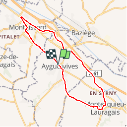
Randonnée Course à pied de 15,6 km à découvrir à Occitanie, Haute-Garonne, Ayguesvives. Cette randonnée est proposée par tracegps.

Description

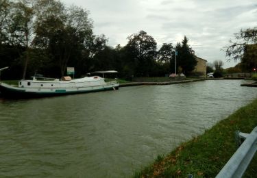
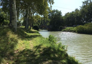
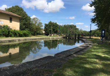
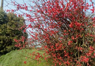
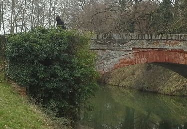
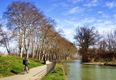
Balade entre côteaux et Canal du Midi. Roller possible le long du Canal.

Profil altimétrique

Photos

Localisation

Pays :
France
Région :
Occitanie
Département/Province :
Haute-Garonne
Commune :
Ayguesvives
Localité :
Unknown
Départ:(Dec)
Départ:(UTM)
386363 ; 4810509 (31T) N.

Randonnées à proximité

Randonnée Course à pied Saint-Léon - Une bonne sueur à St Léon... - Photo
Course à pied
tracegps

Course à pied

Difficile
(1)
Saint-Léon, Occitanie, Haute-Garonne, France
18,8 km | 23 km-effort
1h 15min
Oui
Randonnée A pied Donneville - Boucle de Saint-Ignace - Photo
A pied
PRO

A pied

Facile
Donneville, Occitanie, Haute-Garonne, France
4,1 km | 5,7 km-effort
1h 17min
Oui
Randonnée Marche Montesquieu-Lauragais - mardi 20 octobre  - Photo
Marche
arnoultjf

Marche

Très facile
Montesquieu-Lauragais, Occitanie, Haute-Garonne, France
12 km | 13,7 km-effort
2h 40min
Oui
Randonnée Marche Ayguesvives - Montgiscard  - Photo
Marche
richardsimopons

Marche

Ayguesvives, Occitanie, Haute-Garonne, France
7,3 km | 8,3 km-effort
1h 45min
Oui
Randonnée Marche Ayguesvives - Canal du midi 31719 - Photo
Marche
richardsimopons

Marche

Ayguesvives, Occitanie, Haute-Garonne, France
11,4 km | 12,6 km-effort
2h 42min
Non
Randonnée Marche Donneville - Donneville -Toulouse - Photo
Marche
RR31

Marche

Moyen
Donneville, Occitanie, Haute-Garonne, France
31 km | 34 km-effort
Inconnu
Non
Randonnée Marche Montlaur - 23 février 2021 - Photo
Marche
arnoultjf

Marche

Très facile
Montlaur, Occitanie, Haute-Garonne, France
10,4 km | 11,8 km-effort
2h 5min
Non
Randonnée Marche Montgiscard - Montgiscard ÷Villenouvelle - Photo
Marche
RR31

Marche

Moyen
Montgiscard, Occitanie, Haute-Garonne, France
25 km | 28 km-effort
5h 58min
Oui
Randonnée Marche Ayguesvives - Canal du Midi - Ecluse du Sanglier - Ecluse de Laval - Photo
Marche
tracegps

Marche

Facile
Ayguesvives, Occitanie, Haute-Garonne, France
7,9 km | 8,6 km-effort
1h 30min
Non


Fermer
Mes abonnements