Randonnée Marche Sainte-Engrâce - Gorges de Kakouetta - Photo
 tracegps
tracegps

Utilisateur

© OpenStreetMap contributors
Longueur
Longueur
20 km
Altitude max
Altitude max
1318 m
Dénivelé positif
Dénivelé positif
1168 m
Km-Effort
Km-Effort  
36 km
Altitude min
Altitude min
463 m
Dénivelé négatif
Dénivelé négatif
1167 m
Boucle
Boucle
Oui
Date de création :
2014-12-10 00:00:00.0
Dernière modification :
2014-12-10 00:00:00.0

(0 Avis)

Marche
Marche
6h00
Difficulté : Très difficile

Scannez ce code QR pour ouvrir la randonnée dans l'application SityTrail

Application GPS de randonnée GRATUITE

Logo SityTrail SityTrail

IGN / Instituts géographiques

Télécharger SityTrail sur l'App Store Télécharger SityTrail sur Google Play

Logo SityTrail SityTrail World

Le monde est à vous

Télécharger SityTrail sur l'App Store Télécharger SityTrail sur Google Play Télécharger SityTrail sur Huawei AppGallery

À propos

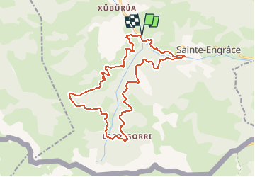
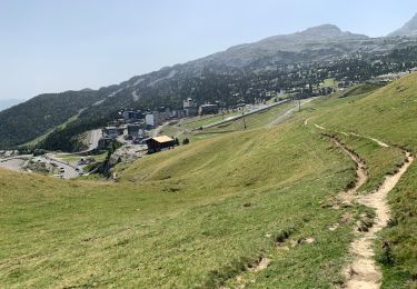
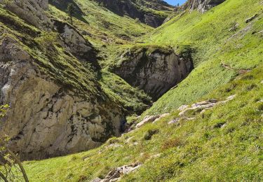
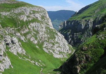
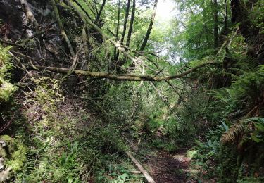
Randonnée Marche de 20 km à découvrir à Nouvelle-Aquitaine, Pyrénées-Atlantiques, Sainte-Engrâce. Cette randonnée est proposée par tracegps.

Description

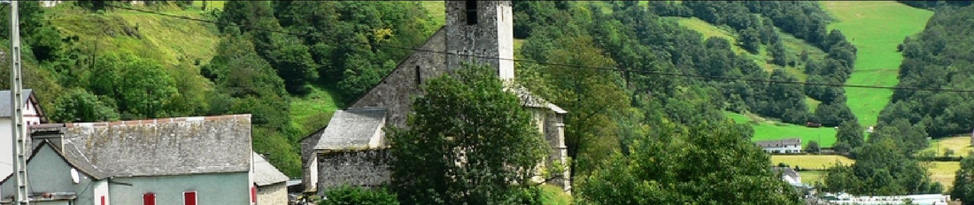
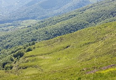
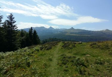
L’Amazonie au cœur de la montagne basque, voilà ce que vous offre ce site, un des plus sauvages et prestigieux d’Europe, les Gorges de Kakuetta, aujourd’hui protégées, forcent l’admiration.

Profil altimétrique

Photos

Localisation

Pays :
France
Région :
Nouvelle-Aquitaine
Département/Province :
Pyrénées-Atlantiques
Commune :
Sainte-Engrâce
Localité :
Unknown
Départ:(Dec)
Départ:(UTM)
675804 ; 4763115 (30T) N.

Randonnées à proximité

Randonnée Marche Larrau - holcarte-kakoueta - Photo
Marche
yt34

Marche

Facile
(1)
Larrau, Nouvelle-Aquitaine, Pyrénées-Atlantiques, France
6,8 km | 14,4 km-effort
2h 29min
Non
Randonnée A pied Lanne-en-Barétous - ISSARBE les crêtes    2893126 - Photo
A pied
GUIDE
marmotte65

A pied

Facile
Lanne-en-Barétous, Nouvelle-Aquitaine, Pyrénées-Atlantiques, France
10,1 km | 14,2 km-effort
3h 13min
Oui
Randonnée Marche Sainte-Engrâce - GR 10 - 11ème étape : Sainte Engrâce -refuge La Pierre-Szint-Martin - Photo
Marche
LEGUE

Marche

Moyen
Sainte-Engrâce, Nouvelle-Aquitaine, Pyrénées-Atlantiques, France
12,4 km | 25 km-effort
3h 34min
Non
Randonnée Autre activité Sainte-Engrâce - TDP N°9 STE EN GRÂCE   ARÊTE LA PIERRE ST MARTIN - Photo
Autre activité
jeff2

Autre activité

Très facile
Sainte-Engrâce, Nouvelle-Aquitaine, Pyrénées-Atlantiques, France
12,4 km | 25 km-effort
4h 31min
Non
Randonnée Marche Sainte-Engrâce - st-engrace-Gorges-D'Ehujarre - Photo
Marche
ChristopheLefauconnier

Marche

Difficile
Sainte-Engrâce, Nouvelle-Aquitaine, Pyrénées-Atlantiques, France
14,4 km | 30 km-effort
5h 6min
Oui
Randonnée Marche Sainte-Engrâce - Le Canyon d'Ehujarre depuis Sainte-Engrâce - Photo
Marche
tracegps

Marche

Difficile
(1)
Sainte-Engrâce, Nouvelle-Aquitaine, Pyrénées-Atlantiques, France
14 km | 28 km-effort
6h 15min
Oui
Randonnée Marche Sainte-Engrâce - Pierre st martin - Photo
Marche
Did Lassus-pomes

Marche

Très difficile
Sainte-Engrâce, Nouvelle-Aquitaine, Pyrénées-Atlantiques, France
9,9 km | 22 km-effort
7h 16min
Non
Randonnée Marche Sainte-Engrâce - boucle gorges d'Ehujarre - Photo
Marche
momoguitou

Marche

Difficile
Sainte-Engrâce, Nouvelle-Aquitaine, Pyrénées-Atlantiques, France
14,8 km | 30 km-effort
7h 23min
Oui
Randonnée Marche Sainte-Engrâce - 20 - Photo
Marche
pirene

Marche

Très difficile
Sainte-Engrâce, Nouvelle-Aquitaine, Pyrénées-Atlantiques, France
24 km | 49 km-effort
4h 37min
Non


Fermer
Mes abonnements