Randonnée Marche Liévin - 50 km Lievin en nocturne - Photo
 tracegps
tracegps

Utilisateur

© OpenStreetMap contributors
Longueur
Longueur
52 km
Altitude max
Altitude max
195 m
Dénivelé positif
Dénivelé positif
685 m
Km-Effort
Km-Effort  
61 km
Altitude min
Altitude min
37 m
Dénivelé négatif
Dénivelé négatif
678 m
Boucle
Boucle
Oui
Date de création :
2014-12-10 00:00:00.0
Dernière modification :
2014-12-10 00:00:00.0

(1 Avis)

Marche
Marche
9h00
Difficulté : Très difficile

Scannez ce code QR pour ouvrir la randonnée dans l'application SityTrail

Application GPS de randonnée GRATUITE

Logo SityTrail SityTrail

IGN / Instituts géographiques

Télécharger SityTrail sur l'App Store Télécharger SityTrail sur Google Play

Logo SityTrail SityTrail World

Le monde est à vous

Télécharger SityTrail sur l'App Store Télécharger SityTrail sur Google Play Télécharger SityTrail sur Huawei AppGallery

À propos

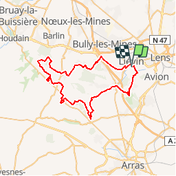
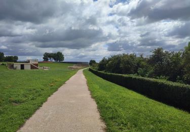
Randonnée Marche de 52 km à découvrir à Hauts-de-France, Pas-de-Calais, Liévin. Cette randonnée est proposée par tracegps.

Description

Randonnée nocturne autour de Lievin, organisée au printemps.

Profil altimétrique

Localisation

Pays :
France
Région :
Hauts-de-France
Département/Province :
Pas-de-Calais
Commune :
Liévin
Localité :
Unknown
Départ:(Dec)
Départ:(UTM)
484013 ; 5585065 (31U) N.

Commentaires

Veuillez vous connecter pour laisser un commentaire ou une note


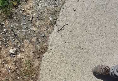
Respecte bien le tracé de la rando


Randonnées à proximité

Randonnée Marche Lens - randonnée  - Photo
Marche
sandrine brisset

Marche

Difficile
Lens, Hauts-de-France, Pas-de-Calais, France
10,5 km | 13,4 km-effort
3h 41min
Oui
Randonnée Marche Angres - randonnée pinchonvalles - Photo
Marche
Chene62

Marche

Très difficile
Angres, Hauts-de-France, Pas-de-Calais, France
27 km | 0 m-effort
3h 24min
Non
Randonnée Autre activité Liévin - boucle Liévin - Photo
Autre activité
crijack

Autre activité

Très facile
Liévin, Hauts-de-France, Pas-de-Calais, France
11 km | 12,3 km-effort
2h 2min
Oui
Randonnée Autre activité Liévin - boucle Liévin - Photo
Autre activité
crijack

Autre activité

Très facile
Liévin, Hauts-de-France, Pas-de-Calais, France
11 km | 12,3 km-effort
2h 2min
Oui
Randonnée Course à pied Aix-Noulette - aix noulette sity guide 25,3 km D530+ - Photo
Course à pied
jamboxland

Course à pied

Moyen
Aix-Noulette, Hauts-de-France, Pas-de-Calais, France
23 km | 30 km-effort
2h 45min
Oui
Randonnée Marche Souchez - Souchez-Noulette-Lorette-Ablain - Photo
Marche
tracegps

Marche

Facile
Souchez, Hauts-de-France, Pas-de-Calais, France
6,7 km | 8,4 km-effort
1h 45min
Oui
Randonnée Marche Ablain-Saint-Nazaire - lorette août 23 - Photo
Marche
Benoît66

Marche

Difficile
Ablain-Saint-Nazaire, Hauts-de-France, Pas-de-Calais, France
11,8 km | 15,6 km-effort
2h 29min
Non
Randonnée Marche Ablain-Saint-Nazaire - autour d'Alain Saint nazaire - Photo
Marche
temmichel

Marche

Moyen
Ablain-Saint-Nazaire, Hauts-de-France, Pas-de-Calais, France
8,9 km | 11,1 km-effort
2h 4min
Oui
Randonnée Marche Souchez - Lorette et Carency CAF - Photo
Marche
reneperrin

Marche

Facile
Souchez, Hauts-de-France, Pas-de-Calais, France
21 km | 25 km-effort
5h 24min
Oui


Fermer
Mes abonnements