Randonnée Marche Soultz-Haut-Rhin - Traversée des Vosges - du Grand Ballon à Thann  - Photo

Traversée des Vosges - du Grand Ballon à Thann

 tracegps
tracegps

Utilisateur

© OpenStreetMap contributors
Longueur
Longueur
19,5 km
Altitude max
Altitude max
1343 m
Dénivelé positif
Dénivelé positif
467 m
Km-Effort
Km-Effort  
29 km
Altitude min
Altitude min
333 m
Dénivelé négatif
Dénivelé négatif
1465 m
Boucle
Boucle
Non
Date de création :
2014-12-10 00:00:00.0
Dernière modification :
2014-12-10 00:00:00.0

(0 Avis)

Marche
Marche
5h00
Difficulté : Moyen

Scannez ce code QR pour ouvrir la randonnée dans l'application SityTrail

Application GPS de randonnée GRATUITE

Logo SityTrail SityTrail

IGN / Instituts géographiques

Télécharger SityTrail sur l'App Store Télécharger SityTrail sur Google Play

Logo SityTrail SityTrail World

Le monde est à vous

Télécharger SityTrail sur l'App Store Télécharger SityTrail sur Google Play Télécharger SityTrail sur Huawei AppGallery

À propos

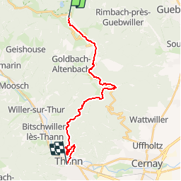
Randonnée Marche de 19,5 km à découvrir à Grand Est, Haut-Rhin, Soultz-Haut-Rhin. Cette randonnée est proposée par tracegps.

Description

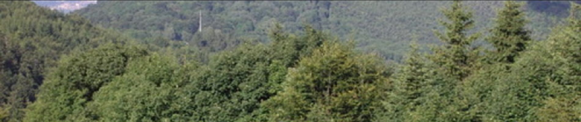
Étape en forêt par le Col Amic, le Col du Silberloch, le Camp des Pyramides et le Col du Grumbach.

Profil altimétrique

Photos

Localisation

Pays :
France
Région :
Grand Est
Département/Province :
Haut-Rhin
Commune :
Soultz-Haut-Rhin
Localité :
Unknown
Départ:(Dec)
Départ:(UTM)
358218 ; 5307423 (32T) N.

Randonnées à proximité

Randonnée Marche Linthal - Markstein - Photo
Marche
VacheKiri67

Marche

Moyen
(1)
Linthal, Grand Est, Haut-Rhin, France
14 km | 19,8 km-effort
4h 45min
Oui
Randonnée Marche Lautenbachzell - Le Markstein - Photo
Marche
tracegps

Marche

Difficile
(1)
Lautenbachzell, Grand Est, Haut-Rhin, France
22 km | 35 km-effort
6h 0min
Oui
Randonnée A pied Goldbach-Altenbach - Firstacker - Willer sur Thur - Photo
A pied
PRO

A pied

Facile
Goldbach-Altenbach, Grand Est, Haut-Rhin, France
7,4 km | 9,6 km-effort
2h 11min
Non
Randonnée A pied Lautenbachzell - Parking Bellevue - Hundsrucken - Markstein - Photo
A pied
patrickbeyrath

A pied

Moyen
(1)
Lautenbachzell, Grand Est, Haut-Rhin, France
9,4 km | 13 km-effort
Inconnu
Oui
Randonnée Marche Soultz-Haut-Rhin - Rando Marcheurs..04/04_2025 - Photo
Marche
boubou68

Marche

Très difficile
Soultz-Haut-Rhin, Grand Est, Haut-Rhin, France
21 km | 35 km-effort
4h 42min
Oui
Randonnée Marche Soultz-Haut-Rhin - Mon tour des Vosges (4 jours) - Photo
Marche
annefrance70

Marche

Très difficile
Soultz-Haut-Rhin, Grand Est, Haut-Rhin, France
71 km | 113 km-effort
25h 38min
Oui
Randonnée Marche Murbach - La
Marche
boubou68

Marche

Très difficile
Murbach, Grand Est, Haut-Rhin, France
14,7 km | 28 km-effort
4h 3min
Oui
Randonnée Marche Murbach - Murbach - Photo
Marche
oscar1

Marche

Difficile
Murbach, Grand Est, Haut-Rhin, France
15,4 km | 25 km-effort
4h 25min
Oui
Randonnée Marche Moosch - Moosch Haag - Photo
Marche
Estelle Handschin

Marche

Difficile
(1)
Moosch, Grand Est, Haut-Rhin, France
21 km | 0 m-effort
5h 27min
Oui


Fermer
Mes abonnements