Randonnée Marche Glandage - Glandage  - Photo
 ajd26
ajd26

Utilisateur

© OpenStreetMap contributors
Longueur
Longueur
10,4 km
Altitude max
Altitude max
1717 m
Dénivelé positif
Dénivelé positif
737 m
Km-Effort
Km-Effort  
20 km
Altitude min
Altitude min
992 m
Dénivelé négatif
Dénivelé négatif
737 m
Boucle
Boucle
Oui
Date de création :
2019-05-19 18:03:16.26
Dernière modification :
2019-05-19 18:03:16.365

(0 Avis)

Marche
Marche
3h55
Difficulté : Moyen

Scannez ce code QR pour ouvrir la randonnée dans l'application SityTrail

Application GPS de randonnée GRATUITE

Logo SityTrail SityTrail

IGN / Instituts géographiques

Télécharger SityTrail sur l'App Store Télécharger SityTrail sur Google Play

Logo SityTrail SityTrail World

Le monde est à vous

Télécharger SityTrail sur l'App Store Télécharger SityTrail sur Google Play Télécharger SityTrail sur Huawei AppGallery

À propos

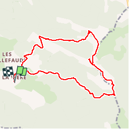
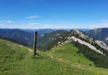
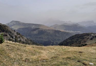
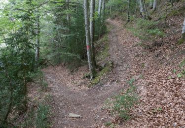
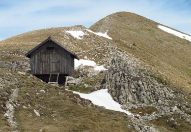
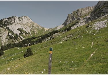
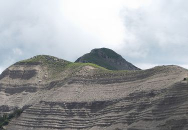
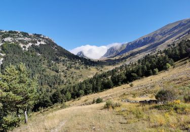
Randonnée Marche de 10,4 km à découvrir à Auvergne-Rhône-Alpes, Drôme, Glandage. Cette randonnée est proposée par ajd26.

Description

Au départ du hameau de Viere. Nbreuses variantes possibles

Profil altimétrique

Localisation

Pays :
France
Région :
Auvergne-Rhône-Alpes
Département/Province :
Drôme
Commune :
Glandage
Localité :
Unknown
Départ:(Dec)
Départ:(UTM)
707272 ; 4949934 (31T) N.

Randonnées à proximité

Randonnée Marche Glandage - Grimone-Le Jocou 12km - Photo
Marche
GUIDE
thonyc

Marche

Difficile
Glandage, Auvergne-Rhône-Alpes, Drôme, France
12 km | 24 km-effort
6h 0min
Oui
Randonnée Marche Saint-Julien-en-Beauchêne - ST JULIEN EN BEAUCHENE- VAUNIERES - Photo
Marche
BLANCHET

Marche

Moyen
(1)
Saint-Julien-en-Beauchêne, Provence-Alpes-Côte d'Azur, Hautes-Alpes, France
9,4 km | 18,4 km-effort
3h 59min
Non
Randonnée Marche Glandage - Le Jocou 2 - Photo
Marche
Marco05

Marche

Difficile
Glandage, Auvergne-Rhône-Alpes, Drôme, France
8,5 km | 18,1 km-effort
4h 0min
Oui
Randonnée Marche Châtillon-en-Diois - Circuit des Baumes - Pont de vachères-Soubreroche - Boulc - Photo
Marche
Philindy26

Marche

Moyen
Châtillon-en-Diois, Auvergne-Rhône-Alpes, Drôme, France
11,4 km | 18,5 km-effort
4h 20min
Oui
Randonnée Marche Glandage - Le Jocou-col de Seysse 12km. - Photo
Marche
chancha

Marche

Très difficile
Glandage, Auvergne-Rhône-Alpes, Drôme, France
11,6 km | 24 km-effort
5h 27min
Oui
Randonnée Marche Glandage - Le Jocou par les crêtes des  Amoussières 10km - Photo
Marche
chancha

Marche

Très difficile
Glandage, Auvergne-Rhône-Alpes, Drôme, France
9,6 km | 22 km-effort
5h 9min
Oui
Randonnée Marche Boulc - La Pare - La Toussière à partir de Boulc - Photo
Marche
Philindy26

Marche

Très difficile
Boulc, Auvergne-Rhône-Alpes, Drôme, France
16,1 km | 31 km-effort
6h 0min
Oui
Randonnée Marche Glandage - Col de la Péyère (Grimone) - Photo
Marche
Philindy26

Marche

Difficile
Glandage, Auvergne-Rhône-Alpes, Drôme, France
12,2 km | 20 km-effort
4h 0min
Oui
Randonnée Marche Glandage - Jocou - Photo
Marche
Atchoum26

Marche

Moyen
Glandage, Auvergne-Rhône-Alpes, Drôme, France
11,3 km | 21 km-effort
5h 0min
Non


Fermer
Mes abonnements