Randonnée V.T.T. Picherande - Espace VTT FFC du Sancy - Circuit n°11 - Lac Chauvet - Secteur Picherande  - Photo

Espace VTT FFC du Sancy - Circuit n°11 - Lac Chauvet - Secteur Picherande

 tracegps
tracegps

Utilisateur

© OpenStreetMap contributors
Longueur
Longueur
15,4 km
Altitude max
Altitude max
1204 m
Dénivelé positif
Dénivelé positif
363 m
Km-Effort
Km-Effort  
20 km
Altitude min
Altitude min
1036 m
Dénivelé négatif
Dénivelé négatif
359 m
Boucle
Boucle
Oui
Date de création :
2014-12-10 00:00:00.0
Dernière modification :
2014-12-10 00:00:00.0

(0 Avis)

V.T.T.
V.T.T.
1h15
Difficulté : Difficile

Scannez ce code QR pour ouvrir la randonnée dans l'application SityTrail

Application GPS de randonnée GRATUITE

Logo SityTrail SityTrail

IGN / Instituts géographiques

Télécharger SityTrail sur l'App Store Télécharger SityTrail sur Google Play

Logo SityTrail SityTrail World

Le monde est à vous

Télécharger SityTrail sur l'App Store Télécharger SityTrail sur Google Play Télécharger SityTrail sur Huawei AppGallery

À propos

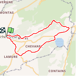
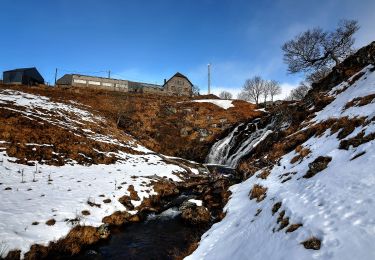
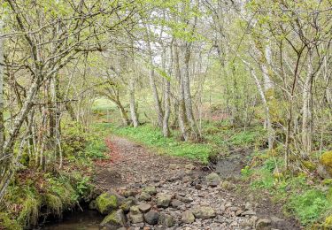
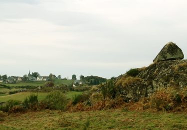
Randonnée V.T.T. de 15,4 km à découvrir à Auvergne-Rhône-Alpes, Puy-de-Dôme, Picherande. Cette randonnée est proposée par tracegps.

Description

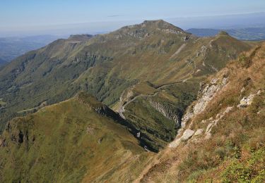
Espace VTT FFC du Sancy - Circuit n°11 - Lac Chauvet - Secteur Picherande Circuit officiel labellisé par la Fédération Française de Cyclisme. Départ devant le camping du Sancy – Gayme. Circuit sportif combinant des secteurs boisés et vallonnés entre les Monts Dore et les plateaux de l’Artense.

Profil altimétrique

Photos

Localisation

Pays :
France
Région :
Auvergne-Rhône-Alpes
Département/Province :
Puy-de-Dôme
Commune :
Picherande
Localité :
Unknown
Départ:(Dec)
Départ:(UTM)
481975 ; 5034532 (31T) N.

Randonnées à proximité

Randonnée V.T.T. Picherande - Espace VTT FFC du Sancy - Circuit n°10 - L'Escudor - Secteur Picherande  - Photo
V.T.T.
tracegps

V.T.T.

Difficile
(1)
Picherande, Auvergne-Rhône-Alpes, Puy-de-Dôme, France
14,9 km | 19,8 km-effort
1h 10min
Oui
Randonnée A pied Saint-Donat - Bertinet - Photo
A pied
PRO

A pied

Facile
Saint-Donat, Auvergne-Rhône-Alpes, Puy-de-Dôme, France
7,9 km | 10 km-effort
2h 15min
Oui
Randonnée A pied Picherande - Le Lac Chauvet - Photo
A pied
PRO

A pied

Facile
Picherande, Auvergne-Rhône-Alpes, Puy-de-Dôme, France
13,2 km | 16,7 km-effort
3h 47min
Oui
Randonnée A pied Picherande - La Fontaine Salée - Photo
A pied
PRO

A pied

Moyen
Picherande, Auvergne-Rhône-Alpes, Puy-de-Dôme, France
20 km | 29 km-effort
6h 41min
Oui
Randonnée A pied Chastreix - Chastreix+la réserve_Bois_dela_Masse - Photo
A pied
v.rabot

A pied

Facile
(1)
Chastreix, Auvergne-Rhône-Alpes, Puy-de-Dôme, France
9 km | 12,4 km-effort
2h 48min
Oui
Randonnée Marche Égliseneuve-d'Entraigues - boucle 10 km autour du lac chauvet - Photo
Marche
famillerudent

Marche

Difficile
Égliseneuve-d'Entraigues, Auvergne-Rhône-Alpes, Puy-de-Dôme, France
10,4 km | 13,4 km-effort
3h 33min
Oui
Randonnée Marche Picherande - Picherande  - Photo
Marche
GUIDE
antignacs

Marche

Très facile
Picherande, Auvergne-Rhône-Alpes, Puy-de-Dôme, France
6,2 km | 7,7 km-effort
2h 4min
Oui
Randonnée Marche Saint-Donat - St_Donat_Bertinet - Photo
Marche
GUIDE
jagarnier

Marche

Facile
Saint-Donat, Auvergne-Rhône-Alpes, Puy-de-Dôme, France
9,3 km | 12,1 km-effort
2h 45min
Oui
Randonnée 4x4 Picherande - Picherande - Photo
4x4
Martial Faulconnier

4x4

Très facile
Picherande, Auvergne-Rhône-Alpes, Puy-de-Dôme, France
7,4 km | 9,9 km-effort
34min
Non


Fermer
Mes abonnements