Randonnée Marche Sommeval - Le sentier du Loup en pays d'Othe - Photo

Le sentier du Loup en pays d'Othe

 tracegps
tracegps

Utilisateur

© OpenStreetMap contributors
Longueur
Longueur
14,4 km
Altitude max
Altitude max
303 m
Dénivelé positif
Dénivelé positif
297 m
Km-Effort
Km-Effort  
18,3 km
Altitude min
Altitude min
175 m
Dénivelé négatif
Dénivelé négatif
297 m
Boucle
Boucle
Oui
Date de création :
2014-12-10 00:00:00.0
Dernière modification :
2014-12-10 00:00:00.0

(1 Avis)

Marche
Marche
3h00
Difficulté : Moyen

Scannez ce code QR pour ouvrir la randonnée dans l'application SityTrail

Application GPS de randonnée GRATUITE

Logo SityTrail SityTrail

IGN / Instituts géographiques

Télécharger SityTrail sur l'App Store Télécharger SityTrail sur Google Play

Logo SityTrail SityTrail World

Le monde est à vous

Télécharger SityTrail sur l'App Store Télécharger SityTrail sur Google Play Télécharger SityTrail sur Huawei AppGallery

À propos

Randonnée Marche de 14,4 km à découvrir à Grand Est, Aube, Sommeval. Cette randonnée est proposée par tracegps.

Description

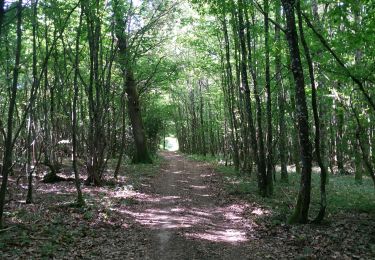
Les Randonnées Thématiques du Comité Régional du Tourisme de Champagne-Ardenne Le sentier du Loup en pays d’Othe Ce circuit, au départ de Sommeval, vous emmènera dans les sous bois du pays d’Othe, sur les chemins empruntés jadis par de nombreuses meutes de loups. Découvrez ainsi les légendes locales qu’ils ont fait naître, comme celle des « Voirloups ».

Profil altimétrique

Photos

Localisation

Pays :
France
Région :
Grand Est
Département/Province :
Aube
Commune :
Sommeval
Localité :
Unknown
Départ:(Dec)
Départ:(UTM)
571938 ; 5334745 (31U) N.

Commentaires

Veuillez vous connecter pour laisser un commentaire ou une note


sentier très agréable, très bien balisé et sans difficulté particulière ; le faire par temps de grosse chaleur est un réel plaisir, car il est la plupart du temps très ombragé


Randonnées à proximité

Randonnée Marche Bouilly - Bouilly le 30.07.22 (9.6kms) N° 2 - Photo
Marche
COTELEVELYNE

Marche

Moyen
(1)
Bouilly, Grand Est, Aube, France
8,1 km | 10,5 km-effort
2h 23min
Oui
Randonnée Marche Bouilly - Bucey 19 Juillet 2022 - Photo
Marche
FPortier

Marche

Moyen
Bouilly, Grand Est, Aube, France
8,5 km | 10,7 km-effort
2h 11min
Oui
Randonnée Marche Vauchassis - Grands Bois - Photo
Marche
FPortier

Marche

Facile
Vauchassis, Grand Est, Aube, France
5,2 km | 6,4 km-effort
1h 27min
Oui
Randonnée Marche Bouilly - Balade dans les bois - Photo
Marche
FPortier

Marche

Facile
Bouilly, Grand Est, Aube, France
7,7 km | 9,3 km-effort
1h 52min
Oui
Randonnée Marche Bouilly - Forêt de Laines aux Bois - Photo
Marche
FPortier

Marche

Moyen
Bouilly, Grand Est, Aube, France
8,3 km | 10 km-effort
2h 0min
Oui
Randonnée Marche Javernant - Javernant (Bon) 12,7km le 12/10/2010 - Photo
Marche
francis1952

Marche

Difficile
(1)
Javernant, Grand Est, Aube, France
12,8 km | 18,1 km-effort
2h 56min
Oui
Randonnée Marche Javernant - Javernant 5 (14,5km) le 30/09/2019 - Photo
Marche
francis1952

Marche

Difficile
(1)
Javernant, Grand Est, Aube, France
14,8 km | 19,9 km-effort
3h 24min
Oui
Randonnée Marche Villery - Orientation Thierry Villery le 27.09.19 - Photo
Marche
COTELEVELYNE

Marche

Villery, Grand Est, Aube, France
8 km | 11,9 km-effort
3h 32min
Oui
Randonnée Marche Bouilly - Rando Thierry forêt Bouilly le 19.07.19 - Photo
Marche
COTELEVELYNE

Marche

Bouilly, Grand Est, Aube, France
5,9 km | 7,4 km-effort
2h 38min
Oui


Fermer
Mes abonnements