Randonnée Marche Tinchebray-Bocage - Michelot Moulin - Pays de Tinchebray - Photo

Michelot Moulin - Pays de Tinchebray

 tracegps
tracegps

Utilisateur

© OpenStreetMap contributors
Longueur
Longueur
12,4 km
Altitude max
Altitude max
320 m
Dénivelé positif
Dénivelé positif
225 m
Km-Effort
Km-Effort  
15,4 km
Altitude min
Altitude min
204 m
Dénivelé négatif
Dénivelé négatif
223 m
Boucle
Boucle
Oui
Date de création :
2014-12-10 00:00:00.0
Dernière modification :
2014-12-10 00:00:00.0

(0 Avis)

Marche
Marche
3h00
Difficulté : Moyen

Scannez ce code QR pour ouvrir la randonnée dans l'application SityTrail

Application GPS de randonnée GRATUITE

Logo SityTrail SityTrail

IGN / Instituts géographiques

Télécharger SityTrail sur l'App Store Télécharger SityTrail sur Google Play

Logo SityTrail SityTrail World

Le monde est à vous

Télécharger SityTrail sur l'App Store Télécharger SityTrail sur Google Play Télécharger SityTrail sur Huawei AppGallery

À propos

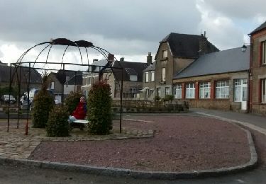
Randonnée Marche de 12,4 km à découvrir à Normandie, Orne, Tinchebray-Bocage. Cette randonnée est proposée par tracegps.

Description

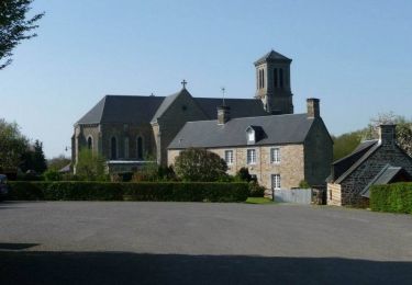
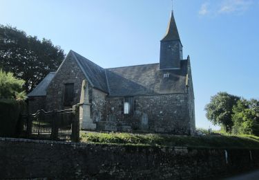
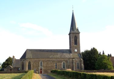
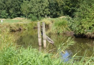
Michelot Moulin - Pays de Tinchebray. Départ de Saint Jean des Bois, du parking de la salle polyvalente, Balisage jaune de 1 à 2, blanc et rouge de 2 à 3, jaune de 3 à 6 , blanc et rouge ensuite. Retrouvez les Coup de Cœur Randonnée dans l’Orne en Normandie.

Profil altimétrique

Photos

Localisation

Pays :
France
Région :
Normandie
Département/Province :
Orne
Commune :
Tinchebray-Bocage
Localité :
Saint-Jean-des-Bois
Départ:(Dec)
Départ:(UTM)
662450 ; 5398951 (30U) N.

Randonnées à proximité

Randonnée Marche Tinchebray-Bocage - Chemin de l'Egrenne (n° 9) - Beauchêne  - Photo
Marche
tracegps

Marche

Moyen
(1)
Tinchebray-Bocage, Normandie, Orne, France
11,2 km | 14,6 km-effort
2h 49min
Oui
Randonnée A pied Saint-Christophe-de-Chaulieu - La Forêt - Photo
A pied
PRO

A pied

Facile
Saint-Christophe-de-Chaulieu, Normandie, Orne, France
6 km | 7,6 km-effort
1h 43min
Non
Randonnée V.T.T. Saint-Christophe-de-Chaulieu - La Forêt (n° 13)  - Saint Christophe de Chaulieu - Photo
V.T.T.
tracegps

V.T.T.

Facile
Saint-Christophe-de-Chaulieu, Normandie, Orne, France
6,5 km | 8,4 km-effort
34min
Oui
Randonnée Marche Saint-Christophe-de-Chaulieu - La Forêt (n° 13)  - Saint Christophe de Chaulieu - Photo
Marche
tracegps

Marche

Facile
Saint-Christophe-de-Chaulieu, Normandie, Orne, France
6,5 km | 8,4 km-effort
1h 40min
Oui
Randonnée A pied Tinchebray-Bocage - Le Ruslé - Photo
A pied
PRO

A pied

Facile
Tinchebray-Bocage, Normandie, Orne, France
5,4 km | 6,9 km-effort
1h 34min
Non
Randonnée Marche Tinchebray-Bocage - Randonnée pédestre organisée - Sur les pas des Chouans - Tinchebray - Photo
Marche
tracegps

Marche

Difficile
Tinchebray-Bocage, Normandie, Orne, France
44 km | 54 km-effort
8h 0min
Oui
Randonnée A pied Tinchebray-Bocage - Chemin de l'Egrenne - Photo
A pied
PRO

A pied

Facile
Tinchebray-Bocage, Normandie, Orne, France
10,6 km | 14 km-effort
3h 10min
Oui
Randonnée Marche Tinchebray-Bocage - Tinchebray Plan D'eau - Photo
Marche
svread

Marche

Facile
Tinchebray-Bocage, Normandie, Orne, France
1,4 km | 1,6 km-effort
23min
Oui
Randonnée Marche Tinchebray-Bocage - Le Ruslé  (n° 11)  - Yvrandes - Photo
Marche
tracegps

Marche

Facile
Tinchebray-Bocage, Normandie, Orne, France
5,7 km | 7,3 km-effort
1h 30min
Oui


Fermer
Mes abonnements