Randonnée Marche Marcilly-sur-Eure - Circuit de Marcilly-sur-Eure - Photo

Circuit de Marcilly-sur-Eure

 tracegps
tracegps

Utilisateur

© OpenStreetMap contributors
Longueur
Longueur
8,6 km
Altitude max
Altitude max
135 m
Dénivelé positif
Dénivelé positif
109 m
Km-Effort
Km-Effort  
10 km
Altitude min
Altitude min
67 m
Dénivelé négatif
Dénivelé négatif
109 m
Boucle
Boucle
Oui
Date de création :
2014-12-10 00:00:00.0
Dernière modification :
2014-12-10 00:00:00.0

(2 Avis)

Marche
Marche
2h10
Difficulté : Moyen

Scannez ce code QR pour ouvrir la randonnée dans l'application SityTrail

Application GPS de randonnée GRATUITE

Logo SityTrail SityTrail

IGN / Instituts géographiques

Télécharger SityTrail sur l'App Store Télécharger SityTrail sur Google Play

Logo SityTrail SityTrail World

Le monde est à vous

Télécharger SityTrail sur l'App Store Télécharger SityTrail sur Google Play Télécharger SityTrail sur Huawei AppGallery

À propos

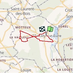
Randonnée Marche de 8,6 km à découvrir à Normandie, Eure, Marcilly-sur-Eure. Cette randonnée est proposée par tracegps.

Description

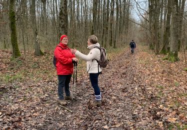
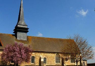
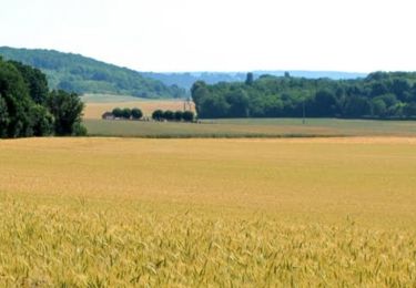
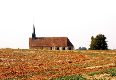
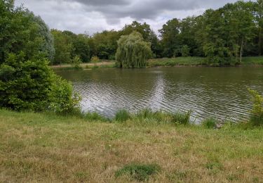
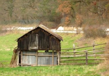
Circuit proposé par l'Office de Tourisme du Pays d'Avre, d'Eure et d'Iton. Nichée au creux de la vallée de l'Eure le village du Marcilly présente à travers cette randonnée tous ces charmes : forets , cours d'eau , patrimoine rural. Départ de la mairie de Marcilly-sur-Eure. Retrouvez le circuit et son descriptif sur le site de l'Office de Tourisme du Pays d'Avre, d'Eure et d'Iton.

Profil altimétrique

Photos

Localisation

Pays :
France
Région :
Normandie
Département/Province :
Eure
Commune :
Marcilly-sur-Eure
Localité :
Unknown
Départ:(Dec)
Départ:(UTM)
378561 ; 5409412 (31U) N.

Commentaires

Veuillez vous connecter pour laisser un commentaire ou une note


Randonnées à proximité

Randonnée Marche Louye - 10-01-2020 Louye  - Photo
Marche
lestelou27

Marche

Louye, Normandie, Eure, France
12,7 km | 14,3 km-effort
3h 12min
Oui
Randonnée V.T.T. Croth - La vallée d'Eure - Croth - Photo
V.T.T.
tracegps

V.T.T.

Moyen
Croth, Normandie, Eure, France
27 km | 31 km-effort
2h 15min
Oui
Randonnée Marche Croth - Circuit de Croth - Photo
Marche
tracegps

Marche

Facile
Croth, Normandie, Eure, France
6,1 km | 6,8 km-effort
1h 30min
Oui
Randonnée V.T.T. Louye - La Transcoudanne - Louye - Photo
V.T.T.
tracegps

V.T.T.

Moyen
Louye, Normandie, Eure, France
16 km | 17,8 km-effort
2h 0min
Oui
Randonnée Marche Croth - croth - Photo
Marche
JamesVautier

Marche

Moyen
Croth, Normandie, Eure, France
27 km | 33 km-effort
3h 8min
Non
Randonnée V.T.T. Abondant - Forêt de Dreux - Photo
V.T.T.
tracegps

V.T.T.

Moyen
Abondant, Centre-Val de Loire, Eure-et-Loir, France
45 km | 52 km-effort
3h 0min
Oui
Randonnée V.T.T. Abondant - 2023-11-23 NPH Dreux - Photo
V.T.T.
patrick2m

V.T.T.

Difficile
Abondant, Centre-Val de Loire, Eure-et-Loir, France
29 km | 32 km-effort
5h 33min
Oui
Randonnée Marche Louye - 2022_09_03_Louye_Modofiée - Photo
Marche
jeanlucien

Marche

Moyen
Louye, Normandie, Eure, France
10,4 km | 11,7 km-effort
2h 25min
Oui
Randonnée V.T.T. Marcilly-sur-Eure - MARCILLY/MARCILLY - Photo
V.T.T.
dhegron

V.T.T.

Très facile
Marcilly-sur-Eure, Normandie, Eure, France
19 km | 21 km-effort
2h 58min
Oui


Fermer
Mes abonnements