Randonnée Marche Huisnes-sur-Mer - Huisnes-sur-Mer - vue Mont-St-Michel - Pointe de Roche Torin - 14km 75m 4h30 (45mn) - 2017 06 26 - Photo

Huisnes-sur-Mer - vue Mont-St-Michel - Pointe de Roche Torin - 14km 75m 4h30 (45mn) - 2017 06 26

 Orcal37
Orcal37

Utilisateur

© OpenStreetMap contributors
Longueur
Longueur
14 km
Altitude max
Altitude max
30 m
Dénivelé positif
Dénivelé positif
75 m
Km-Effort
Km-Effort  
15 km
Altitude min
Altitude min
0 m
Dénivelé négatif
Dénivelé négatif
74 m
Boucle
Boucle
Oui
Date de création :
2019-05-07 01:57:24.983
Dernière modification :
2019-08-14 18:34:37.159

(0 Avis)

Marche
Marche
4h30
Difficulté : Facile

Scannez ce code QR pour ouvrir la randonnée dans l'application SityTrail

Application GPS de randonnée GRATUITE

Logo SityTrail SityTrail

IGN / Instituts géographiques

Télécharger SityTrail sur l'App Store Télécharger SityTrail sur Google Play

Logo SityTrail SityTrail World

Le monde est à vous

Télécharger SityTrail sur l'App Store Télécharger SityTrail sur Google Play Télécharger SityTrail sur Huawei AppGallery

À propos

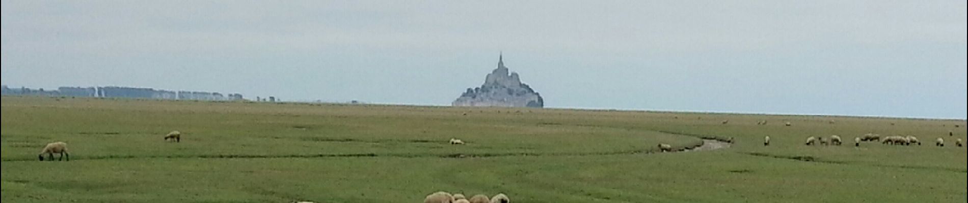
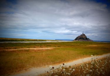
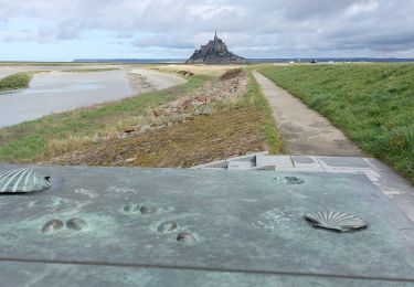
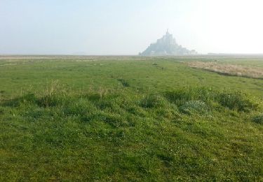
Randonnée Marche de 14 km à découvrir à Normandie, Manche, Huisnes-sur-Mer. Cette randonnée est proposée par Orcal37.

Description

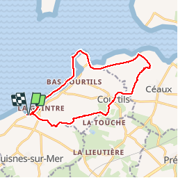
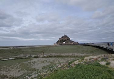
Huisnes-sur-Mer - vue sur le Mont-St-Michel - Pointe de Roche Torin - 14km 75m 4h30 (45mn) - 2017 06 26

Profil altimétrique

Photos

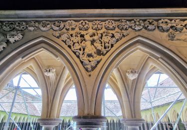
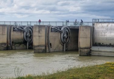
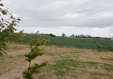
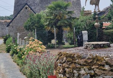
27 photos au total. Cliquez sur une photo pour les afficher toutes dans la galerie.

Localisation

Pays :
France
Région :
Normandie
Département/Province :
Manche
Commune :
Huisnes-sur-Mer
Localité :
Unknown
Départ:(Dec)
Départ:(UTM)
614099 ; 5386675 (30U) N.

Randonnées à proximité

Randonnée V.T.T. Beauvoir - VTT autour du Mont Saint Michel - Photo
V.T.T.
GUIDE
pascalou73

V.T.T.

Moyen
Beauvoir, Normandie, Manche, France
29 km | 32 km-effort
Inconnu
Oui
Randonnée Marche Courtils - La roche taurin Mont st michel - Photo
Marche
mamyzine

Marche

Facile
(1)
Courtils, Normandie, Manche, France
10,8 km | 11,4 km-effort
3h 52min
Non
Randonnée Marche Le Mont-Saint-Michel - GR_34_AA_01_Mt-St-Michel_St-Marcan_20230318 - Photo
Marche
patrickdanilo

Marche

Très facile
Le Mont-Saint-Michel, Normandie, Manche, France
16,7 km | 18,7 km-effort
4h 1min
Non
Randonnée Marche Le Mont-Saint-Michel - Mont St Michel J2 - Photo
Marche
chessyca

Marche

Très facile
Le Mont-Saint-Michel, Normandie, Manche, France
17,4 km | 21 km-effort
4h 22min
Oui
Randonnée Marche Le Mont-Saint-Michel - Mont St Michel J1 - Photo
Marche
chessyca

Marche

Difficile
Le Mont-Saint-Michel, Normandie, Manche, France
12,1 km | 14 km-effort
2h 46min
Oui
Randonnée Marche Beauvoir - GR_37_AA_15_Beauvoir_Pleine-Fougeres_20210521 - Photo
Marche
patrickdanilo

Marche

Très facile
Beauvoir, Normandie, Manche, France
14,2 km | 15,5 km-effort
3h 8min
Non
Randonnée Marche Pontorson - GR34 étape 6 - Photo
Marche
lagardienne

Marche

Facile
Pontorson, Normandie, Manche, France
23 km | 25 km-effort
5h 30min
Non
Randonnée Marche Pontorson - 2020-03-19 mont saint Michel  - Photo
Marche
jacq58

Marche

Moyen
Pontorson, Normandie, Manche, France
6,5 km | 7,5 km-effort
1h 2min
Non
Randonnée Marche Pontorson - RA 2023 Les Polders - Photo
Marche
dfluzin

Marche

Très difficile
Pontorson, Normandie, Manche, France
18,1 km | 21 km-effort
5h 25min
Non


Fermer
Mes abonnements