Randonnée Marche Paimpont - Sur Les Traces De Merlin - Photo

Sur Les Traces De Merlin

 Patakk
Patakk

Utilisateur

© OpenStreetMap contributors
Longueur
Longueur
44 km
Altitude max
Altitude max
242 m
Dénivelé positif
Dénivelé positif
729 m
Km-Effort
Km-Effort  
54 km
Altitude min
Altitude min
89 m
Dénivelé négatif
Dénivelé négatif
731 m
Boucle
Boucle
Oui
Date de création :
2014-12-10 00:00:00.0
Dernière modification :
2014-12-10 00:00:00.0

(1 Avis)

Marche
Marche
10h00
Difficulté : Difficile

Scannez ce code QR pour ouvrir la randonnée dans l'application SityTrail

Application GPS de randonnée GRATUITE

Logo SityTrail SityTrail

IGN / Instituts géographiques

Télécharger SityTrail sur l'App Store Télécharger SityTrail sur Google Play

Logo SityTrail SityTrail World

Le monde est à vous

Télécharger SityTrail sur l'App Store Télécharger SityTrail sur Google Play Télécharger SityTrail sur Huawei AppGallery

À propos

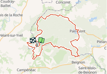
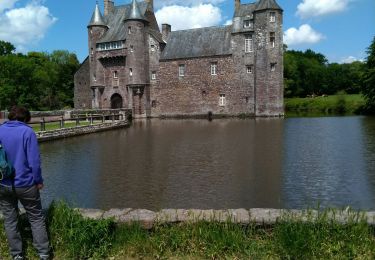
Randonnée Marche de 44 km à découvrir à Bretagne, Ille-et-Vilaine, Paimpont. Cette randonnée est proposée par Patakk.

Description

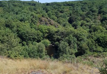
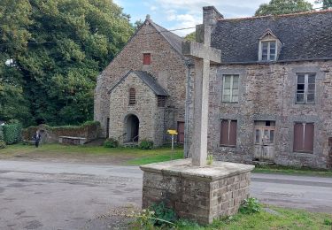
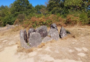
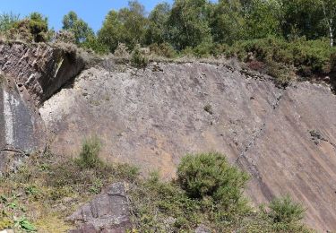
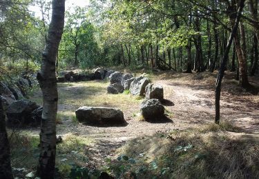
Parcours en plein coeur de Brocéliande...
(non testé)

Profil altimétrique

Points d'intérêt

Point d'intérêt Paimpont - La Maison de Viviane - Photo
Patakk
Point d'intérêt Paimpont - Le Val Sans Retour  - Photo
Patakk
Point d'intérêt Paimpont - Fontaine de Baronton - Photo
Patakk
Point d'intérêt Néant-sur-Yvel - Le Jardin aux Moines - Photo
Patakk
NÉANT-SUR-YVEL 
Point d'intérêt Concoret - Le Chêne Guillotin - Photo
Patakk
Point d'intérêt Campénéac - Le Tombeau du Géant - Photo
Patakk
Point d'intérêt Paimpont - Le Pont du Secret - Photo
Patakk

Localisation

Pays :
France
Région :
Bretagne
Département/Province :
Ille-et-Vilaine
Commune :
Paimpont
Localité :
Unknown
Départ:(Dec)
Départ:(UTM)
554749 ; 5315992 (30T) N.

Commentaires

Veuillez vous connecter pour laisser un commentaire ou une note


Randonnées à proximité

Randonnée Marche Campénéac - Château de TRECESSON - Tombeau du Géant - L'Hotié de la Fée Viviane - (8/2019) - Photo
Marche
nicolibris

Marche

Moyen
(1)
Campénéac, Bretagne, Morbihan, France
11 km | 13,4 km-effort
2h 43min
Oui
Randonnée Marche Tréhorenteuc - les landes de Gurwant et le Val sans retour - Photo
Marche
GUIDE
amiral13

Marche

Facile
Tréhorenteuc, Bretagne, Morbihan, France
14,9 km | 18,2 km-effort
4h 46min
Oui
Randonnée Marche Tréhorenteuc - Tréhorenteuc  - Photo
Marche
FOUCAULT

Marche

Tréhorenteuc, Bretagne, Morbihan, France
4,8 km | 5,7 km-effort
1h 40min
Oui
Randonnée Marche Paimpont - GR_37_CE_39_Paimpont_Mauron_20220924 - Photo
Marche
patrickdanilo

Marche

Très difficile
Paimpont, Bretagne, Ille-et-Vilaine, France
20 km | 25 km-effort
5h 17min
Non
Randonnée Marche Tréhorenteuc - Broceliande - Photo
Marche
Raymond DAVID

Marche

Moyen
Tréhorenteuc, Bretagne, Morbihan, France
72 km | 85 km-effort
4h 45min
Non
Randonnée A pied Campénéac - Les Landes de Gurwan - Photo
A pied
PRO

A pied

Facile
Campénéac, Bretagne, Morbihan, France
11,4 km | 13,7 km-effort
3h 6min
Oui
Randonnée Marche Néant-sur-Yvel - TUMULUS DU JARDIN AUX MOINES (9/20) - Photo
Marche
nicolibris

Marche

Moyen
Néant-sur-Yvel, Bretagne, Morbihan, France
11,7 km | 14,2 km-effort
3h 30min
Oui
Randonnée Marche Néant-sur-Yvel - Autour des étangs à partir du gîte de tante Phonsine - Photo
Marche
sebastienjacqmin

Marche

Moyen
Néant-sur-Yvel, Bretagne, Morbihan, France
4 km | 4,9 km-effort
1h 0min
Oui
Randonnée Marche Campénéac - l'arbre d'or Val sans retour - Photo
Marche
motardfou.dgs

Marche

Moyen
Campénéac, Bretagne, Morbihan, France
13,3 km | 0 m-effort
3h 15min
Oui


Fermer
Mes abonnements