Randonnée Autre activité Sarrebourg - Kayak Sarrebourg - Photo
 bbazin
bbazin

Utilisateur

© OpenStreetMap contributors
Longueur
Longueur
83 km
Altitude max
Altitude max
254 m
Dénivelé positif
Dénivelé positif
400 m
Km-Effort
Km-Effort  
88 km
Altitude min
Altitude min
190 m
Dénivelé négatif
Dénivelé négatif
451 m
Boucle
Boucle
Non
Date de création :
2014-12-10 00:00:00.0
Dernière modification :
2014-12-10 00:00:00.0

(0 Avis)

Autre activité
Autre activité
--
Difficulté : Inconnu

Scannez ce code QR pour ouvrir la randonnée dans l'application SityTrail

Application GPS de randonnée GRATUITE

Logo SityTrail SityTrail

IGN / Instituts géographiques

Télécharger SityTrail sur l'App Store Télécharger SityTrail sur Google Play

Logo SityTrail SityTrail World

Le monde est à vous

Télécharger SityTrail sur l'App Store Télécharger SityTrail sur Google Play Télécharger SityTrail sur Huawei AppGallery

À propos

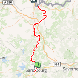
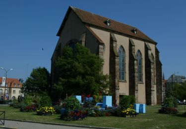
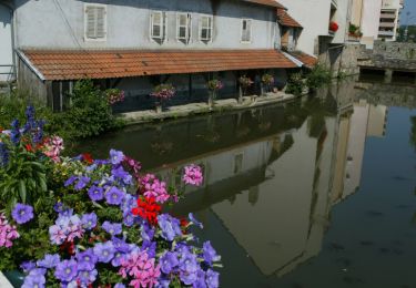
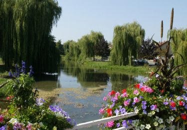
Randonnée Autre activité de 83 km à découvrir à Grand Est, Moselle, Sarrebourg. Cette randonnée est proposée par bbazin.

Description

Descente de la Sarre de Sarrebourg à Sarreguemines

Profil altimétrique

Localisation

Pays :
France
Région :
Grand Est
Département/Province :
Moselle
Commune :
Sarrebourg
Localité :
Unknown
Départ:(Dec)
Départ:(UTM)
355058 ; 5398967 (32U) N.

Randonnées à proximité

Randonnée Vélo Sarrebourg - Aux portes de Sarrebourg, le Pays des Grands Etangs - Sarrebourg - Circuit 20 - Photo
Vélo
tracegps

Vélo

Difficile
Sarrebourg, Grand Est, Moselle, France
59 km | 69 km-effort
3h 30min
Oui
Randonnée Marche Dolving - 2022-05-25-Circuit St Ulrich - Photo
Marche
milou1941

Marche

Facile
Dolving, Grand Est, Moselle, France
4,8 km | 5,9 km-effort
1h 20min
Oui
Randonnée V.T.T. Sarrebourg - Circuit VTT de Réding-Sarrebourg - Photo
V.T.T.
tracegps

V.T.T.

Difficile
Sarrebourg, Grand Est, Moselle, France
35 km | 42 km-effort
4h 0min
Oui
Randonnée V.T.T. Sarrebourg - Circuit VTT des Etangs de Rinting - Photo
V.T.T.
tracegps

V.T.T.

Difficile
Sarrebourg, Grand Est, Moselle, France
26 km | 31 km-effort
2h 30min
Oui
Randonnée V.T.T. Sarrebourg - Circuit VTT de la Vallée de la Sarre -Sarrebourg - Photo
V.T.T.
tracegps

V.T.T.

Moyen
(1)
Sarrebourg, Grand Est, Moselle, France
18,9 km | 23 km-effort
1h 30min
Oui
Randonnée V.T.T. Sarrebourg - Circuit VTT de la Zone de Loisirs - Sarrebourg - Photo
V.T.T.
tracegps

V.T.T.

Facile
Sarrebourg, Grand Est, Moselle, France
4,6 km | 5,3 km-effort
30min
Oui
Randonnée Moto Sarrebourg - Moto(88)-Vosges - Route-des-cretes-cols-vosgiens - Photo
Moto
HG74250

Moto

Très facile
Sarrebourg, Grand Est, Moselle, France
449 km | 571 km-effort
Inconnu
Non
Randonnée V.T.T. Bébing - Bebing-Walscheid-Mont Ste Odile en VTT - Photo
V.T.T.
bbazin

V.T.T.

Difficile
Bébing, Grand Est, Moselle, France
72 km | 97 km-effort
6h 40min
Non
Randonnée Cyclotourisme Hesse - Boucle Hesse - Abreschviller - Sarrebourg - Photo
Cyclotourisme
nfranche

Cyclotourisme

Moyen
Hesse, Grand Est, Moselle, France
49 km | 56 km-effort
Inconnu
Oui


Fermer
Mes abonnements