Randonnée V.T.T. Haux - 33-haux-20120527 - Photo
 Gus64
Gus64

Utilisateur

© OpenStreetMap contributors
Longueur
Longueur
32 km
Altitude max
Altitude max
106 m
Dénivelé positif
Dénivelé positif
674 m
Km-Effort
Km-Effort  
41 km
Altitude min
Altitude min
10 m
Dénivelé négatif
Dénivelé négatif
670 m
Boucle
Boucle
Oui
Date de création :
2014-12-10 00:00:00.0
Dernière modification :
2014-12-10 00:00:00.0

(0 Avis)

V.T.T.
V.T.T.
3h00
Difficulté : Difficile

Scannez ce code QR pour ouvrir la randonnée dans l'application SityTrail

Application GPS de randonnée GRATUITE

Logo SityTrail SityTrail

IGN / Instituts géographiques

Télécharger SityTrail sur l'App Store Télécharger SityTrail sur Google Play

Logo SityTrail SityTrail World

Le monde est à vous

Télécharger SityTrail sur l'App Store Télécharger SityTrail sur Google Play Télécharger SityTrail sur Huawei AppGallery

À propos

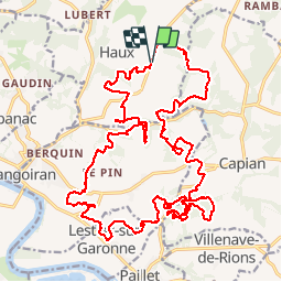
Randonnée V.T.T. de 32 km à découvrir à Nouvelle-Aquitaine, Gironde, Haux. Cette randonnée est proposée par Gus64.

Description

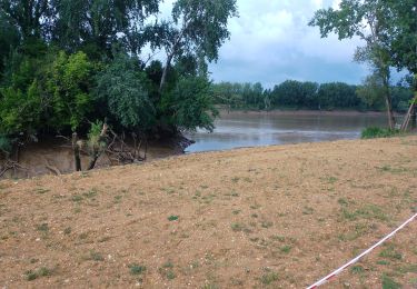
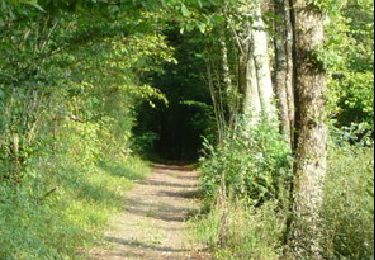
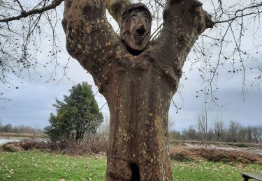
un concentré du top dans le secteur de Langoiran / Haux
         

Profil altimétrique

Photos

Points d'intérêt

Point d'intérêt Langoiran - Nico caca - Photo
Gus64
LANGOIRAN 

Localisation

Pays :
France
Région :
Nouvelle-Aquitaine
Département/Province :
Gironde
Commune :
Haux
Localité :
Unknown
Départ:(Dec)
Départ:(UTM)
709006 ; 4956697 (30T) N.

Randonnées à proximité

Randonnée Marche Lestiac-sur-Garonne - aze - Photo
Marche
PatrickBEGUIN

Marche

Facile
Lestiac-sur-Garonne, Nouvelle-Aquitaine, Gironde, France
4,5 km | 4,8 km-effort
2h 34min
Non
Randonnée Marche Le Tourne - langoiran - Photo
Marche
bedous

Marche

Facile
Le Tourne, Nouvelle-Aquitaine, Gironde, France
17,8 km | 24 km-effort
4h 12min
Non
Randonnée Marche Lestiac-sur-Garonne - lestiac   - Photo
Marche
phil33

Marche

Très facile
Lestiac-sur-Garonne, Nouvelle-Aquitaine, Gironde, France
9,4 km | 11,3 km-effort
3h 2min
Oui
Randonnée V.T.T. Créon - De Créon à Saint Genès de Lombaud - Photo
V.T.T.
tracegps

V.T.T.

Difficile
Créon, Nouvelle-Aquitaine, Gironde, France
24 km | 28 km-effort
2h 30min
Oui
Randonnée Marche Tabanac - languaran  - Photo
Marche
jara

Marche

Très facile
Tabanac, Nouvelle-Aquitaine, Gironde, France
9,8 km | 12,1 km-effort
2h 54min
Oui
Randonnée Marche La Sauve - sauvé  Majeure 10 km - Photo
Marche
rigo33

Marche

Très facile
(1)
La Sauve, Nouvelle-Aquitaine, Gironde, France
9,8 km | 11,5 km-effort
2h 35min
Non
Randonnée Marche Haux - haux - Photo
Marche
gerardbarreau

Marche

Très facile
Haux, Nouvelle-Aquitaine, Gironde, France
11,8 km | 15,3 km-effort
4h 1min
Oui
Randonnée Marche Lestiac-sur-Garonne - Lestiac V2 - Photo
Marche
Rosko65

Marche

Très facile
Lestiac-sur-Garonne, Nouvelle-Aquitaine, Gironde, France
18,2 km | 23 km-effort
5h 20min
Oui
Randonnée Autre activité Créon - rando creon Fred  - Photo
Autre activité
manchado

Autre activité

Difficile
Créon, Nouvelle-Aquitaine, Gironde, France
43 km | 52 km-effort
5h 8min
Oui


Fermer
Mes abonnements