Randonnée Marche Mouthe - Mouthe - La Source du Doubs - Photo

Mouthe - La Source du Doubs

 bmorel@orange.fr
bmorel@orange.fr

Utilisateur

© OpenStreetMap contributors
Longueur
Longueur
5,4 km
Altitude max
Altitude max
976 m
Dénivelé positif
Dénivelé positif
83 m
Km-Effort
Km-Effort  
6,5 km
Altitude min
Altitude min
932 m
Dénivelé négatif
Dénivelé négatif
83 m
Boucle
Boucle
Oui
Date de création :
2014-12-10 00:00:00.0
Dernière modification :
2014-12-10 00:00:00.0

(1 Avis)

Marche
Marche
--
Difficulté : Très facile

Scannez ce code QR pour ouvrir la randonnée dans l'application SityTrail

Application GPS de randonnée GRATUITE

Logo SityTrail SityTrail

IGN / Instituts géographiques

Télécharger SityTrail sur l'App Store Télécharger SityTrail sur Google Play

Logo SityTrail SityTrail World

Le monde est à vous

Télécharger SityTrail sur l'App Store Télécharger SityTrail sur Google Play Télécharger SityTrail sur Huawei AppGallery

À propos

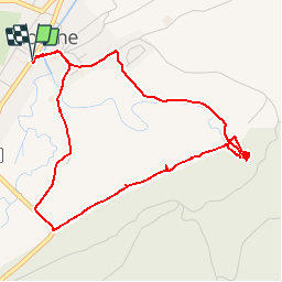
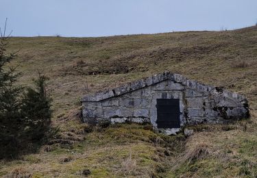
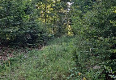
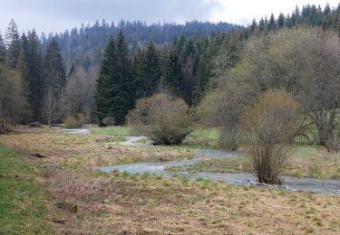
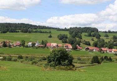
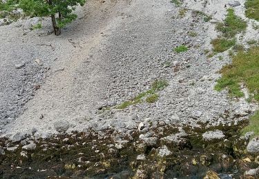
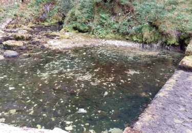
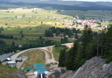
Randonnée Marche de 5,4 km à découvrir à Bourgogne-Franche-Comté, Doubs, Mouthe. Cette randonnée est proposée par bmorel@orange.fr.

Description

Tracé GPS

Profil altimétrique

Points d'intérêt

Point d'intérêt Mouthe -  - Photo
bmorel@orange.fr
MOUTHE 

Localisation

Pays :
France
Région :
Bourgogne-Franche-Comté
Département/Province :
Doubs
Commune :
Mouthe
Localité :
Unknown
Départ:(Dec)
Départ:(UTM)
285408 ; 5176798 (32T) N.

Commentaires

Veuillez vous connecter pour laisser un commentaire ou une note


parfait pour la version France. J'ai été très déçue par celle de la Suisse


Randonnées à proximité

Randonnée Marche Chaux-Neuve - Chaux Neuve - cascade Bief Bridaux - tremplin - Photo
Marche
daniellebou

Marche

Difficile
(1)
Chaux-Neuve, Bourgogne-Franche-Comté, Doubs, France
9,1 km | 12,5 km-effort
2h 50min
Oui
Randonnée Marche Remoray-Boujeons - Boucle autour de la baume champion - Photo
Marche
mallovon

Marche

Moyen
Remoray-Boujeons, Bourgogne-Franche-Comté, Doubs, France
8,5 km | 10,9 km-effort
2h 28min
Oui
Randonnée A pied Mouthe - Les Roches - Photo
A pied
PRO

A pied

Facile
Mouthe, Bourgogne-Franche-Comté, Doubs, France
4,2 km | 6,1 km-effort
1h 23min
Oui
Randonnée A pied Rondefontaine - Le Rivier - Photo
A pied
PRO

A pied

Facile
Rondefontaine, Bourgogne-Franche-Comté, Doubs, France
9,5 km | 12,5 km-effort
2h 51min
Oui
Randonnée Marche Mouthe - GTJ 4 Mouthe, Foncine le Haut - Photo
Marche
Praff

Marche

Moyen
Mouthe, Bourgogne-Franche-Comté, Doubs, France
28 km | 39 km-effort
7h 12min
Non
Randonnée Marche Mouthe - SOURCE DU DOUBS - Photo
Marche
walrou63

Marche

Moyen
Mouthe, Bourgogne-Franche-Comté, Doubs, France
5,7 km | 7,2 km-effort
1h 25min
Oui
Randonnée Marche Mouthe - Belvédère de la source du Doubs - Photo
Marche
mallovon

Marche

Facile
(1)
Mouthe, Bourgogne-Franche-Comté, Doubs, France
4 km | 5,2 km-effort
1h 45min
Oui
Randonnée Marche Mouthe - Petite Chaux - Photo
Marche
TRIMAILLE

Marche

Très facile
Mouthe, Bourgogne-Franche-Comté, Doubs, France
19,7 km | 26 km-effort
5h 31min
Non
Randonnée Marche Mouthe - Mouthe2 - Photo
Marche
gil05

Marche

Mouthe, Bourgogne-Franche-Comté, Doubs, France
5 km | 5,8 km-effort
2h 36min
Oui


Fermer
Mes abonnements