Randonnée V.T.T. La Motte-d'Aveillans - Tour du Paradis - Photo
 jimmyfend
jimmyfend

Utilisateur

© OpenStreetMap contributors
Longueur
Longueur
31 km
Altitude max
Altitude max
1595 m
Dénivelé positif
Dénivelé positif
1047 m
Km-Effort
Km-Effort  
45 km
Altitude min
Altitude min
883 m
Dénivelé négatif
Dénivelé négatif
1050 m
Boucle
Boucle
Oui
Date de création :
2014-12-10 00:00:00.0
Dernière modification :
2014-12-10 00:00:00.0

(0 Avis)

V.T.T.
V.T.T.
3h00
Difficulté : Moyen

Scannez ce code QR pour ouvrir la randonnée dans l'application SityTrail

Application GPS de randonnée GRATUITE

Logo SityTrail SityTrail

IGN / Instituts géographiques

Télécharger SityTrail sur l'App Store Télécharger SityTrail sur Google Play

Logo SityTrail SityTrail World

Le monde est à vous

Télécharger SityTrail sur l'App Store Télécharger SityTrail sur Google Play Télécharger SityTrail sur Huawei AppGallery

À propos

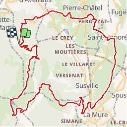
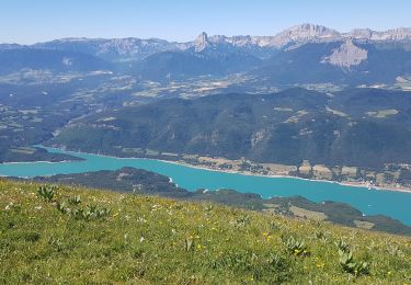
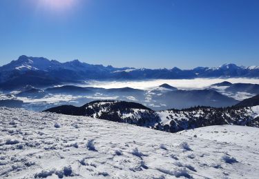
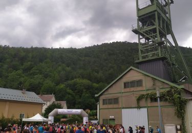
Randonnée V.T.T. de 31 km à découvrir à Auvergne-Rhône-Alpes, Isère, La Motte-d'Aveillans. Cette randonnée est proposée par jimmyfend.

Profil altimétrique

Localisation

Pays :
France
Région :
Auvergne-Rhône-Alpes
Département/Province :
Isère
Commune :
La Motte-d'Aveillans
Localité :
Unknown
Départ:(Dec)
Départ:(UTM)
715735 ; 4979757 (31T) N.

Randonnées à proximité

Randonnée Vélo de route La Mure - La Mure les 4 lacs - Photo
Vélo de route
Uio73

Vélo de route

Moyen
(1)
La Mure, Auvergne-Rhône-Alpes, Isère, France
58 km | 72 km-effort
4h 22min
Oui
Randonnée V.T.T. Pierre-Châtel - Tour des lacs Pierre-Chatel - Photo
V.T.T.
Vicenzozo

V.T.T.

Très facile
(1)
Pierre-Châtel, Auvergne-Rhône-Alpes, Isère, France
32 km | 46 km-effort
4h 28min
Oui
Randonnée Marche La Motte-Saint-Martin - connex - Photo
Marche
paulin bruno

Marche

Moyen
La Motte-Saint-Martin, Auvergne-Rhône-Alpes, Isère, France
15,6 km | 28 km-effort
6h 26min
Oui
Randonnée Marche Susville - Susville les Merlins boucle par le col du Sénépiy - Photo
Marche
gmtrando

Marche

Moyen
Susville, Auvergne-Rhône-Alpes, Isère, France
10,1 km | 16,3 km-effort
3h 30min
Oui
Randonnée Marche Treffort - ISERE: MONTEYNARD PASSERELLES HIMALAYENNES  - Photo
Marche
djeepee74

Marche

Moyen
Treffort, Auvergne-Rhône-Alpes, Isère, France
16,1 km | 22 km-effort
3h 52min
Oui
Randonnée Marche La Motte-Saint-Martin - Sinepi  - Photo
Marche
marc vitoria

Marche

(1)
La Motte-Saint-Martin, Auvergne-Rhône-Alpes, Isère, France
24 km | 40 km-effort
6h 0min
Non
Randonnée V.T.T. La Motte-d'Aveillans - Le Sénépy depuis Les Signaraux - Photo
V.T.T.
patjobou

V.T.T.

Moyen
La Motte-d'Aveillans, Auvergne-Rhône-Alpes, Isère, France
20 km | 32 km-effort
3h 39min
Oui
Randonnée Marche La Motte-d'Aveillans - Col du Sénépy et Pierre Plantée depuis les Signaraux - Photo
Marche
GuyVachet

Marche

Moyen
La Motte-d'Aveillans, Auvergne-Rhône-Alpes, Isère, France
10,2 km | 15,8 km-effort
5h 39min
Oui
Randonnée Trail Prunières - Trail du 3ème Poste  - Photo
Trail
phd04

Trail

Moyen
Prunières, Auvergne-Rhône-Alpes, Isère, France
17,7 km | 28 km-effort
2h 33min
Non


Fermer
Mes abonnements