Randonnée Marche Saint-Christophe-sur-Guiers - Petit Som par le Col de la Ruchère - Photo
 simon.paume
simon.paume

Utilisateur

© OpenStreetMap contributors
Longueur
Longueur
7,1 km
Altitude max
Altitude max
1753 m
Dénivelé positif
Dénivelé positif
603 m
Km-Effort
Km-Effort  
15,2 km
Altitude min
Altitude min
1132 m
Dénivelé négatif
Dénivelé négatif
609 m
Boucle
Boucle
Oui
Date de création :
2014-12-10 00:00:00.0
Dernière modification :
2014-12-10 00:00:00.0

(2 Avis)

Marche
Marche
3h05
Difficulté : Moyen

Scannez ce code QR pour ouvrir la randonnée dans l'application SityTrail

Application GPS de randonnée GRATUITE

Logo SityTrail SityTrail

IGN / Instituts géographiques

Télécharger SityTrail sur l'App Store Télécharger SityTrail sur Google Play

Logo SityTrail SityTrail World

Le monde est à vous

Télécharger SityTrail sur l'App Store Télécharger SityTrail sur Google Play Télécharger SityTrail sur Huawei AppGallery

À propos

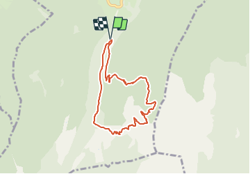
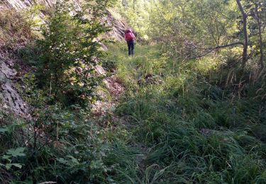
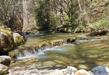
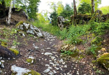
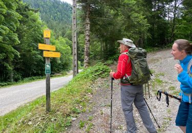
Randonnée Marche de 7,1 km à découvrir à Auvergne-Rhône-Alpes, Isère, Saint-Christophe-sur-Guiers. Cette randonnée est proposée par simon.paume.

Description

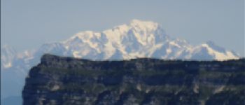
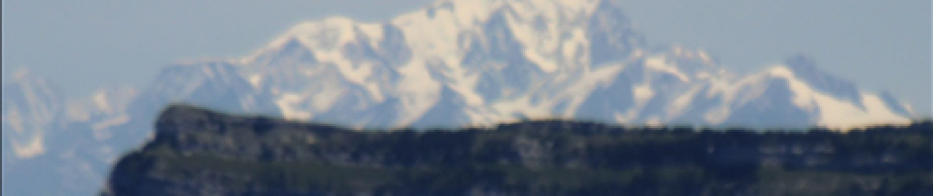
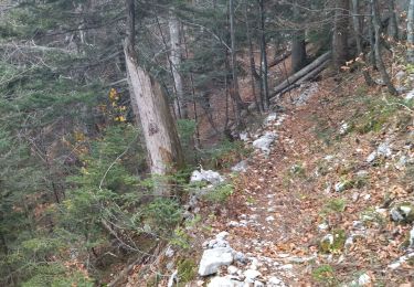
Départ du Habert direction le col de la Ruchère. Ensuite montée finale. Au sommet: vue splendide sur le Mont-Blanc. Redescente par le Col de Léchaud.

Profil altimétrique

Photos

Points d'intérêt

Point d'intérêt Saint-Christophe-sur-Guiers - Sommet du Petit Som - Photo
simon.paume
SAINT-CHRISTOPHE-SUR-GUIERS 

Localisation

Pays :
France
Région :
Auvergne-Rhône-Alpes
Département/Province :
Isère
Commune :
Saint-Christophe-sur-Guiers
Localité :
Unknown
Départ:(Dec)
Départ:(UTM)
719111 ; 5031398 (31T) N.

Commentaires

Veuillez vous connecter pour laisser un commentaire ou une note


bel itinéraire


Randonnées à proximité

Randonnée Raquettes à neige Saint-Christophe-sur-Guiers - Le Belvédère d'Arpison - Photo
Raquettes à neige
patjobou

Raquettes à neige

Moyen
(1)
Saint-Christophe-sur-Guiers, Auvergne-Rhône-Alpes, Isère, France
11,1 km | 17,4 km-effort
4h 43min
Oui
Randonnée Marche Saint-Pierre-d'Entremont - Le Grand Som 2026m, depuis Saint-Philibert - Photo
Marche
tracegps

Marche

Difficile
(1)
Saint-Pierre-d'Entremont, Auvergne-Rhône-Alpes, Isère, France
11,2 km | 25 km-effort
7h 0min
Oui
Randonnée Marche Saint-Pierre-d'Entremont - Roche Veyrand par les Clapiers, 1429m - Photo
Marche
tracegps

Marche

Difficile
(1)
Saint-Pierre-d'Entremont, Auvergne-Rhône-Alpes, Savoie, France
4,8 km | 14,3 km-effort
4h 10min
Oui
Randonnée Marche Saint-Christophe-sur-Guiers - Petit Som 1772m,  depuis La Ruchère - Photo
Marche
tracegps

Marche

Moyen
(2)
Saint-Christophe-sur-Guiers, Auvergne-Rhône-Alpes, Isère, France
6 km | 13,2 km-effort
3h 30min
Oui
Randonnée Marche Saint-Christophe-sur-Guiers - 38 grand som par sente intermediaire - Photo
Marche
himba26100

Marche

Moyen
Saint-Christophe-sur-Guiers, Auvergne-Rhône-Alpes, Isère, France
14,5 km | 28 km-effort
7h 11min
Oui
Randonnée Marche Saint-Pierre-d'Entremont - col cucheron grande Som_col de Bevinant_Col de fret - Photo
Marche
Mich&Agnès

Marche

Très difficile
Saint-Pierre-d'Entremont, Auvergne-Rhône-Alpes, Isère, France
14,3 km | 30 km-effort
4h 32min
Oui
Randonnée Marche Saint-Pierre-d'Entremont - Saint Pierre d'Entremont- le long du Cozon- Epernay - Photo
Marche
Valgaudemar

Marche

Facile
(1)
Saint-Pierre-d'Entremont, Auvergne-Rhône-Alpes, Savoie, France
14,5 km | 21 km-effort
4h 2min
Non
Randonnée Marche Saint-Pierre-de-Chartreuse - Champs Massot saint Pierre de Charteuse 7,2 Km - Photo
Marche
GUIDE
rvapeldo

Marche

Moyen
Saint-Pierre-de-Chartreuse, Auvergne-Rhône-Alpes, Isère, France
7,3 km | 11,8 km-effort
2h 48min
Oui
Randonnée Marche Saint-Christophe-sur-Guiers - Petit Som 8 km - Photo
Marche
GUIDE
rvapeldo

Marche

Moyen
(1)
Saint-Christophe-sur-Guiers, Auvergne-Rhône-Alpes, Isère, France
7,9 km | 16,1 km-effort
4h 54min
Oui


Fermer
Mes abonnements