Randonnée Randonnée équestre Eygalières - 2019-04-29 Rando CVA Alpilles La Sarriette Ranch Petit Roman - Photo

2019-04-29 Rando CVA Alpilles La Sarriette Ranch Petit Roman

 holtzv
holtzv

Utilisateur GUIDE

© OpenStreetMap contributors
Longueur
Longueur
24 km
Altitude max
Altitude max
305 m
Dénivelé positif
Dénivelé positif
440 m
Km-Effort
Km-Effort  
30 km
Altitude min
Altitude min
28 m
Dénivelé négatif
Dénivelé négatif
468 m
Boucle
Boucle
Non
Date de création :
2019-04-16 17:07:50.501
Dernière modification :
2019-05-06 11:19:31.831

(0 Avis)

Randonnée équestre
Randonnée équestre
3h51
Difficulté : Moyen

Scannez ce code QR pour ouvrir la randonnée dans l'application SityTrail

Application GPS de randonnée GRATUITE

Logo SityTrail SityTrail

IGN / Instituts géographiques

Télécharger SityTrail sur l'App Store Télécharger SityTrail sur Google Play

Logo SityTrail SityTrail World

Le monde est à vous

Télécharger SityTrail sur l'App Store Télécharger SityTrail sur Google Play Télécharger SityTrail sur Huawei AppGallery

À propos

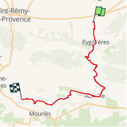
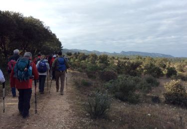
Randonnée Randonnée équestre de 24 km à découvrir à Provence-Alpes-Côte d'Azur, Bouches-du-Rhône, Eygalières. Cette randonnée est proposée par holtzv.

Description

Passage par Eygalières et Aureille.
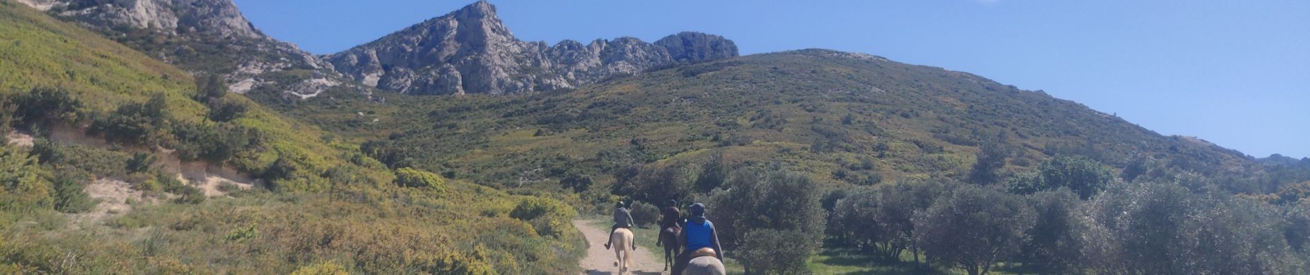
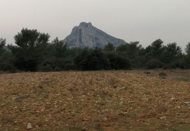
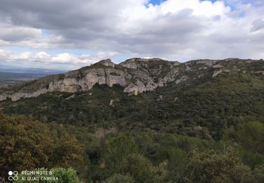
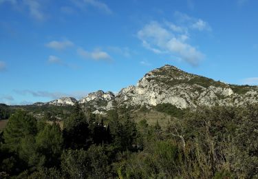
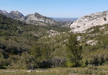
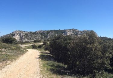
Point de vue sur les Caisses de Servanne la Castellas

Profil altimétrique

Photos

Points d'intérêt

Point d'intérêt Aureille - Repas de midi - Photo
holtzv
AUREILLE 

Localisation

Pays :
France
Région :
Provence-Alpes-Côte d'Azur
Département/Province :
Bouches-du-Rhône
Commune :
Eygalières
Localité :
Unknown
Départ:(UTM)
656562 ; 4849415 (31T) N.

Randonnées à proximité

Randonnée Marche Eygalières - Eygalières, Petit Calan - Photo
Marche
Amaralain

Marche

Facile
(1)
Eygalières, Provence-Alpes-Côte d'Azur, Bouches-du-Rhône, France
8,2 km | 10,4 km-effort
2h 15min
Oui
Randonnée Marche Eygalières - Eygalieres Tour de la Baume Brignolle - Photo
Marche
Manoune

Marche

Facile
Eygalières, Provence-Alpes-Côte d'Azur, Bouches-du-Rhône, France
13,6 km | 17,7 km-effort
4h 3min
Oui
Randonnée Marche Eygalières - Les Alpilles au dessus d'Eygalieres - Photo
Marche
MarcLEBARON

Marche

Moyen
Eygalières, Provence-Alpes-Côte d'Azur, Bouches-du-Rhône, France
21 km | 28 km-effort
5h 28min
Oui
Randonnée Marche Saint-Rémy-de-Provence - Alpilles - Photo
Marche
darranger

Marche

Difficile
Saint-Rémy-de-Provence, Provence-Alpes-Côte d'Azur, Bouches-du-Rhône, France
13 km | 18,8 km-effort
3h 56min
Oui
Randonnée Marche Eygalières - Eygalières et les Calans  - Photo
Marche
GUIDE
nadinebondoux

Marche

Moyen
Eygalières, Provence-Alpes-Côte d'Azur, Bouches-du-Rhône, France
19,7 km | 26 km-effort
5h 3min
Oui
Randonnée Marche Orgon - PF-Orgon - La Plaine des Alpilles - Photo
Marche
MicDul

Marche

Moyen
(1)
Orgon, Provence-Alpes-Côte d'Azur, Bouches-du-Rhône, France
16,3 km | 21 km-effort
5h 13min
Oui
Randonnée Cheval Orgon - Les Alpilles de provence  - Photo
Cheval
Berbezier

Cheval

Moyen
(1)
Orgon, Provence-Alpes-Côte d'Azur, Bouches-du-Rhône, France
18,8 km | 22 km-effort
2h 51min
Oui
Randonnée Marche Eygalières - Le Gros Calan - Photo
Marche
SabetMick

Marche

Moyen
Eygalières, Provence-Alpes-Côte d'Azur, Bouches-du-Rhône, France
10,7 km | 14,2 km-effort
3h 48min
Oui
Randonnée Marche Eygalières - PF-Eygalières - Chemin du Mas de Pascal - Photo
Marche
MicDul

Marche

Facile
Eygalières, Provence-Alpes-Côte d'Azur, Bouches-du-Rhône, France
8,9 km | 11,5 km-effort
2h 37min
Oui


Fermer
Mes abonnements