Randonnée Marche Bellecombe-Tarendol - 26 Col de Soubeyrand au relais - Photo
 ericf64
ericf64

Utilisateur

© OpenStreetMap contributors
Longueur
Longueur
7,4 km
Altitude max
Altitude max
1302 m
Dénivelé positif
Dénivelé positif
354 m
Km-Effort
Km-Effort  
12,1 km
Altitude min
Altitude min
986 m
Dénivelé négatif
Dénivelé négatif
354 m
Boucle
Boucle
Oui
Date de création :
2019-07-13 06:20:42.111
Dernière modification :
2019-07-13 09:26:24.188

(0 Avis)

Marche
Marche
2h30
Difficulté : Facile

Scannez ce code QR pour ouvrir la randonnée dans l'application SityTrail

Application GPS de randonnée GRATUITE

Logo SityTrail SityTrail

IGN / Instituts géographiques

Télécharger SityTrail sur l'App Store Télécharger SityTrail sur Google Play

Logo SityTrail SityTrail World

Le monde est à vous

Télécharger SityTrail sur l'App Store Télécharger SityTrail sur Google Play Télécharger SityTrail sur Huawei AppGallery

À propos

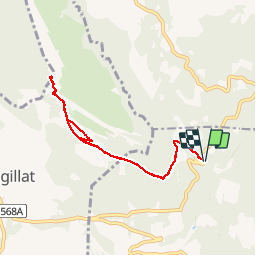
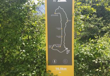
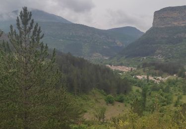
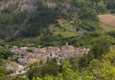
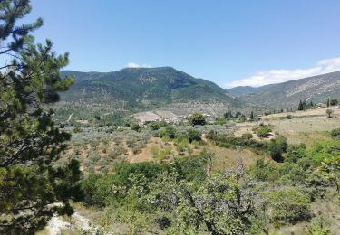
Randonnée Marche de 7,4 km à découvrir à Auvergne-Rhône-Alpes, Drôme, Bellecombe-Tarendol. Cette randonnée est proposée par ericf64.

Description

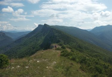
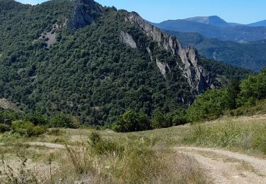
très belle vue à 360
2h30 aller retour

Profil altimétrique

Localisation

Pays :
France
Région :
Auvergne-Rhône-Alpes
Département/Province :
Drôme
Commune :
Bellecombe-Tarendol
Localité :
Unknown
Départ:(UTM)
687657 ; 4915808 (31T) N.

Randonnées à proximité

Randonnée Marche Rémuzat - Remuzat,les Aiguilles - Photo
Marche
alinetpierre

Marche

Difficile
Rémuzat, Auvergne-Rhône-Alpes, Drôme, France
15,7 km | 29 km-effort
4h 36min
Non
Randonnée Marche Rémuzat - Remuzat,Montrond - Photo
Marche
alinetpierre

Marche

Facile
Rémuzat, Auvergne-Rhône-Alpes, Drôme, France
10,3 km | 17,9 km-effort
2h 55min
Oui
Randonnée Marche Rémuzat - Remuzat rocher du Caire  - Photo
Marche
alinetpierre

Marche

Difficile
Rémuzat, Auvergne-Rhône-Alpes, Drôme, France
11,3 km | 20 km-effort
3h 34min
Oui
Randonnée Marche Rémuzat - Rémusat ➡️Montrond - Photo
Marche
sereton

Marche

Moyen
Rémuzat, Auvergne-Rhône-Alpes, Drôme, France
6,3 km | 9,9 km-effort
2h 5min
Oui
Randonnée Marche Rémuzat - 26 - REMUZAT - Rocher du Caire  - Photo
Marche
chris13370

Marche

Moyen
Rémuzat, Auvergne-Rhône-Alpes, Drôme, France
11,3 km | 20 km-effort
4h 0min
Oui
Randonnée Marche Rémuzat - les Aiguilles en partant de Remuzat - Photo
Marche
nadd73

Marche

Moyen
Rémuzat, Auvergne-Rhône-Alpes, Drôme, France
16 km | 29 km-effort
4h 45min
Oui
Randonnée Marche Le Poët-Sigillat - poët Sigillat-col de Soubeyrand-Tarendol - Photo
Marche
Bruno Berlemont

Marche

Moyen
Le Poët-Sigillat, Auvergne-Rhône-Alpes, Drôme, France
12,9 km | 20 km-effort
3h 35min
Oui
Randonnée Marche Rémuzat - REMUZAT - LE MONTROND - Photo
Marche
jean-marie.parachini

Marche

Moyen
Rémuzat, Auvergne-Rhône-Alpes, Drôme, France
10,5 km | 18 km-effort
5h 32min
Oui
Randonnée Marche Rémuzat - GRP Baronnies Rémuzat Villeperdrix 14km  - Photo
Marche
GUIDE
thonyc

Marche

Difficile
Rémuzat, Auvergne-Rhône-Alpes, Drôme, France
14,4 km | 24 km-effort
6h 47min
Non


Fermer
Mes abonnements