Randonnée V.T.T. Virton - Autour de Ethe  -  Balade_VTT_20kms - Photo

Autour de Ethe - Balade_VTT_20kms

 Pascal L
Pascal L

Utilisateur

© OpenStreetMap contributors
Longueur
Longueur
21 km
Altitude max
Altitude max
327 m
Dénivelé positif
Dénivelé positif
442 m
Km-Effort
Km-Effort  
26 km
Altitude min
Altitude min
209 m
Dénivelé négatif
Dénivelé négatif
442 m
Boucle
Boucle
Oui
Date de création :
2019-07-19 07:38:14.962
Dernière modification :
2022-08-29 20:15:03.109

(1 Avis)

V.T.T.
V.T.T.
1h40
Difficulté : Facile

Scannez ce code QR pour ouvrir la randonnée dans l'application SityTrail

Application GPS de randonnée GRATUITE

Logo SityTrail SityTrail

IGN / Instituts géographiques

Télécharger SityTrail sur l'App Store Télécharger SityTrail sur Google Play

Logo SityTrail SityTrail World

Le monde est à vous

Télécharger SityTrail sur l'App Store Télécharger SityTrail sur Google Play Télécharger SityTrail sur Huawei AppGallery

À propos

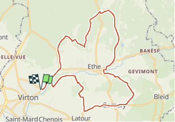
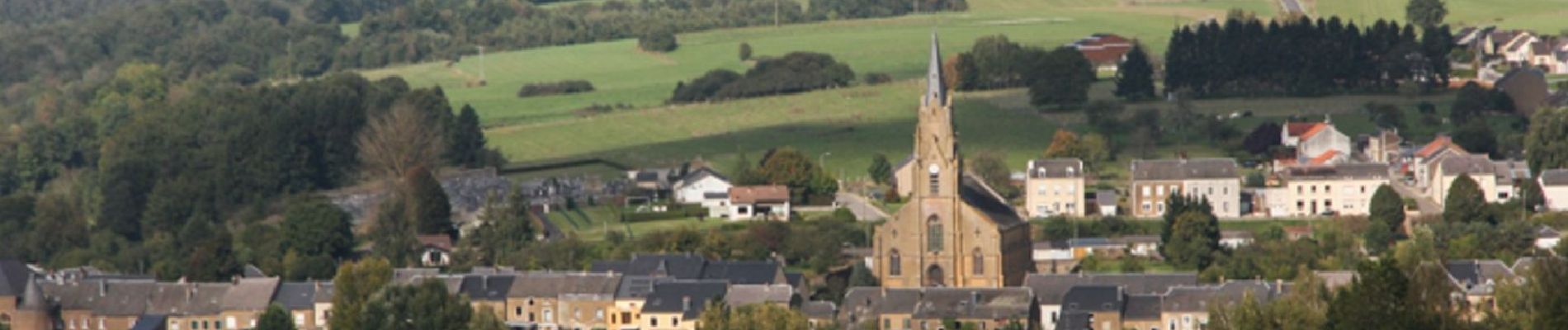
Randonnée V.T.T. de 21 km à découvrir à Wallonie, Luxembourg, Virton. Cette randonnée est proposée par Pascal L.

Description

Départ/Retour: Virton (Delhaize)
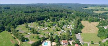
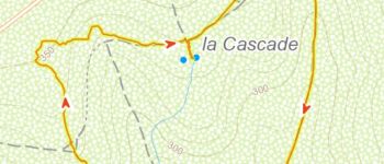
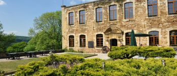
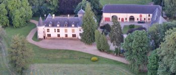
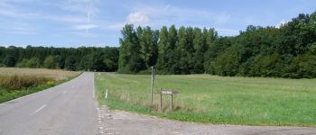
Endroits de passage : Pierrard (Institut des Arts et Métiers), Ravel, Bois des Loges, Latour, Gomery (château de Gerlache), Croix (22 août 1914 , Hauteclocque), Ethe, Ravel (Laclaireau), Bois (Sablonnière), Rue de Chenois, Bois (Le Chenoi), Rue de Belle Vue (point de vue), Vallée de Rabais (Lac), Fagne Pierrard.

(20190616)

Profil altimétrique

Photos

Points d'intérêt

Point d'intérêt Virton - Camping la Colline - Photo
Pascal L
Point d'intérêt Virton - Château de Laclaireau - Photo
Pascal L
Point d'intérêt Virton - Les étangs de Latour - Photo
Pascal L
Point d'intérêt Virton - Pas Bayard à Virton - Photo
Pascal L
Point d'intérêt Virton - Le Sentier des Songes - Photo
Pascal L
Point d'intérêt Virton - Château de Latour - Photo
Pascal L
Point d'intérêt Virton - Mégalithe de Gomery - Photo
Pascal L
Point d'intérêt Virton - Croix de Hauteclocque - Photo
Pascal L

Localisation

Pays :
Belgique
Région :
Wallonie
Département/Province :
Luxembourg
Commune :
Virton
Localité :
Virton
Départ:(UTM)
683799 ; 5494042 (31U) N.

Commentaires

Veuillez vous connecter pour laisser un commentaire ou une note


Merci pour cette belle randonnée !


Randonnées à proximité

Randonnée Marche Virton - RB-Lu-17_Ethe_via-var-1-et-2-et-3 - Photo
Marche
PRO

Marche

Très facile
(3)
Virton, Wallonie, Luxembourg, Belgique
29 km | 35 km-effort
7h 33min
Oui
Randonnée Marche Virton - GAUME Balade  naturelle et historique - Photo
Marche
julucasi

Marche

Très facile
(1)
Virton, Wallonie, Luxembourg, Belgique
5,2 km | 6,8 km-effort
1h 16min
Oui
Randonnée A pied Virton - La Bajocienne - Photo
A pied
GUIDE+

A pied

Facile
(1)
Virton, Wallonie, Luxembourg, Belgique
11 km | 14,5 km-effort
3h 17min
Oui
Randonnée A pied Virton - Chenois-Latour Boucle agricole et touristique - Entre villages, pommes et petits fruits - Photo
A pied
GUIDE
DUPONT Rita

A pied

Facile
Virton, Wallonie, Luxembourg, Belgique
6,4 km | 7,7 km-effort
1h 45min
Oui
Randonnée Marche Virton - RB-Lu-17_Ethe_via-racc - Photo
Marche
PRO

Marche

Très facile
Virton, Wallonie, Luxembourg, Belgique
15,6 km | 19,3 km-effort
4h 8min
Oui
Randonnée Marche Virton - RB-Lu-17_Ethe - Photo
Marche
PRO

Marche

Très facile
Virton, Wallonie, Luxembourg, Belgique
22 km | 28 km-effort
5h 55min
Oui
Randonnée Cheval Rouvroy - rallye 2014 - Photo
Cheval
christianegabriel

Cheval

Moyen
(1)
Rouvroy, Wallonie, Luxembourg, Belgique
26 km | 32 km-effort
4h 1min
Oui
Randonnée V.T.T. Virton - Autour de Tintigny  -  Balade_VTT_54Kms - Photo
V.T.T.
Pascal L

V.T.T.

Très difficile
Virton, Wallonie, Luxembourg, Belgique
54 km | 64 km-effort
4h 25min
Oui
Randonnée V.T.T. Virton - Monquintin  -  Balade_VTT_22Kms - Photo
V.T.T.
Pascal L

V.T.T.

Moyen
Virton, Wallonie, Luxembourg, Belgique
22 km | 26 km-effort
1h 48min
Oui


Fermer
Mes abonnements