


22 km | 31 km-effort

Utilisateur


Application GPS de randonnée GRATUITE
 SityTrail
IGN / Instituts géographiques
SityTrail World
Le monde est à vous
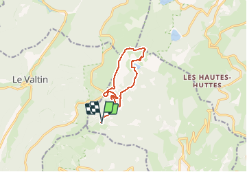
Randonnée Marche de 10,1 km à découvrir à Grand Est, Haut-Rhin, Soultzeren. Cette randonnée est proposée par E.BURCK.
Une randonnée entre Le Tanet - Lac Vert - FA du Forlet - Lac des Truites
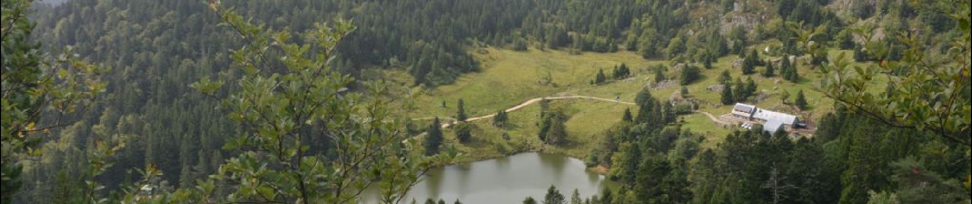
Ferme auberge du Forlet (fermée le mardi)
PARKING :
Parking près du Lac Vert
N 48° 05' 00,5 "
E 7 ° 03' 35,6 "
ACCÈS : comptez 1h10 environ
- par Cernay - Rouffach - Wintzenheim 75 km
- par autoroute A35 - Wintzenheim 82 km
ou par Illzach - D430 (voie rapide Guebwiller) - Wintzenheim 70 km
RESTAURATION : Ferme auberge du Forlet
Tél. : 03 89 77 49 22
Coordonnées GPS :
7.07483,
48.10361


Randonnée équestre

Randonnée équestre

Marche

Autre activité

Marche

Marche

Marche

Marche

Raquettes à neige