Randonnée Marche Fauvillers - RB-Lu-09_Tintange_via-racc-1 - Photo

RB-Lu-09_Tintange_via-racc-1

Randonnez sur et autour des GR ® wallons (Sentiers de Grande Randonnée). PRO

© OpenStreetMap contributors
Longueur
Longueur
17 km
Altitude max
Altitude max
499 m
Dénivelé positif
Dénivelé positif
557 m
Km-Effort
Km-Effort  
24 km
Altitude min
Altitude min
342 m
Dénivelé négatif
Dénivelé négatif
556 m
Boucle
Boucle
Oui
Date de création :
2019-08-07 07:25:37.872
Dernière modification :
2023-10-26 14:49:09.876

(2 Avis)

Marche
Marche
5h04
Difficulté : Facile

Scannez ce code QR pour ouvrir la randonnée dans l'application SityTrail

Application GPS de randonnée GRATUITE

Logo SityTrail SityTrail

IGN / Instituts géographiques

Télécharger SityTrail sur l'App Store Télécharger SityTrail sur Google Play

Logo SityTrail SityTrail World

Le monde est à vous

Télécharger SityTrail sur l'App Store Télécharger SityTrail sur Google Play Télécharger SityTrail sur Huawei AppGallery

À propos

Randonnée Marche de 17 km à découvrir à Wallonie, Luxembourg, Fauvillers. Cette randonnée est proposée par GR Rando.

Description

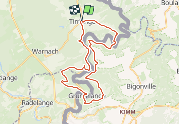
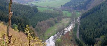
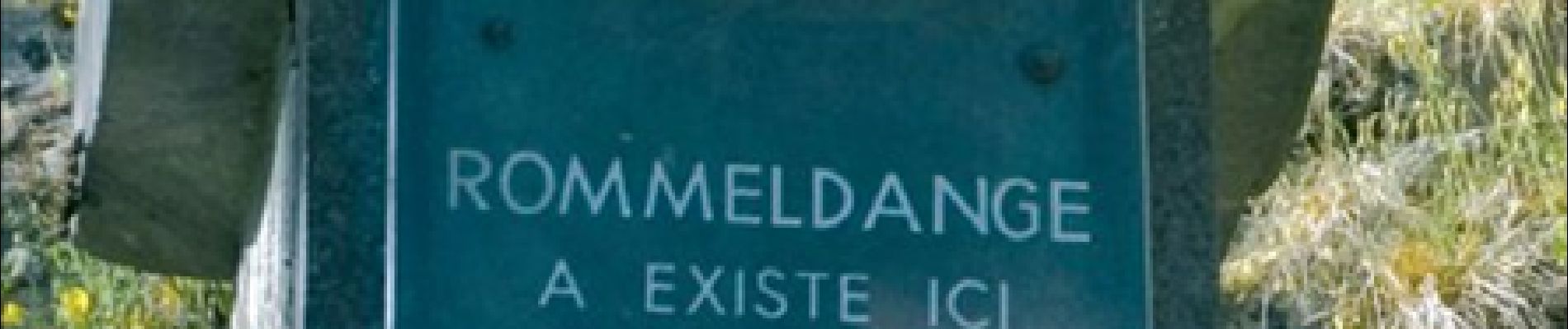
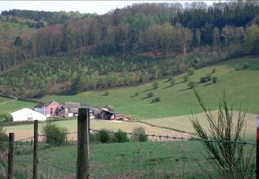
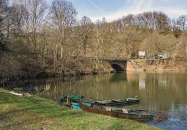
Tintange, ancien moulin d’OEil, ferme d’OEil, Grumelange, Martelinville, Romeldange, TintangeCartographie et documentation :Carte IGN au 1 : 20 000, 65/7-8 « Fauvillers – Martelange ».Carte IGN de promenades « Martelange », éditeur responsable : Administration communale de Martelange, chemin du Moulin, 1 – 6630 Martelange – Tél. 063 60 01 73.Topo-guide du GR 15 « Monschau – Martelange ».Où se désaltérer et se restaurer :À Martelange ou à Bastogne tout proches, vous trouverez de quoi apaiser votre soif et votre faim !

Photos

Points d'intérêt

Point d'intérêt Fauvillers - Tintange - Photo
GR Rando
FAUVILLERS 
Point d'intérêt Fauvillers - Ancien moulin d’OEil - Photo
GR Rando
Point d'intérêt Rambrouch - Ferme d’Oeil - Photo
GR Rando
RAMBROUCH 
Point d'intérêt Martelange - Grumelange - Photo
GR Rando
MARTELANGE 
Point d'intérêt Fauvillers - vallée de la Sûre - Photo
GR Rando
Point d'intérêt Fauvillers - Romeldange - Photo
GR Rando
FAUVILLERS 

Localisation

Pays :
Belgique
Région :
Wallonie
Département/Province :
Luxembourg
Commune :
Fauvillers
Localité :
Unknown
Départ:(Dec)
Départ:(UTM)
697675 ; 5528794 (31U) N.

Commentaires

Veuillez vous connecter pour laisser un commentaire ou une note


Super


super


Randonnées à proximité

Randonnée Marche Fauvillers - RB-Lu-09_Tintange - Photo
Marche
PRO

Marche

Difficile
(4)
Fauvillers, Wallonie, Luxembourg, Belgique
25 km | 34 km-effort
7h 3min
Oui
Randonnée A pied Boulaide - Auto-Pédestre Boulaide 1 - Photo
A pied
PRO

A pied

Facile
Boulaide, Inconnu, Canton Wiltz, Luxembourg
6,9 km | 9,6 km-effort
2h 10min
Oui
Randonnée A pied Boulaide - Auto-Pédestre Boulaide 2 - Photo
A pied
PRO

A pied

Facile
Boulaide, Inconnu, Canton Wiltz, Luxembourg
7,5 km | 10,5 km-effort
2h 23min
Oui
Randonnée A pied Fauvillers - Balade de la Strange - Photo
A pied
GUIDE+

A pied

Moyen
Fauvillers, Wallonie, Luxembourg, Belgique
15,8 km | 21 km-effort
4h 43min
Oui
Randonnée Marche Fauvillers - Strainchamps 2 - Photo
Marche
PhilWas

Marche

Très difficile
(1)
Fauvillers, Wallonie, Luxembourg, Belgique
14,5 km | 19,6 km-effort
4h 27min
Oui
Randonnée Marche Fauvillers - Strainchamps  - Photo
Marche
PhilWas

Marche

Très difficile
(1)
Fauvillers, Wallonie, Luxembourg, Belgique
16,3 km | 21 km-effort
4h 47min
Oui
Randonnée Marche Fauvillers - Wikiloc Bodange (PVDB) - Photo
Marche
GUIDE
Peter.vdbergh

Marche

Très facile
(1)
Fauvillers, Wallonie, Luxembourg, Belgique
7,8 km | 10,4 km-effort
Inconnu
Oui
Randonnée Marche Fauvillers - Hollange - Photo
Marche
nico_be

Marche

Très facile
Fauvillers, Wallonie, Luxembourg, Belgique
11,4 km | 15,6 km-effort
3h 16min
Oui
Randonnée Marche Boulaide - Autopedestres : Boulaide 1 - Photo
Marche
GUIDE+

Marche

Très facile
(2)
Boulaide, Inconnu, Canton Wiltz, Luxembourg
7,8 km | 10,9 km-effort
Inconnu
Oui


Fermer
Mes abonnements