Randonnée Marche Villeperdue - Villeperdue - 5.6km 25m 1h00 - 2019 08 16 - Photo

Villeperdue - 5.6km 25m 1h00 - 2019 08 16

 Orcal37
Orcal37

Utilisateur

© OpenStreetMap contributors
Longueur
Longueur
5,6 km
Altitude max
Altitude max
122 m
Dénivelé positif
Dénivelé positif
27 m
Km-Effort
Km-Effort  
6 km
Altitude min
Altitude min
104 m
Dénivelé négatif
Dénivelé négatif
26 m
Boucle
Boucle
Oui
Date de création :
2019-08-16 12:38:16.657
Dernière modification :
2019-08-17 11:06:03.457

(0 Avis)

Marche
Marche
1h00
Difficulté : Très facile

Scannez ce code QR pour ouvrir la randonnée dans l'application SityTrail

Application GPS de randonnée GRATUITE

Logo SityTrail SityTrail

IGN / Instituts géographiques

Télécharger SityTrail sur l'App Store Télécharger SityTrail sur Google Play

Logo SityTrail SityTrail World

Le monde est à vous

Télécharger SityTrail sur l'App Store Télécharger SityTrail sur Google Play Télécharger SityTrail sur Huawei AppGallery

À propos

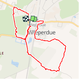
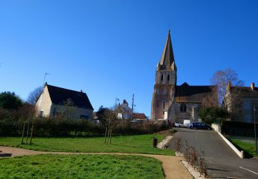
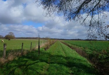
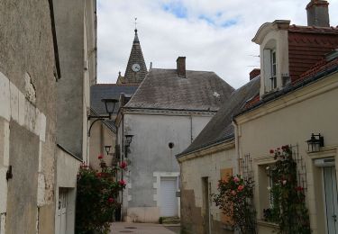
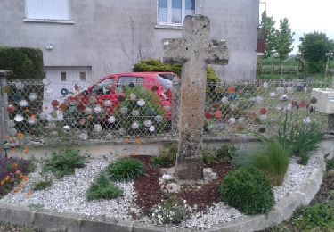
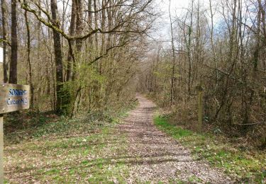
Randonnée Marche de 5,6 km à découvrir à Centre-Val de Loire, Indre-et-Loire, Villeperdue. Cette randonnée est proposée par Orcal37.

Description

Villeperdue - 5.6km 25m 1h00 - 2019 08 16

Profil altimétrique

Photos

Localisation

Pays :
France
Région :
Centre-Val de Loire
Département/Province :
Indre-et-Loire
Commune :
Villeperdue
Localité :
Unknown
Départ:(UTM)
320620 ; 5230206 (31T) N.

Randonnées à proximité

Randonnée Marche Thilouze - Thilouze - PR Pont-de-Ruan GR46A PR Croix Maurice - 20.5km 200m 4h25 - 2022 02 12 - Photo
Marche
Orcal37

Marche

Facile
Thilouze, Centre-Val de Loire, Indre-et-Loire, France
20 km | 23 km-effort
4h 25min
Oui
Randonnée Marche Sainte-Catherine-de-Fierbois - Sainte-Catherine-de-Fierbois - GR655 - 21.1km 100m 4h25 (24mn) - 2021 03 14 - Photo
Marche
Orcal37

Marche

Facile
Sainte-Catherine-de-Fierbois, Centre-Val de Loire, Indre-et-Loire, France
21 km | 22 km-effort
4h 25min
Oui
Randonnée Marche Sorigny - Sorigny - GR655 vers le nord - 13.1km 70m 2h45 - 2018 04 20 - Photo
Marche
Orcal37

Marche

Facile
Sorigny, Centre-Val de Loire, Indre-et-Loire, France
13,1 km | 14,1 km-effort
2h 45min
Oui
Randonnée Marche Sorigny - JFT YB Etape2 28-4 -2014  - Photo
Marche
jeff2

Marche

Facile
Sorigny, Centre-Val de Loire, Indre-et-Loire, France
25 km | 27 km-effort
6h 10min
Non
Randonnée Marche Sorigny - Sorigny - GR655 vers le sud - 10.6km 50m 2h10 - 2018 03 18 - Photo
Marche
Orcal37

Marche

Très facile
Sorigny, Centre-Val de Loire, Indre-et-Loire, France
10,6 km | 11,2 km-effort
2h 10min
Oui
Randonnée Marche Thilouze - THILOUZE - Photo
Marche
LEMENIO

Marche

Très facile
Thilouze, Centre-Val de Loire, Indre-et-Loire, France
11,6 km | 12,9 km-effort
2h 35min
Oui
Randonnée Marche Sorigny - Sorigny - Photo
Marche
fustier

Marche

Moyen
Sorigny, Centre-Val de Loire, Indre-et-Loire, France
24 km | 26 km-effort
5h 36min
Oui
Randonnée Marche Sorigny - Sorigny_Montbazon_2017 - Photo
Marche
jeanlucien

Marche

Facile
Sorigny, Centre-Val de Loire, Indre-et-Loire, France
7,3 km | 8 km-effort
1h 25min
Non


Fermer
Mes abonnements