Randonnée V.T.T. Pradines - Tour de VTT du 25 septembre 2019 - Photo

Tour de VTT du 25 septembre 2019

 Louis JORDANET
Louis JORDANET

Utilisateur

© OpenStreetMap contributors
Longueur
Longueur
27 km
Altitude max
Altitude max
293 m
Dénivelé positif
Dénivelé positif
397 m
Km-Effort
Km-Effort  
32 km
Altitude min
Altitude min
107 m
Dénivelé négatif
Dénivelé négatif
396 m
Boucle
Boucle
Oui
Date de création :
2019-09-25 14:04:48.0
Dernière modification :
2019-09-25 16:18:17.581

(0 Avis)

V.T.T.
V.T.T.
1h58
Difficulté : Inconnu

Scannez ce code QR pour ouvrir la randonnée dans l'application SityTrail

Application GPS de randonnée GRATUITE

Logo SityTrail SityTrail

IGN / Instituts géographiques

Télécharger SityTrail sur l'App Store Télécharger SityTrail sur Google Play

Logo SityTrail SityTrail World

Le monde est à vous

Télécharger SityTrail sur l'App Store Télécharger SityTrail sur Google Play Télécharger SityTrail sur Huawei AppGallery

À propos

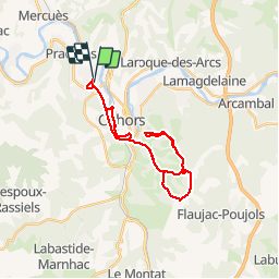
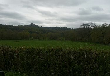
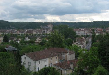
Randonnée V.T.T. de 27 km à découvrir à Occitanie, Lot, Pradines. Cette randonnée est proposée par Louis JORDANET.

Description

Vtt

Profil altimétrique

Localisation

Pays :
France
Région :
Occitanie
Département/Province :
Lot
Commune :
Pradines
Localité :
Unknown
Départ:(Dec)
Départ:(UTM)
374258 ; 4924854 (31T) N.

Randonnées à proximité

Randonnée Marche Pradines - Cahors les Durands 7km - Photo
Marche
PariseJL

Marche

Facile
(1)
Pradines, Occitanie, Lot, France
7,1 km | 9,3 km-effort
2h 13min
Oui
Randonnée Marche nordique Pradines - 15km chemin des combettes - Photo
Marche nordique
Dominique Molinier

Marche nordique

Très facile
(1)
Pradines, Occitanie, Lot, France
14,8 km | 17,9 km-effort
2h 15min
Oui
Randonnée Marche Bellefont-La Rauze - Larroque des arcs constant valroufie  - Photo
Marche
GUIDE
antignacs

Marche

Très facile
Bellefont-La Rauze, Occitanie, Lot, France
11,6 km | 15 km-effort
2h 38min
Oui
Randonnée Marche Cahors - Croix magne  - Photo
Marche
GUIDE
antignacs

Marche

Très facile
Cahors, Occitanie, Lot, France
5,2 km | 7,2 km-effort
1h 20min
Non
Randonnée Marche Cahors - Étape Cahors Lascabannes  - Photo
Marche
Jean-MarieFaux

Marche

Facile
Cahors, Occitanie, Lot, France
23 km | 30 km-effort
18h 50min
Non
Randonnée Marche Cahors - CC_Velay_DC_15_Cahors_Lendou-En-Quercy_20080506 - Photo
Marche
patrickdanilo

Marche

Moyen
Cahors, Occitanie, Lot, France
22 km | 29 km-effort
4h 40min
Non
Randonnée Moteur Cahors - ballade touristique - Photo
Moteur
alain46

Moteur

Très facile
Cahors, Occitanie, Lot, France
78 km | 95 km-effort
1h 45min
Non
Randonnée Marche Cahors - Cahors - Lascabanes - Chemin de Compostelle - Photo
Marche
tracegps

Marche

Très difficile
(1)
Cahors, Occitanie, Lot, France
24 km | 31 km-effort
9h 30min
Non
Randonnée Course à pied Cahors - Cahors, le Lot, le causse, la vieille ville - Photo
Course à pied
tracegps

Course à pied

Moyen
Cahors, Occitanie, Lot, France
7,3 km | 10 km-effort
45min
Oui


Fermer
Mes abonnements