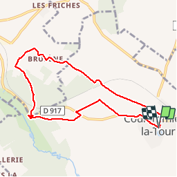
7,4 km | 8,3 km-effort
Coulommiers-la-Tour
guydu41
Utilisateur
Longueur
7,9 km
Altitude max
135 m
Dénivelé positif
79 m
Km-Effort
8,9 km
Altitude min
92 m
Dénivelé négatif
80 m
Boucle
Oui
Date de création :
2019-11-13 12:53:50.562
Dernière modification :
2019-11-13 16:02:40.816
2h24
Difficulté : Très facile
Application GPS de randonnée GRATUITE
À propos
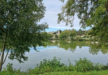
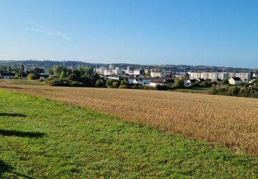
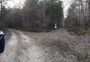
Randonnée Marche de 7,9 km à découvrir à Centre-Val de Loire, Loir-et-Cher, Coulommiers-la-Tour. Cette randonnée est proposée par guydu41.
Description
Petite rando facile
Localisation
Pays :
France
Région :
Centre-Val de Loire
Département/Province :
Loir-et-Cher
Commune :
Coulommiers-la-Tour
Localité :
Unknown
Départ:(Dec)
Départ:(UTM)
360838 ; 5293807 (31T) N.
Commentaires
Randonnées à proximité
Coulommiers-la-Tour
Marche
Moyen
Coulommiers-la-Tour,
Centre-Val de Loire,
Loir-et-Cher,
France
9,4 km | 11 km-effort
2h 29min
Oui
Les Bois d'Huchigny, des Péseries et de Villemalin
Marche
Moyen
Coulommiers-la-Tour,
Centre-Val de Loire,
Loir-et-Cher,
France
8,7 km | 10,4 km-effort
2h 14min
Oui
Parcours nature à Saint-Ouen (41100)
Marche
Facile
Saint-Ouen,
Centre-Val de Loire,
Loir-et-Cher,
France
16,1 km | 19 km-effort
4h 3min
Oui
Saint-Ouen - Circuit découverte 2
Marche
Très facile
Saint-Ouen,
Centre-Val de Loire,
Loir-et-Cher,
France
10,5 km | 12,4 km-effort
3h 16min
Oui
balade la chapelle en encherie
Marche
Très facile
La Chapelle-Enchérie,
Centre-Val de Loire,
Loir-et-Cher,
France
6,4 km | 7,6 km-effort
1h 45min
Oui
SityTrail - 2024-02-07_17h31m05_Cirkwi-Circuit_le_Bois_de_Bricsard_à_la_Chape...
sport
Très facile
La Chapelle-Enchérie,
Centre-Val de Loire,
Loir-et-Cher,
France
16,1 km | 18,6 km-effort
Inconnu
Oui
02A - Coulommiers - Boisseau
Marche
Facile
Coulommiers-la-Tour,
Centre-Val de Loire,
Loir-et-Cher,
France
13,6 km | 14,4 km-effort
Inconnu
Non
01A-Areines - Coulommiers
Marche
Facile
Areines,
Centre-Val de Loire,
Loir-et-Cher,
France
14,5 km | 16,7 km-effort
Inconnu
Oui