Randonnée Cheval Nassogne - Chevauchée forestière  - liaisons Grupont - Photo

Chevauchée forestière - liaisons Grupont

Randonnées de la Grande Forêt de Saint-Hubert GUIDE+

© OpenStreetMap contributors
Longueur
Longueur
4,3 km
Altitude max
Altitude max
298 m
Dénivelé positif
Dénivelé positif
88 m
Km-Effort
Km-Effort  
5,6 km
Altitude min
Altitude min
224 m
Dénivelé négatif
Dénivelé négatif
120 m
Boucle
Boucle
Non
Date de création :
2020-01-10 13:27:17.698
Dernière modification :
2020-05-15 09:46:34.27

(0 Avis)

Cheval
Cheval
--
Difficulté : Très facile

Scannez ce code QR pour ouvrir la randonnée dans l'application SityTrail

Application GPS de randonnée GRATUITE

Logo SityTrail SityTrail

IGN / Instituts géographiques

Télécharger SityTrail sur l'App Store Télécharger SityTrail sur Google Play

Logo SityTrail SityTrail World

Le monde est à vous

Télécharger SityTrail sur l'App Store Télécharger SityTrail sur Google Play Télécharger SityTrail sur Huawei AppGallery

À propos

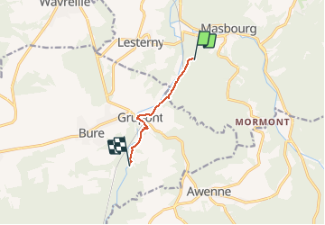
Randonnée Cheval de 4,3 km à découvrir à Wallonie, Luxembourg, Nassogne. Cette randonnée est proposée par La Grande Forêt de Saint-Hubert.

Profil altimétrique

Localisation

Pays :
Belgique
Région :
Wallonie
Département/Province :
Luxembourg
Commune :
Nassogne
Localité :
Lesterny
Départ:(UTM)
664504 ; 5553019 (31U) N.

Randonnées à proximité

Randonnée Marche Tellin - RL-GG-13_Grupont_Poix-Saint-Hubert - Photo
Marche
PRO

Marche

Très difficile
(2)
Tellin, Wallonie, Luxembourg, Belgique
26 km | 34 km-effort
7h 23min
Non
Randonnée Marche Tellin - Balade à Grupont - Photo
Marche
GUIDE
Desrumaux

Marche

Facile
(1)
Tellin, Wallonie, Luxembourg, Belgique
8,4 km | 11,9 km-effort
2h 33min
Oui
Randonnée Marche Tellin - Bure - Promenade des chapelles - Photo
Marche
GUIDE+

Marche

Facile
(1)
Tellin, Wallonie, Luxembourg, Belgique
4,5 km | 5,9 km-effort
1h 15min
Oui
Randonnée Marche Tellin - Grupont - Promenade du bois de Machi - Photo
Marche
GUIDE+

Marche

Moyen
(1)
Tellin, Wallonie, Luxembourg, Belgique
8,6 km | 12,6 km-effort
2h 37min
Oui
Randonnée Marche Tellin - Bure - Promenade du Pont des Cloyes - Photo
Marche
GUIDE+

Marche

Moyen
(1)
Tellin, Wallonie, Luxembourg, Belgique
6,9 km | 9 km-effort
1h 59min
Oui
Randonnée V.T.T. Nassogne - Nassogne - Circuit VTT rouge 4 - Photo
V.T.T.
GUIDE+

V.T.T.

Difficile
(1)
Nassogne, Wallonie, Luxembourg, Belgique
26 km | 36 km-effort
2h 16min
Oui
Randonnée Marche Nassogne - Forrières/Lesterny - Promenade Saint-Martin (NG 08) - Photo
Marche
GUIDE+

Marche

Moyen
(4)
Nassogne, Wallonie, Luxembourg, Belgique
7,3 km | 9 km-effort
1h 57min
Oui
Randonnée Marche Nassogne - Forrières - Promenade de Cocher (NG 07) - Photo
Marche
GUIDE+

Marche

Moyen
(2)
Nassogne, Wallonie, Luxembourg, Belgique
5,4 km | 6,7 km-effort
1h 28min
Oui
Randonnée Marche Nassogne - Ambly - Promenade de Javingue (NG 02) - Photo
Marche
GUIDE+

Marche

Moyen
(7)
Nassogne, Wallonie, Luxembourg, Belgique
9 km | 11,6 km-effort
2h 28min
Oui


Fermer
Mes abonnements