Randonnée Marche Saint-Jean-de-Fos - St Jean de Fos et le Max Nègre - Photo

St Jean de Fos et le Max Nègre

 randotines
randotines

Utilisateur GUIDE

© OpenStreetMap contributors
Longueur
Longueur
19,1 km
Altitude max
Altitude max
545 m
Dénivelé positif
Dénivelé positif
567 m
Km-Effort
Km-Effort  
27 km
Altitude min
Altitude min
91 m
Dénivelé négatif
Dénivelé négatif
568 m
Boucle
Boucle
Oui
Date de création :
2014-12-10 00:00:00.0
Dernière modification :
2014-12-10 00:00:00.0

(0 Avis)

Marche
Marche
5h42
Difficulté : Moyen

Scannez ce code QR pour ouvrir la randonnée dans l'application SityTrail

Application GPS de randonnée GRATUITE

Logo SityTrail SityTrail

IGN / Instituts géographiques

Télécharger SityTrail sur l'App Store Télécharger SityTrail sur Google Play

Logo SityTrail SityTrail World

Le monde est à vous

Télécharger SityTrail sur l'App Store Télécharger SityTrail sur Google Play Télécharger SityTrail sur Huawei AppGallery

À propos

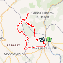
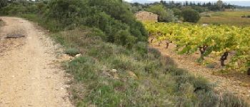
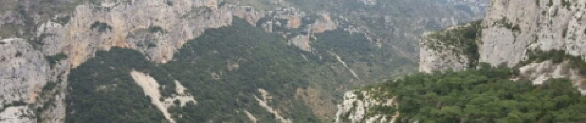
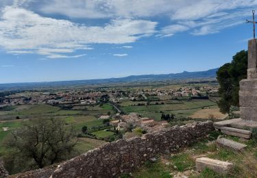
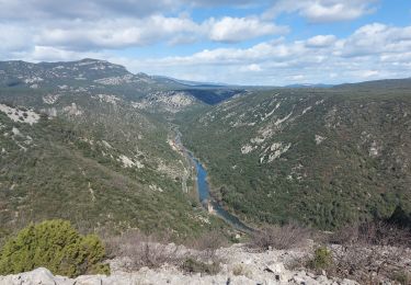
Randonnée Marche de 19,1 km à découvrir à Occitanie, Hérault, Saint-Jean-de-Fos. Cette randonnée est proposée par randotines.

Description

Belle rando au départ de St Jean de Fos ( Hérault ) près de St Guilhem le désert.Parking soit le long du cimetière soit à l'Argileum ( la maison de la poterie ).

Profil altimétrique

Photos

Points d'intérêt

Point d'intérêt Saint-Guilhem-le-Désert - Lavogne - Photo
randotines
SAINT-GUILHEM-LE-DÉSERT 
Point d'intérêt Saint-Guilhem-le-Désert - lavogne - Photo
randotines
SAINT-GUILHEM-LE-DÉSERT 
Point d'intérêt Saint-Guilhem-le-Désert - lavogne - Photo
randotines
SAINT-GUILHEM-LE-DÉSERT 
Point d'intérêt Saint-Guilhem-le-Désert - Point 3 - Photo
randotines
SAINT-GUILHEM-LE-DÉSERT 
Point d'intérêt Saint-Guilhem-le-Désert - Point 3 - Photo
randotines
SAINT-GUILHEM-LE-DÉSERT 
Point d'intérêt Saint-Guilhem-le-Désert - Belvedere du Max negre - Photo
randotines
SAINT-GUILHEM-LE-DÉSERT 
Point d'intérêt Saint-Guilhem-le-Désert - Belvedere du Max negre - Photo
randotines
SAINT-GUILHEM-LE-DÉSERT 
Point d'intérêt Montpeyroux - Point 10 - Photo
randotines
MONTPEYROUX 
Point d'intérêt Montpeyroux - Point 10 - Photo
randotines
MONTPEYROUX 

Localisation

Pays :
France
Région :
Occitanie
Département/Province :
Hérault
Commune :
Saint-Jean-de-Fos
Localité :
Unknown
Départ:(Dec)
Départ:(UTM)
544530 ; 4839097 (31T) N.

Randonnées à proximité

Randonnée Marche Aniane - Aniane ruisseau des Corbières - Photo
Marche
kephas

Marche

Facile
(3)
Aniane, Occitanie, Hérault, France
9,5 km | 12 km-effort
2h 34min
Oui
Randonnée Marche Saint-Jean-de-Fos - St Jean de fos Les Plos - Photo
Marche
mrclic34

Marche

Facile
(3)
Saint-Jean-de-Fos, Occitanie, Hérault, France
11 km | 15,2 km-effort
3h 5min
Oui
Randonnée Marche Montpeyroux - château de castelas - Photo
Marche
mrclic34

Marche

Facile
(3)
Montpeyroux, Occitanie, Hérault, France
10,3 km | 15,1 km-effort
3h 12min
Oui
Randonnée Marche Montpeyroux - Saint baudille - Photo
Marche
yt34

Marche

Facile
(3)
Montpeyroux, Occitanie, Hérault, France
10,2 km | 16,2 km-effort
3h 22min
Oui
Randonnée Marche Saint-Guilhem-le-Désert - Herault - St-Guilhem-le-Desert le Roc de la Vigne depuis le barrage 12km 609m - Photo
Marche
RandoVal

Marche

Moyen
(1)
Saint-Guilhem-le-Désert, Occitanie, Hérault, France
12,1 km | 21 km-effort
4h 17min
Oui
Randonnée Marche Puéchabon - Causse Puechabon - Photo
Marche
dpop34

Marche

Très facile
(1)
Puéchabon, Occitanie, Hérault, France
12,8 km | 15,9 km-effort
Inconnu
Oui
Randonnée Marche Saint-Guilhem-le-Désert - St Guilhem Le Désert - Mas Aubert - Photo
Marche
tracegps

Marche

Difficile
(1)
Saint-Guilhem-le-Désert, Occitanie, Hérault, France
19,7 km | 30 km-effort
6h 30min
Oui
Randonnée Marche Montpeyroux - Le bary Arboras le Castelas - Photo
Marche
labarone

Marche

Facile
Montpeyroux, Occitanie, Hérault, France
11,8 km | 17,1 km-effort
5h 7min
Oui
Randonnée Marche Saint-Guilhem-le-Désert - de Saint guilhem le désert au plot - Photo
Marche
labarone

Marche

Moyen
Saint-Guilhem-le-Désert, Occitanie, Hérault, France
16,8 km | 26 km-effort
6h 5min
Oui


Fermer
Mes abonnements