Randonnée Marche Sombreffe - Sombreffe - Photo
 calofrancis
calofrancis

Utilisateur

© OpenStreetMap contributors
Longueur
Longueur
9,5 km
Altitude max
Altitude max
162 m
Dénivelé positif
Dénivelé positif
82 m
Km-Effort
Km-Effort  
10,6 km
Altitude min
Altitude min
134 m
Dénivelé négatif
Dénivelé négatif
83 m
Boucle
Boucle
Oui
Date de création :
2018-07-07 13:34:00.38
Dernière modification :
2018-07-07 13:34:00.38

(0 Avis)

Marche
Marche
2h20
Difficulté : Très facile

Scannez ce code QR pour ouvrir la randonnée dans l'application SityTrail

Application GPS de randonnée GRATUITE

Logo SityTrail SityTrail

IGN / Instituts géographiques

Télécharger SityTrail sur l'App Store Télécharger SityTrail sur Google Play

Logo SityTrail SityTrail World

Le monde est à vous

Télécharger SityTrail sur l'App Store Télécharger SityTrail sur Google Play Télécharger SityTrail sur Huawei AppGallery

À propos

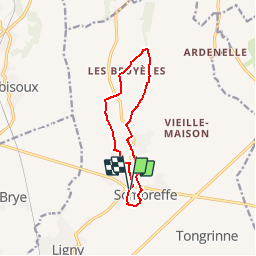
Randonnée Marche de 9,5 km à découvrir à Wallonie, Namur, Sombreffe. Cette randonnée est proposée par calofrancis.

Description

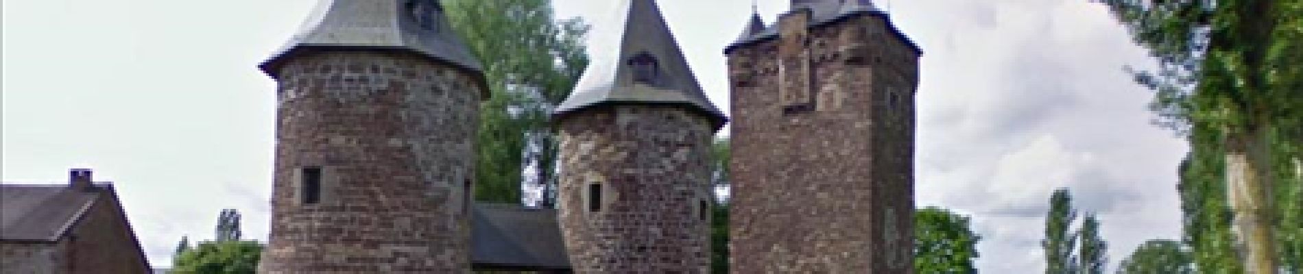
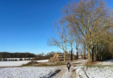
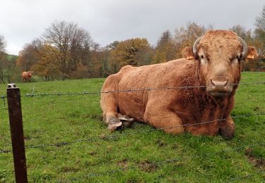
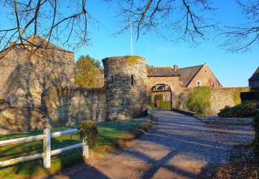
Balade dans un environnement très rural en passant devant le Château de Sombreffe

Profil altimétrique

Photos

Points d'intérêt

Point d'intérêt Sombreffe - Sombreffe - Photo
calofrancis
SOMBREFFE 

Localisation

Pays :
Belgique
Région :
Wallonie
Département/Province :
Namur
Commune :
Sombreffe
Localité :
Sombreffe
Départ:(Dec)
Départ:(UTM)
613215 ; 5598333 (31U) N.

Randonnées à proximité

Randonnée Marche Jemeppe-sur-Sambre - RF-Na-01-Onoz_Petite-boucle - Photo
Marche
PRO

Marche

Facile
(10)
Jemeppe-sur-Sambre, Wallonie, Namur, Belgique
7,4 km | 8,9 km-effort
1h 59min
Oui
Randonnée Marche Jemeppe-sur-Sambre - De Balâtre à Tongrinne par la vallée de la Ligne - Photo
Marche
GUIDE
Desrumaux

Marche

Facile
(1)
Jemeppe-sur-Sambre, Wallonie, Namur, Belgique
12,9 km | 15,4 km-effort
3h 0min
Oui
Randonnée Marche Jemeppe-sur-Sambre - La petite boucle de Onoz - Photo
Marche
griffet

Marche

Facile
(3)
Jemeppe-sur-Sambre, Wallonie, Namur, Belgique
7 km | 8,4 km-effort
1h 57min
Oui
Randonnée Marche Villers-la-Ville - #190324 - Rigenée, rives de la Thyle, château du Châtelet et golf**** - Photo
Marche
Randos Ouvertes

Marche

Moyen
(2)
Villers-la-Ville, Wallonie, Brabant wallon, Belgique
8,8 km | 10,1 km-effort
2h 13min
Oui
Randonnée Marche Jemeppe-sur-Sambre - RF-Na-01-Onoz_Grande-boucle - Photo
Marche
PRO

Marche

Moyen
(7)
Jemeppe-sur-Sambre, Wallonie, Namur, Belgique
8,8 km | 10,5 km-effort
2h 19min
Oui
Randonnée Marche Sombreffe - Marche Adeps à Tongrinne - Sombreffe - Photo
Marche
GUIDE
Desrumaux

Marche

Difficile
Sombreffe, Wallonie, Namur, Belgique
11,3 km | 13,1 km-effort
2h 59min
Oui
Randonnée Marche Villers-la-Ville - Balade autour de Villers-la-Ville - Photo
Marche
GUIDE
Desrumaux

Marche

Moyen
Villers-la-Ville, Wallonie, Brabant wallon, Belgique
7,6 km | 9,2 km-effort
2h 57min
Oui
Randonnée V.T.T. Fleurus - VTT autour de Saint-Amand. - Photo
V.T.T.
GUIDE
pascalou73

V.T.T.

Très difficile
Fleurus, Wallonie, Hainaut, Belgique
40 km | 46 km-effort
3h 10min
Oui
Randonnée Marche Jemeppe-sur-Sambre - SNS 8 ONOZ 010321 - Photo
Marche
Patrick Martinus

Marche

Moyen
(1)
Jemeppe-sur-Sambre, Wallonie, Namur, Belgique
8,1 km | 9,5 km-effort
2h 4min
Oui


Fermer
Mes abonnements