Randonnée Marche Saint-Aquilin - St Aquilin Chateaux 12km - Photo
 YV24
YV24

Utilisateur

© OpenStreetMap contributors
Longueur
Longueur
11,9 km
Altitude max
Altitude max
214 m
Dénivelé positif
Dénivelé positif
332 m
Km-Effort
Km-Effort  
16,3 km
Altitude min
Altitude min
117 m
Dénivelé négatif
Dénivelé négatif
331 m
Boucle
Boucle
Oui
Date de création :
2017-04-21 00:00:00.0
Dernière modification :
2017-04-21 00:00:00.0

(1 Avis)

Marche
Marche
3h33
Difficulté : Facile

Scannez ce code QR pour ouvrir la randonnée dans l'application SityTrail

Application GPS de randonnée GRATUITE

Logo SityTrail SityTrail

IGN / Instituts géographiques

Télécharger SityTrail sur l'App Store Télécharger SityTrail sur Google Play

Logo SityTrail SityTrail World

Le monde est à vous

Télécharger SityTrail sur l'App Store Télécharger SityTrail sur Google Play Télécharger SityTrail sur Huawei AppGallery

À propos

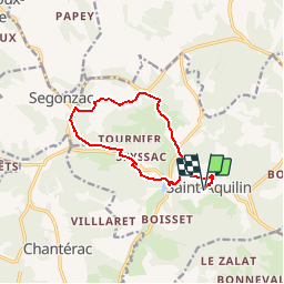
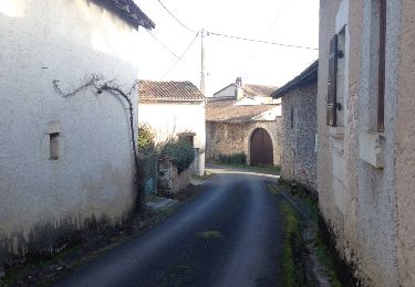
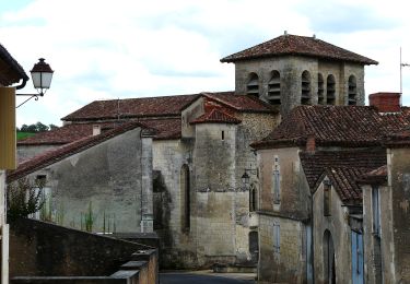
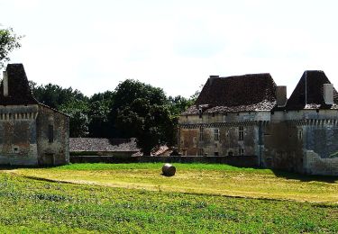
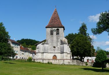
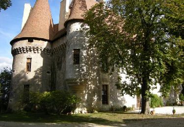
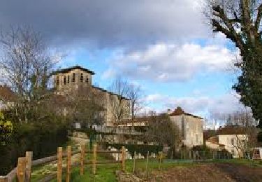
Randonnée Marche de 11,9 km à découvrir à Nouvelle-Aquitaine, Dordogne, Saint-Aquilin. Cette randonnée est proposée par YV24.

Profil altimétrique

Localisation

Pays :
France
Région :
Nouvelle-Aquitaine
Département/Province :
Dordogne
Commune :
Saint-Aquilin
Localité :
Unknown
Départ:(Dec)
Départ:(UTM)
303000 ; 5006600 (31T) N.

Commentaires

Veuillez vous connecter pour laisser un commentaire ou une note


très bon outil pour faire une rando sans faire une reconnaissance du parcours et facile d'utilisation bravo à vous.


Randonnées à proximité

Randonnée Marche Saint-Astier - 24 Saint-Astier  - Photo
Marche
Patxito

Marche

Facile
(1)
Saint-Astier, Nouvelle-Aquitaine, Dordogne, France
11,4 km | 14,3 km-effort
2h 42min
Oui
Randonnée Marche Saint-Astier - GR654 ST ASTIER BERGERAC PINEL - Photo
Marche
kmedone

Marche

Difficile
(3)
Saint-Astier, Nouvelle-Aquitaine, Dordogne, France
122 km | 150 km-effort
31h 13min
Non
Randonnée A pied Chantérac - Boucle des Hameaux, variante des Plombières - Photo
A pied
PRO

A pied

Facile
Chantérac, Nouvelle-Aquitaine, Dordogne, France
7 km | 8,8 km-effort
1h 59min
Oui
Randonnée A pied Saint-Aquilin - Boucle des Châteaux - Photo
A pied
PRO

A pied

Facile
Saint-Aquilin, Nouvelle-Aquitaine, Dordogne, France
11,3 km | 15,4 km-effort
3h 29min
Non
Randonnée A pied Chantérac - Boucle des Hameaux - Photo
A pied
PRO

A pied

Facile
Chantérac, Nouvelle-Aquitaine, Dordogne, France
13,4 km | 17,5 km-effort
3h 58min
Oui
Randonnée A pied Saint-Aquilin - Promenade de Charroux - Photo
A pied
PRO

A pied

Facile
Saint-Aquilin, Nouvelle-Aquitaine, Dordogne, France
4,2 km | 5,8 km-effort
1h 19min
Oui
Randonnée Marche Saint-Astier - Boucle de Saint Astier - Photo
Marche
CC.RIDER

Marche

Difficile
Saint-Astier, Nouvelle-Aquitaine, Dordogne, France
12,6 km | 16,3 km-effort
3h 42min
Oui
Randonnée Marche Chantérac - Boucle de Chantérac - Photo
Marche
CC.RIDER

Marche

Difficile
Chantérac, Nouvelle-Aquitaine, Dordogne, France
13,5 km | 17,7 km-effort
4h 0min
Oui
Randonnée Marche Chantérac - Boucle de Chantérac sud ( version courte)  - Photo
Marche
Marc 24

Marche

Moyen
Chantérac, Nouvelle-Aquitaine, Dordogne, France
7,9 km | 10,6 km-effort
2h 33min
Oui


Fermer
Mes abonnements