Randonnée Canoë - kayak Barberey-Saint-Sulpice - Barberey savieres - Photo
 DaVinci
DaVinci

Utilisateur

© OpenStreetMap contributors
Longueur
Longueur
14,6 km
Altitude max
Altitude max
99 m
Dénivelé positif
Dénivelé positif
52 m
Km-Effort
Km-Effort  
15,4 km
Altitude min
Altitude min
84 m
Dénivelé négatif
Dénivelé négatif
59 m
Boucle
Boucle
Non
Date de création :
2020-05-31 07:39:09.279
Dernière modification :
2020-05-31 09:52:02.54

(0 Avis)

Canoë - kayak
Canoë - kayak
2h11
Difficulté : Très facile

Scannez ce code QR pour ouvrir la randonnée dans l'application SityTrail

Application GPS de randonnée GRATUITE

Logo SityTrail SityTrail

IGN / Instituts géographiques

Télécharger SityTrail sur l'App Store Télécharger SityTrail sur Google Play

Logo SityTrail SityTrail World

Le monde est à vous

Télécharger SityTrail sur l'App Store Télécharger SityTrail sur Google Play Télécharger SityTrail sur Huawei AppGallery

À propos

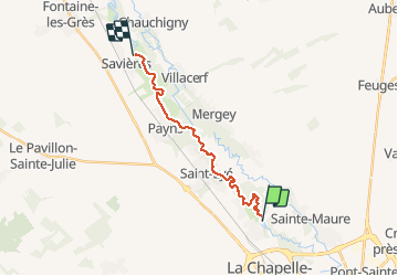
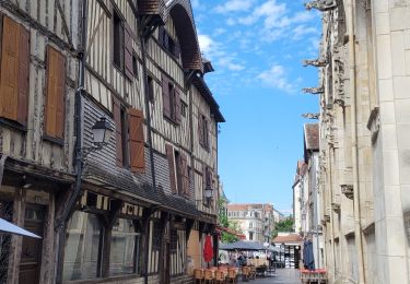
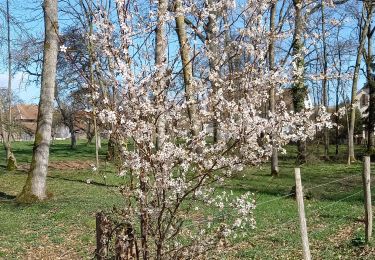
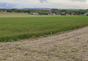
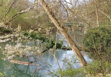
Randonnée Canoë - kayak de 14,6 km à découvrir à Grand Est, Aube, Barberey-Saint-Sulpice. Cette randonnée est proposée par DaVinci.

Profil altimétrique

Localisation

Pays :
France
Région :
Grand Est
Département/Province :
Aube
Commune :
Barberey-Saint-Sulpice
Localité :
Unknown
Départ:(UTM)
576817 ; 5354790 (31U) N.

Randonnées à proximité

Randonnée Marche Barberey-Saint-Sulpice - Montgueux Vignes et champs depuis la D 60 9,1 km - Photo
Marche
jacky rahir

Marche

Moyen
(1)
Barberey-Saint-Sulpice, Grand Est, Aube, France
9,1 km | 11,5 km-effort
2h 37min
Oui
Randonnée Marche Barberey-Saint-Sulpice - Barberey - Photo
Marche
Arnaud de Charrin

Marche

Moyen
Barberey-Saint-Sulpice, Grand Est, Aube, France
12,9 km | 13,9 km-effort
3h 6min
Oui
Randonnée Marche Barberey-Saint-Sulpice - Barberey 20,5km le 15-03-2019 - Photo
Marche
francis1952

Marche

Facile
Barberey-Saint-Sulpice, Grand Est, Aube, France
20 km | 22 km-effort
4h 55min
Oui
Randonnée Marche Barberey-Saint-Sulpice - Barberey voie verte canal de la Haute seine - Photo
Marche
gildascb

Marche

Très facile
Barberey-Saint-Sulpice, Grand Est, Aube, France
9,9 km | 10,5 km-effort
2h 10min
Oui
Randonnée Marche Troyes - troyes - Photo
Marche
pistou

Marche

Moyen
Troyes, Grand Est, Aube, France
6,7 km | 7,2 km-effort
3h 9min
Oui
Randonnée Marche Pont-Sainte-Marie - PSM Villacerf 22,5km - Photo
Marche
francis1952

Marche

Difficile
Pont-Sainte-Marie, Grand Est, Aube, France
23 km | 24 km-effort
4h 6min
Oui
Randonnée Marche Mergey - Mergey - Photo
Marche
randoam

Marche

Facile
Mergey, Grand Est, Aube, France
6,7 km | 7,6 km-effort
1h 42min
Oui
Randonnée Marche Barberey-Saint-Sulpice - Barberey st Lyé Pont canal 17,3km - Photo
Marche
francis1952

Marche

Facile
Barberey-Saint-Sulpice, Grand Est, Aube, France
17,3 km | 18,5 km-effort
3h 21min
Oui
Randonnée Marche Troyes - Troyes les 10 églises le 16/02/2020 - Photo
Marche
francis1952

Marche

Facile
Troyes, Grand Est, Aube, France
12,5 km | 13,6 km-effort
2h 42min
Oui


Fermer
Mes abonnements