Randonnée Marche Chalencon - Boucle autour de Chervil par Chalençon - Photo

Boucle autour de Chervil par Chalençon

 alaindurbecq
alaindurbecq

Utilisateur

© OpenStreetMap contributors
Longueur
Longueur
9 km
Altitude max
Altitude max
702 m
Dénivelé positif
Dénivelé positif
429 m
Km-Effort
Km-Effort  
14,7 km
Altitude min
Altitude min
278 m
Dénivelé négatif
Dénivelé négatif
431 m
Boucle
Boucle
Oui
Date de création :
2014-12-10 00:00:00.0
Dernière modification :
2014-12-10 00:00:00.0

(0 Avis)

Marche
Marche
3h45
Difficulté : Moyen

Scannez ce code QR pour ouvrir la randonnée dans l'application SityTrail

Application GPS de randonnée GRATUITE

Logo SityTrail SityTrail

IGN / Instituts géographiques

Télécharger SityTrail sur l'App Store Télécharger SityTrail sur Google Play

Logo SityTrail SityTrail World

Le monde est à vous

Télécharger SityTrail sur l'App Store Télécharger SityTrail sur Google Play Télécharger SityTrail sur Huawei AppGallery

À propos

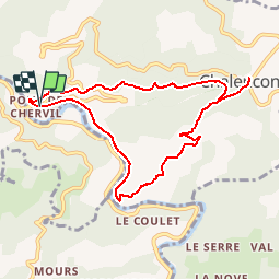
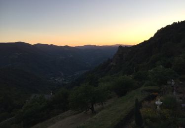
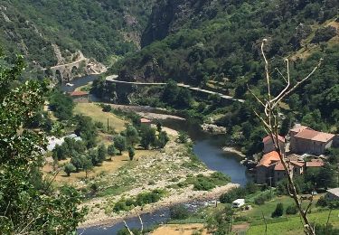
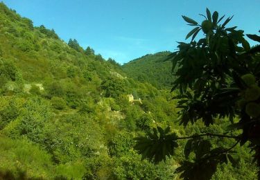
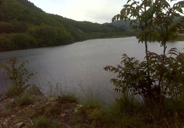
Randonnée Marche de 9 km à découvrir à Auvergne-Rhône-Alpes, Ardèche, Chalencon. Cette randonnée est proposée par alaindurbecq.

Description

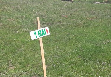
Très belle rando qui permet d'accéder au village de Chalençon. En descendant, après Bourdel, le chemin est peu utilisé et mal défini. GPS utile pour ne pas le perdre

Profil altimétrique

Localisation

Pays :
France
Région :
Auvergne-Rhône-Alpes
Département/Province :
Ardèche
Commune :
Chalencon
Localité :
Unknown
Départ:(Dec)
Départ:(UTM)
621751 ; 4970170 (31T) N.

Randonnées à proximité

Randonnée Marche Saint-Jean-Chambre - Boucle Chalencon Pont de Chervil - Photo
Marche
GUIDE
nadinebondoux

Marche

Difficile
Saint-Jean-Chambre, Auvergne-Rhône-Alpes, Ardèche, France
15,9 km | 24 km-effort
5h 42min
Oui
Randonnée Marche Saint-Maurice-en-Chalencon - 07 gliuras n2 suite - Photo
Marche
himba26100

Marche

Moyen
Saint-Maurice-en-Chalencon, Auvergne-Rhône-Alpes, Ardèche, France
21 km | 34 km-effort
8h 28min
Oui
Randonnée Marche Saint-Maurice-en-Chalencon - 07 gliuras n1 - Photo
Marche
himba26100

Marche

Moyen
Saint-Maurice-en-Chalencon, Auvergne-Rhône-Alpes, Ardèche, France
12,3 km | 21 km-effort
4h 55min
Non
Randonnée Marche Belsentes - Saint-julien-labrousse 1er mai la rando des chanteurs de mai - Photo
Marche
bernadette revoux

Marche

Moyen
Belsentes, Auvergne-Rhône-Alpes, Ardèche, France
20 km | 30 km-effort
4h 35min
Non
Randonnée Marche Chalencon - Circuit 2 Chalencon  - Photo
Marche
choubaka77

Marche

Moyen
Chalencon, Auvergne-Rhône-Alpes, Ardèche, France
15,6 km | 24 km-effort
4h 28min
Oui
Randonnée Marche Chalencon - Chalencon Circuit 2 - Photo
Marche
choubaka77

Marche

Moyen
Chalencon, Auvergne-Rhône-Alpes, Ardèche, France
15,6 km | 24 km-effort
4h 28min
Oui
Randonnée Marche Chalencon - Chalencon circuit 1 - Photo
Marche
choubaka77

Marche

Moyen
Chalencon, Auvergne-Rhône-Alpes, Ardèche, France
10,9 km | 17,2 km-effort
3h 0min
Oui
Randonnée Marche Chalencon - Les trois V  - Le Pont de Chervil  - Photo
Marche
tracegps

Marche

Difficile
Chalencon, Auvergne-Rhône-Alpes, Ardèche, France
9,6 km | 15,6 km-effort
2h 30min
Oui
Randonnée V.T.T. Belsentes - St Julien Boutières - La Gare- Le Cheylard - Photo
V.T.T.
tracegps

V.T.T.

Moyen
Belsentes, Auvergne-Rhône-Alpes, Ardèche, France
35 km | 43 km-effort
2h 30min
Oui


Fermer
Mes abonnements