Randonnée Marche Sisteron - SISTERON.   Le Mollard . Col S Pierre o n  - Photo
 RobinMicheline
RobinMicheline

Utilisateur

© OpenStreetMap contributors
Longueur
Longueur
11,9 km
Altitude max
Altitude max
915 m
Dénivelé positif
Dénivelé positif
514 m
Km-Effort
Km-Effort  
18,7 km
Altitude min
Altitude min
504 m
Dénivelé négatif
Dénivelé négatif
516 m
Boucle
Boucle
Oui
Date de création :
2020-08-03 05:42:55.913
Dernière modification :
2020-08-03 14:03:55.982

(0 Avis)

Marche
Marche
2h58
Difficulté : Moyen

Scannez ce code QR pour ouvrir la randonnée dans l'application SityTrail

Application GPS de randonnée GRATUITE

Logo SityTrail SityTrail

IGN / Instituts géographiques

Télécharger SityTrail sur l'App Store Télécharger SityTrail sur Google Play

Logo SityTrail SityTrail World

Le monde est à vous

Télécharger SityTrail sur l'App Store Télécharger SityTrail sur Google Play Télécharger SityTrail sur Huawei AppGallery

À propos

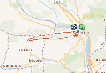
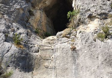
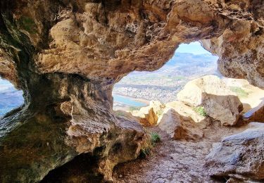
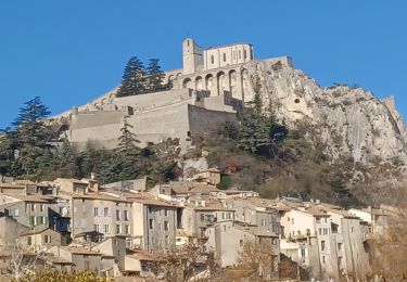
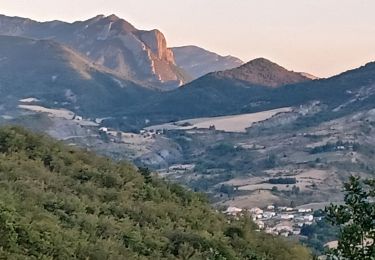
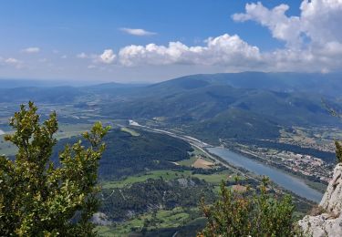
Randonnée Marche de 11,9 km à découvrir à Provence-Alpes-Côte d'Azur, Alpes-de-Haute-Provence, Sisteron. Cette randonnée est proposée par RobinMicheline.

Description

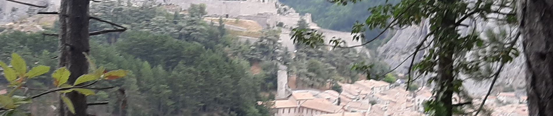
Sentier Cretes sympa belle vue , descente avant col S Pierre raide ne pas faire si pluie

Profil altimétrique

Photos

Localisation

Pays :
France
Région :
Provence-Alpes-Côte d'Azur
Département/Province :
Alpes-de-Haute-Provence
Commune :
Sisteron
Localité :
Unknown
Départ:(UTM)
735044 ; 4897775 (31T) N.

Randonnées à proximité

Randonnée Marche Sisteron - Sisteron La Baume Trou d'Argent - Photo
Marche
motardes04

Marche

Facile
(1)
Sisteron, Provence-Alpes-Côte d'Azur, Alpes-de-Haute-Provence, France
9,3 km | 18,4 km-effort
4h 15min
Oui
Randonnée Marche Sisteron - SISTERON . CHAMP BRANCOU . LA COLLE . LE MOLLARD O  L  S - Photo
Marche
RobinMicheline

Marche

Difficile
Sisteron, Provence-Alpes-Côte d'Azur, Alpes-de-Haute-Provence, France
13,1 km | 20 km-effort
3h 46min
Oui
Randonnée Marche Sisteron - 05 trop argent 02.08.23 - Photo
Marche
himba26100

Marche

Moyen
Sisteron, Provence-Alpes-Côte d'Azur, Alpes-de-Haute-Provence, France
9,2 km | 18,1 km-effort
4h 30min
Oui
Randonnée Marche Sisteron - Grotte trou d'argent - Photo
Marche
cousam

Marche

Difficile
Sisteron, Provence-Alpes-Côte d'Azur, Alpes-de-Haute-Provence, France
8,9 km | 17,6 km-effort
4h 26min
Oui
Randonnée Marche Sisteron - Le Trou de l'Argent (Sisteron) - Photo
Marche
PapouBertrand

Marche

Difficile
(1)
Sisteron, Provence-Alpes-Côte d'Azur, Alpes-de-Haute-Provence, France
9,1 km | 17,9 km-effort
4h 4min
Oui
Randonnée Marche Sisteron - SISTERON.  SUR LA ROUTE DU TEMPS 2. O L M S - Photo
Marche
RobinMicheline

Marche

Moyen
(1)
Sisteron, Provence-Alpes-Côte d'Azur, Alpes-de-Haute-Provence, France
12 km | 16,5 km-effort
3h 36min
Oui
Randonnée Marche Sisteron - BEVONS    crêtes de Chapage o l s m - Photo
Marche
RobinMicheline

Marche

Moyen
Sisteron, Provence-Alpes-Côte d'Azur, Alpes-de-Haute-Provence, France
8,2 km | 15 km-effort
2h 37min
Oui
Randonnée Marche Sisteron - Trou de l'argent - Photo
Marche
Marco05

Marche

Difficile
Sisteron, Provence-Alpes-Côte d'Azur, Alpes-de-Haute-Provence, France
9,2 km | 18,1 km-effort
4h 7min
Oui
Randonnée Marche Sisteron - Bois de Buche depart Sisteron 417 + - Photo
Marche
claude nier

Marche

Facile
Sisteron, Provence-Alpes-Côte d'Azur, Alpes-de-Haute-Provence, France
11,8 km | 17,4 km-effort
6h 13min
Oui


Fermer
Mes abonnements