Randonnée Marche Saint-Joseph - L'aire du Rond à la Plaine des Grègues et le sentier de Curcuma - Photo

L'aire du Rond à la Plaine des Grègues et le sentier de Curcuma

 GilbertLP
GilbertLP

Utilisateur

© OpenStreetMap contributors
Longueur
Longueur
5,2 km
Altitude max
Altitude max
846 m
Dénivelé positif
Dénivelé positif
300 m
Km-Effort
Km-Effort  
9,2 km
Altitude min
Altitude min
654 m
Dénivelé négatif
Dénivelé négatif
300 m
Boucle
Boucle
Oui
Date de création :
2020-08-05 09:08:21.513
Dernière modification :
2020-08-05 09:27:50.838

(0 Avis)

Marche
Marche
1h52
Difficulté : Moyen

Scannez ce code QR pour ouvrir la randonnée dans l'application SityTrail

Application GPS de randonnée GRATUITE

Logo SityTrail SityTrail

IGN / Instituts géographiques

Télécharger SityTrail sur l'App Store Télécharger SityTrail sur Google Play

Logo SityTrail SityTrail World

Le monde est à vous

Télécharger SityTrail sur l'App Store Télécharger SityTrail sur Google Play Télécharger SityTrail sur Huawei AppGallery

À propos

Randonnée Marche de 5,2 km à découvrir à La Réunion, Inconnu, Saint-Joseph. Cette randonnée est proposée par GilbertLP.

Description

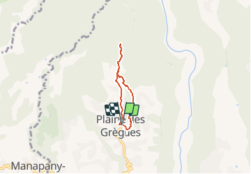
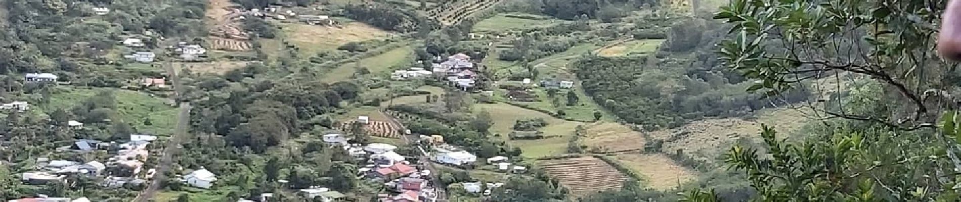
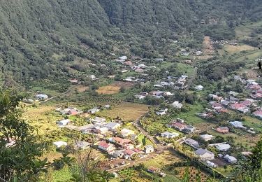
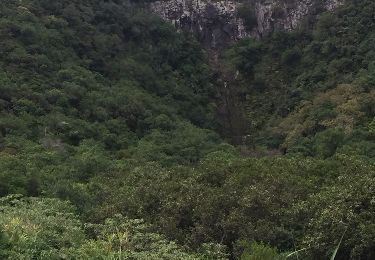
Cette petite randonnée dans la Plaine des Grègues permet de découvrir ce coin retiré de l'île et voir quelques exploitations agricoles qui cultivent le fameux curcuma qui tient son musée au milieu du village. L'itinéraire conduit au fond d'un petit cirque, l'aire du Rond, avant de remonter les pentes de la Petite Plaine. La descente vers la Plaine des Grègues se fait par des escaliers qui sont plus difficiles à monter qu'à descendre. On peut terminer cette sortie par une visite de la Maison du Curcuma.
Pour tous randonneurs.

Profil altimétrique

Photos

Localisation

Pays :
France
Région :
La Réunion
Département/Province :
Inconnu
Commune :
Saint-Joseph
Localité :
Unknown
Départ:(UTM)
355615 ; 7640947 (40K) S.

Randonnées à proximité

Randonnée A pied Saint-Joseph - Boucle des Margosiers - Photo
A pied
PRO

A pied

Moyen
Saint-Joseph, La Réunion, Inconnu, France
11,3 km | 22 km-effort
5h 5min
Oui
Randonnée Marche Saint-Joseph - Cap Blanc - Bourg Murat - Photo
Marche
GilbertLP

Marche

Très difficile
(1)
Saint-Joseph, La Réunion, Inconnu, France
26 km | 49 km-effort
10h 16min
Non
Randonnée Marche Saint-Joseph - Boucle des Margosiers - Photo
Marche
GilbertLP

Marche

Très difficile
Saint-Joseph, La Réunion, Inconnu, France
14 km | 25 km-effort
5h 7min
Oui
Randonnée Marche Saint-Joseph - piton du rond  - Photo
Marche
olivier5960

Marche

Difficile
Saint-Joseph, La Réunion, Inconnu, France
10,7 km | 22 km-effort
5h 18min
Non
Randonnée Marche Saint-Joseph - La Réunion - Cascade du Grand Galet  - Photo
Marche
olive2b

Marche

Très facile
Saint-Joseph, La Réunion, Inconnu, France
559 m | 829 m-effort
11min
Non
Randonnée Marche Saint-Joseph - curcuma  - Photo
Marche
Jo Cornaz

Marche

Très difficile
Saint-Joseph, La Réunion, Inconnu, France
3,6 km | 7 km-effort
10h 0min
Non
Randonnée V.T.T. Saint-Joseph - st joseph - st Philippe par la route forestière  - Photo
V.T.T.
XavierFaidix

V.T.T.

Moyen
Saint-Joseph, La Réunion, Inconnu, France
42 km | 57 km-effort
4h 30min
Non
Randonnée Marche Saint-Joseph - cascades des grands galets - Photo
Marche
Ninie38MD

Marche

Moyen
Saint-Joseph, La Réunion, Inconnu, France
2,2 km | 3 km-effort
1h 4min
Non
Randonnée Marche Saint-Joseph - Cap blanc - Bourg Murat - Photo
Marche
GilbertLP

Marche

Très difficile
Saint-Joseph, La Réunion, Inconnu, France
31 km | 54 km-effort
11h 31min
Non


Fermer
Mes abonnements