Randonnée A pied Saint-Aubin - Saint-Aubin, Quincey - Photo

Saint-Aubin, Quincey

 Alain Picard
Alain Picard

Utilisateur

© OpenStreetMap contributors
Longueur
Longueur
10,8 km
Altitude max
Altitude max
118 m
Dénivelé positif
Dénivelé positif
130 m
Km-Effort
Km-Effort  
12,5 km
Altitude min
Altitude min
71 m
Dénivelé négatif
Dénivelé négatif
128 m
Boucle
Boucle
Oui
Date de création :
2020-09-21 19:33:41.024
Dernière modification :
2020-09-21 19:41:37.455

(0 Avis)

A pied
A pied
2h30
Difficulté : Facile

Scannez ce code QR pour ouvrir la randonnée dans l'application SityTrail

Application GPS de randonnée GRATUITE

Logo SityTrail SityTrail

IGN / Instituts géographiques

Télécharger SityTrail sur l'App Store Télécharger SityTrail sur Google Play

Logo SityTrail SityTrail World

Le monde est à vous

Télécharger SityTrail sur l'App Store Télécharger SityTrail sur Google Play Télécharger SityTrail sur Huawei AppGallery

À propos

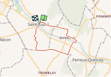
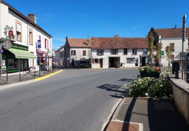
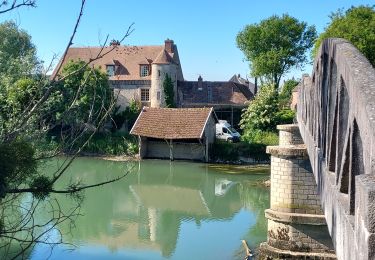
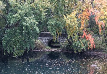
Randonnée A pied de 10,8 km à découvrir à Grand Est, Aube, Saint-Aubin. Cette randonnée est proposée par Alain Picard.

Description

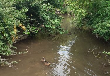
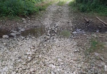
Ballade de 11 km autour de l'Ardusson

Profil altimétrique

Localisation

Pays :
France
Région :
Grand Est
Département/Province :
Aube
Commune :
Saint-Aubin
Localité :
Unknown
Départ:(UTM)
541231 ; 5369382 (31U) N.

Randonnées à proximité

Randonnée A pied Ferreux-Quincey -  FERREUX-QUINCEY à Saint-AUBIN - Photo
A pied
jeannine grandjean

A pied

Facile
(1)
Ferreux-Quincey, Grand Est, Aube, France
12,5 km | 13,9 km-effort
3h 25min
Oui
Randonnée Marche Saint-Aubin - Saint Aubin et la vallée de l'Ardusson - Photo
Marche
jeannine grandjean

Marche

Difficile
Saint-Aubin, Grand Est, Aube, France
11 km | 12,5 km-effort
2h 28min
Oui
Randonnée Marche Saint-Aubin - St Aubin - Fontaine Mâcon - St Aubin - Photo
Marche
Olivier F.

Marche

Difficile
Saint-Aubin, Grand Est, Aube, France
11,5 km | 13,1 km-effort
2h 20min
Oui
Randonnée Marche Saint-Aubin - St Aubin - Fontaine Mâcon - Abbaye du Paraclet - St Aubin - Photo
Marche
Olivier F.

Marche

Difficile
Saint-Aubin, Grand Est, Aube, France
14,2 km | 16,3 km-effort
3h 15min
Oui
Randonnée V.T.C. Marnay-sur-Seine - Marnay bis - Photo
V.T.C.
Olivier F.

V.T.C.

Moyen
Marnay-sur-Seine, Grand Est, Aube, France
20 km | 22 km-effort
73h 2min
Non
Randonnée Vélo de route Nogent-sur-Seine - EXT65 Nogent sur Seine-02 - Photo
Vélo de route
Specialized77

Vélo de route

Facile
Nogent-sur-Seine, Grand Est, Aube, France
66 km | 74 km-effort
2h 52min
Oui
Randonnée Vélo de route Nogent-sur-Seine - EXT65 Nogent sur Seine-01 - Photo
Vélo de route
Specialized77

Vélo de route

Moyen
Nogent-sur-Seine, Grand Est, Aube, France
65 km | 72 km-effort
3h 19min
Oui
Randonnée Marche Pont-sur-Seine - entre Pont sur SEINE et MARNAY - Photo
Marche
jeannine grandjean

Marche

Difficile
(1)
Pont-sur-Seine, Grand Est, Aube, France
13,1 km | 13,8 km-effort
2h 43min
Oui
Randonnée Marche Nogent-sur-Seine - Boucle Nogent Liours  - Photo
Marche
NANE51

Marche

Très facile
Nogent-sur-Seine, Grand Est, Aube, France
13,1 km | 14 km-effort
2h 44min
Oui


Fermer
Mes abonnements