Randonnée Marche Walcourt - Marche Adeps à Chastrès - Photo

Marche Adeps à Chastrès

 Desrumaux
Desrumaux

Utilisateur GUIDE

© OpenStreetMap contributors
Longueur
Longueur
10,2 km
Altitude max
Altitude max
268 m
Dénivelé positif
Dénivelé positif
165 m
Km-Effort
Km-Effort  
12,4 km
Altitude min
Altitude min
188 m
Dénivelé négatif
Dénivelé négatif
176 m
Boucle
Boucle
Oui
Date de création :
2014-12-10 00:00:00.0
Dernière modification :
2014-12-10 00:00:00.0

(0 Avis)

Marche
Marche
2h41
Difficulté : Facile

Scannez ce code QR pour ouvrir la randonnée dans l'application SityTrail

Application GPS de randonnée GRATUITE

Logo SityTrail SityTrail

IGN / Instituts géographiques

Télécharger SityTrail sur l'App Store Télécharger SityTrail sur Google Play

Logo SityTrail SityTrail World

Le monde est à vous

Télécharger SityTrail sur l'App Store Télécharger SityTrail sur Google Play Télécharger SityTrail sur Huawei AppGallery

À propos

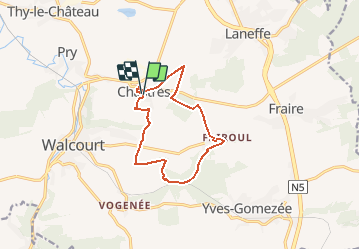
Randonnée Marche de 10,2 km à découvrir à Wallonie, Namur, Walcourt. Cette randonnée est proposée par Desrumaux.

Description

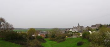
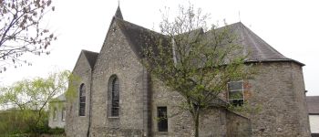
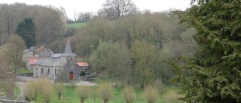
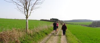
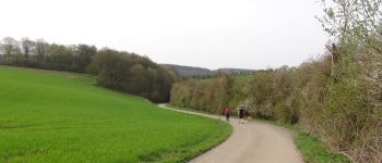
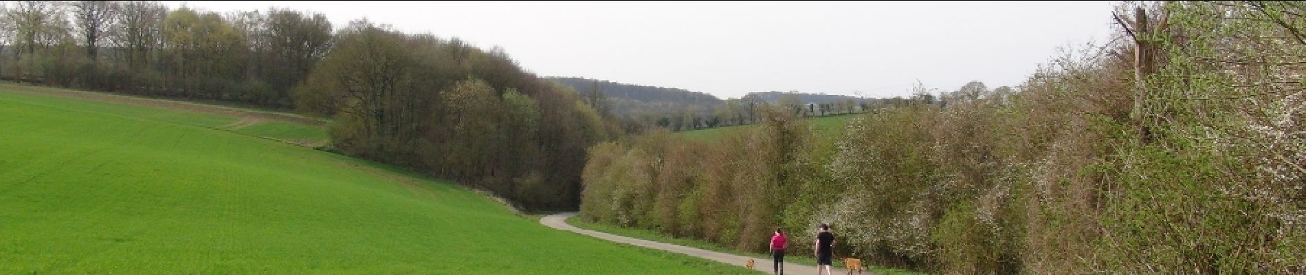
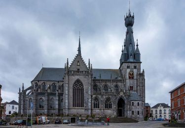
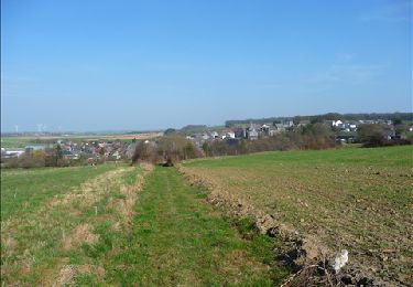
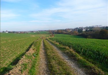
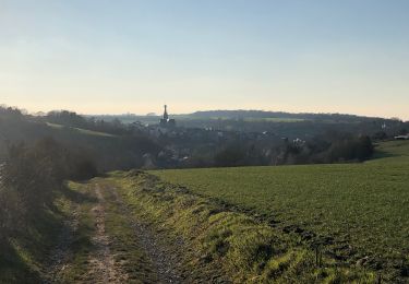
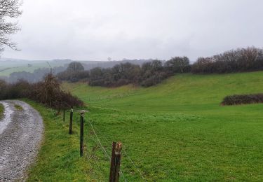
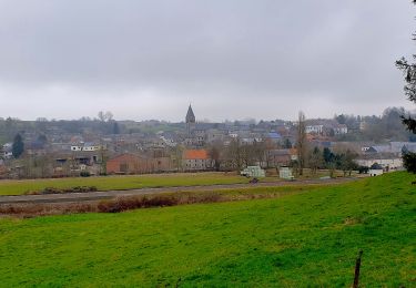
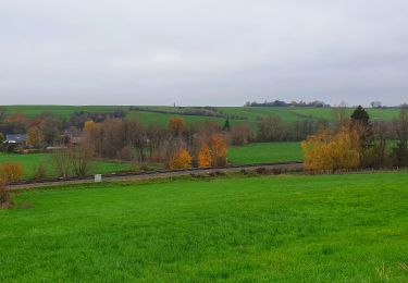
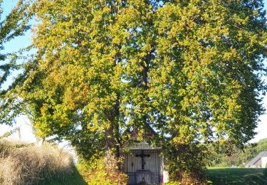
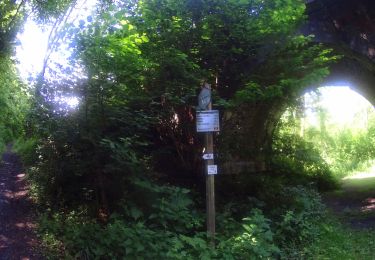
Balade dans l’entité de Walcourt, du village de Chastrès au hameau de Fairoul par bois et campagnes dans la jolie région de l’Entre-Sambre-et-Meuse.Départ : Eglise de Chastrès.

Profil altimétrique

Photos

Points d'intérêt

Point d'intérêt Walcourt - Chastrès - Photo
Desrumaux
WALCOURT 
Point d'intérêt Walcourt - Chastrès - Photo
Desrumaux
WALCOURT 
Point d'intérêt Walcourt - Chastrès - Photo
Desrumaux
WALCOURT 
Point d'intérêt Walcourt - Chastrès - Photo
Desrumaux
WALCOURT 
Point d'intérêt Walcourt - Chastrès - Photo
Desrumaux
WALCOURT 
Point d'intérêt Walcourt - Vidéo - Photo
Desrumaux
WALCOURT 

Localisation

Pays :
Belgique
Région :
Wallonie
Département/Province :
Namur
Commune :
Walcourt
Localité :
Chastrès
Départ:(Dec)
Départ:(UTM)
603989 ; 5569061 (31U) N.

Randonnées à proximité

Randonnée Marche Walcourt - RL-GG-17_Walcourt_Philippeville - Photo
Marche
PRO

Marche

Très difficile
(2)
Walcourt, Wallonie, Namur, Belgique
21 km | 26 km-effort
5h 9min
Non
Randonnée Marche Walcourt - Promenade à Chastrès - Photo
Marche
GUIDE
Desrumaux

Marche

Très facile
(1)
Walcourt, Wallonie, Namur, Belgique
4,7 km | 6 km-effort
1h 10min
Oui
Randonnée Marche Walcourt - De Laneffe à Fraire par bois et campagnes - Photo
Marche
GUIDE
Desrumaux

Marche

Facile
(1)
Walcourt, Wallonie, Namur, Belgique
12,9 km | 15,5 km-effort
3h 0min
Oui
Randonnée Marche Walcourt - Randonnée autour de Walcourt - Photo
Marche
Michele Vercauteren

Marche

Moyen
(2)
Walcourt, Wallonie, Namur, Belgique
16 km | 20 km-effort
3h 43min
Oui
Randonnée Marche Walcourt - Balade à Walcourt - Photo
Marche
GUIDE
Desrumaux

Marche

Moyen
Walcourt, Wallonie, Namur, Belgique
5,9 km | 7,3 km-effort
1h 39min
Oui
Randonnée Marche Walcourt - Balade à Yves-Gomezée - Walcourt - Photo
Marche
GUIDE
Desrumaux

Marche

Difficile
Walcourt, Wallonie, Namur, Belgique
10,8 km | 13,2 km-effort
2h 59min
Oui
Randonnée Marche Ham-sur-Heure-Nalinnes - Balade à Cours-sur-Heure - Photo
Marche
GUIDE
Desrumaux

Marche

Difficile
(1)
Ham-sur-Heure-Nalinnes, Wallonie, Hainaut, Belgique
10,1 km | 13,3 km-effort
3h 44min
Oui
Randonnée Marche Walcourt - Balade à Berzée - Walcourt - Photo
Marche
GUIDE
Desrumaux

Marche

Moyen
Walcourt, Wallonie, Namur, Belgique
8,4 km | 10,4 km-effort
2h 21min
Oui
Randonnée V.T.T. Walcourt - VTT de Walcourt à Cerfontaine. - Photo
V.T.T.
GUIDE
pascalou73

V.T.T.

Très difficile
Walcourt, Wallonie, Namur, Belgique
48 km | 59 km-effort
4h 6min
Oui


Fermer
Mes abonnements