Randonnée Marche Appy - Etang d'appy - Photo
 sga31
sga31

Utilisateur

© OpenStreetMap contributors
Longueur
Longueur
4,2 km
Altitude max
Altitude max
1749 m
Dénivelé positif
Dénivelé positif
759 m
Km-Effort
Km-Effort  
11,8 km
Altitude min
Altitude min
988 m
Dénivelé négatif
Dénivelé négatif
2 m
Boucle
Boucle
Non
Date de création :
2014-12-10 00:00:00.0
Dernière modification :
2014-12-10 00:00:00.0

(1 Avis)

Marche
Marche
2h45
Difficulté : Moyen

Scannez ce code QR pour ouvrir la randonnée dans l'application SityTrail

Application GPS de randonnée GRATUITE

Logo SityTrail SityTrail

IGN / Instituts géographiques

Télécharger SityTrail sur l'App Store Télécharger SityTrail sur Google Play

Logo SityTrail SityTrail World

Le monde est à vous

Télécharger SityTrail sur l'App Store Télécharger SityTrail sur Google Play Télécharger SityTrail sur Huawei AppGallery

À propos

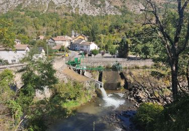
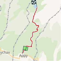
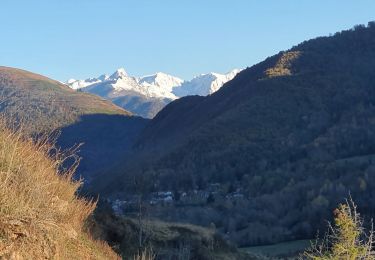
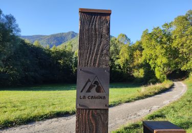
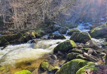
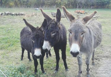
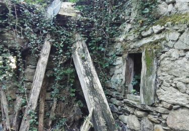
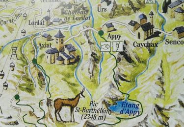
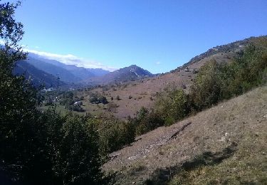
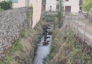
Randonnée Marche de 4,2 km à découvrir à Occitanie, Ariège, Appy. Cette randonnée est proposée par sga31.

Profil altimétrique

Points d'intérêt

Point d'intérêt Appy - Parking Appy - Photo
sga31
Point d'intérêt Appy - Bifurcation - Photo
sga31
Point d'intérêt Appy - Croupe herbeuse - Photo
sga31
Point d'intérêt Appy - Etang d Appy - Photo
sga31

Localisation

Pays :
France
Région :
Occitanie
Département/Province :
Ariège
Commune :
Appy
Localité :
Unknown
Départ:(Dec)
Départ:(UTM)
396368 ; 4738447 (31T) N.

Commentaires

Veuillez vous connecter pour laisser un commentaire ou une note


Randonnées à proximité

Randonnée Marche Vèbre - rocher de Courbas - Photo
Marche
chrisgps

Marche

Facile
Vèbre, Occitanie, Ariège, France
14,8 km | 25 km-effort
5h 44min
Oui
Randonnée Marche Garanou - Camina De Luzenac à Ax les thermes - Photo
Marche
c.chehere

Marche

Moyen
Garanou, Occitanie, Ariège, France
16,8 km | 24 km-effort
6h 41min
Non
Randonnée Marche Luzenac - cabane  coumels - Photo
Marche
chrisgps

Marche

Moyen
Luzenac, Occitanie, Ariège, France
8,8 km | 19,1 km-effort
6h 1min
Oui
Randonnée Marche Verdun - Verdun, Albies, Vebre - Photo
Marche
luccio20231

Marche

Facile
Verdun, Occitanie, Ariège, France
4,4 km | 6 km-effort
1h 33min
Non
Randonnée Marche Vèbre - Vebre, Lassure, La Remise, Vebre - Photo
Marche
luccio20231

Marche

Facile
Vèbre, Occitanie, Ariège, France
8,1 km | 12,6 km-effort
2h 34min
Oui
Randonnée Marche Vèbre - Vebre, Caychax. Alliés, Vebre - Photo
Marche
luccio20231

Marche

Facile
Vèbre, Occitanie, Ariège, France
9,6 km | 15,1 km-effort
2h 53min
Non
Randonnée Marche Unac - Vallée de Caussou - Photo
Marche
c.chehere

Marche

Facile
Unac, Occitanie, Ariège, France
9,1 km | 12,5 km-effort
2h 53min
Oui
Randonnée Marche Les Cabannes - Camina des Cabannes à Luzenac - Photo
Marche
c.chehere

Marche

Facile
Les Cabannes, Occitanie, Ariège, France
8,4 km | 10,6 km-effort
2h 46min
Non
Randonnée Marche Garanou - Garanou - Photo
Marche
c.chehere

Marche

Moyen
Garanou, Occitanie, Ariège, France
13,1 km | 19 km-effort
5h 34min
Oui


Fermer
Mes abonnements