Randonnée Marche Chaux-lès-Passavant - grâce diable  - Photo
 eltonnermou
eltonnermou

Utilisateur

© OpenStreetMap contributors
Longueur
Longueur
7,7 km
Altitude max
Altitude max
550 m
Dénivelé positif
Dénivelé positif
168 m
Km-Effort
Km-Effort  
9,9 km
Altitude min
Altitude min
432 m
Dénivelé négatif
Dénivelé négatif
152 m
Boucle
Boucle
Oui
Date de création :
2021-03-12 12:38:22.133
Dernière modification :
2021-03-17 12:43:52.214

(0 Avis)

Marche
Marche
1h16
Difficulté : Très facile

Scannez ce code QR pour ouvrir la randonnée dans l'application SityTrail

Application GPS de randonnée GRATUITE

Logo SityTrail SityTrail

IGN / Instituts géographiques

Télécharger SityTrail sur l'App Store Télécharger SityTrail sur Google Play

Logo SityTrail SityTrail World

Le monde est à vous

Télécharger SityTrail sur l'App Store Télécharger SityTrail sur Google Play Télécharger SityTrail sur Huawei AppGallery

À propos

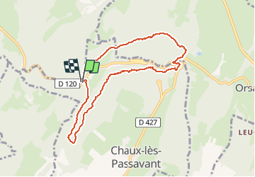
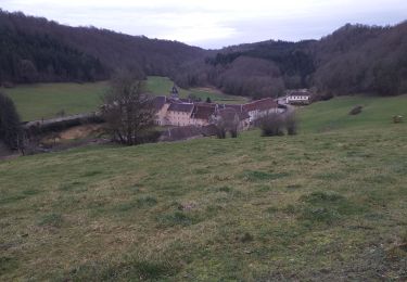
Randonnée Marche de 7,7 km à découvrir à Bourgogne-Franche-Comté, Doubs, Chaux-lès-Passavant. Cette randonnée est proposée par eltonnermou.

Description

2 possibilités suivre le bord de la falaise avec passage sur des lapias, cette sente est très nettement marquée un peu avant le belvédère sur la grâce dieu ; l'autre possibilité est de suivre ce beau chemin empierré et faire les AR pour aller aux belvédères.
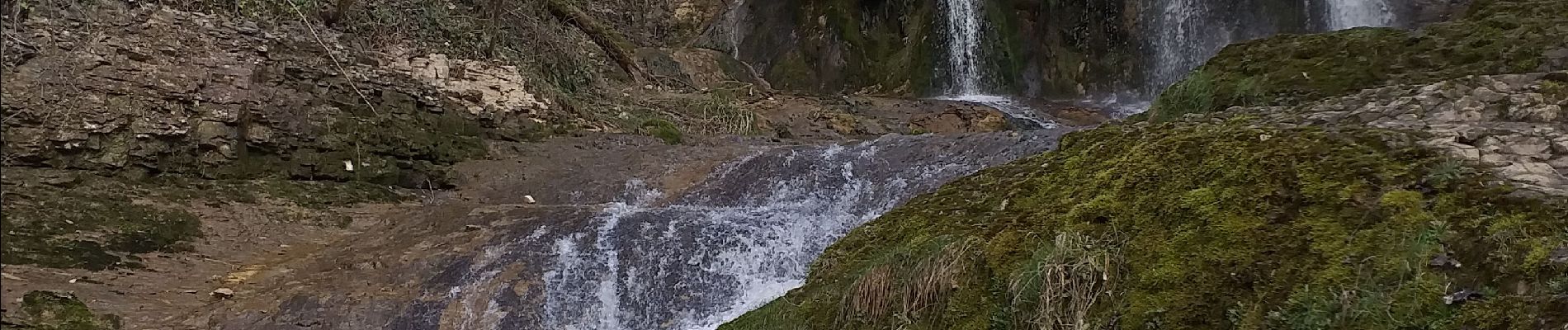
pour voir la cascade du pied faire AR en voiture, malheureusement la randonnée passe sur les
a compléter

Profil altimétrique

Photos

Localisation

Pays :
France
Région :
Bourgogne-Franche-Comté
Département/Province :
Doubs
Commune :
Chaux-lès-Passavant
Localité :
Unknown
Départ:(UTM)
299182 ; 5236194 (32T) N.

Randonnées à proximité

Randonnée Marche Chaux-lès-Passavant - sur les terres de Louis Pergaud. - Chaux passavant - Photo
Marche
eltonnermou

Marche

Moyen
(1)
Chaux-lès-Passavant, Bourgogne-Franche-Comté, Doubs, France
14,7 km | 17,7 km-effort
2h 23min
Oui
Randonnée Marche  - aissey  - Photo
Marche
eltonnermou

Marche

Très difficile
, Bourgogne-Franche-Comté, Doubs, France
18,2 km | 23 km-effort
5h 17min
Oui
Randonnée A pied  - L'Abbaye de Grâce-Dieu - Photo
A pied
PRO

A pied

Facile
, Bourgogne-Franche-Comté, Doubs, France
12,5 km | 17,4 km-effort
3h 57min
Oui
Randonnée Marche Chaux-lès-Passavant - grâce diable retour par coteau opposé - Photo
Marche
eltonnermou

Marche

Facile
Chaux-lès-Passavant, Bourgogne-Franche-Comté, Doubs, France
8,5 km | 11,1 km-effort
2h 11min
Oui
Randonnée Marche Gonsans - 14 juillet 2023 - Photo
Marche
CTR

Marche

Moyen
Gonsans, Bourgogne-Franche-Comté, Doubs, France
6,2 km | 7,7 km-effort
2h 3min
Oui
Randonnée Marche Chaux-lès-Passavant - Abbaye Grâce Dieu Glacière et belvédères et visites - Photo
Marche
BernardSalomon

Marche

Facile
Chaux-lès-Passavant, Bourgogne-Franche-Comté, Doubs, France
9,1 km | 11,5 km-effort
3h 56min
Oui
Randonnée V.T.T. Gonsans - Vélo gonsans - Photo
V.T.T.
CTR

V.T.T.

Facile
Gonsans, Bourgogne-Franche-Comté, Doubs, France
12,3 km | 15,3 km-effort
1h 29min
Oui
Randonnée Marche Gonsans - Gonsans 7 - Photo
Marche
CTR

Marche

Moyen
Gonsans, Bourgogne-Franche-Comté, Doubs, France
8,6 km | 10,1 km-effort
1h 56min
Oui
Randonnée Marche Gonsans - 31 décembre 2021 - Photo
Marche
CTR

Marche

Moyen
Gonsans, Bourgogne-Franche-Comté, Doubs, France
8,3 km | 10,4 km-effort
2h 25min
Oui


Fermer
Mes abonnements