Randonnée Marche Châtel-Guyon - Boucle de Rochepradière en passant par Douhady - Photo

Boucle de Rochepradière en passant par Douhady

 Gegetop
Gegetop

Utilisateur

© OpenStreetMap contributors
Longueur
Longueur
6,7 km
Altitude max
Altitude max
739 m
Dénivelé positif
Dénivelé positif
233 m
Km-Effort
Km-Effort  
9,7 km
Altitude min
Altitude min
513 m
Dénivelé négatif
Dénivelé négatif
229 m
Boucle
Boucle
Oui
Date de création :
2014-12-10 00:00:00.0
Dernière modification :
2014-12-10 00:00:00.0

(1 Avis)

Marche
Marche
2h06
Difficulté : Facile

Scannez ce code QR pour ouvrir la randonnée dans l'application SityTrail

Application GPS de randonnée GRATUITE

Logo SityTrail SityTrail

IGN / Instituts géographiques

Télécharger SityTrail sur l'App Store Télécharger SityTrail sur Google Play

Logo SityTrail SityTrail World

Le monde est à vous

Télécharger SityTrail sur l'App Store Télécharger SityTrail sur Google Play Télécharger SityTrail sur Huawei AppGallery

À propos

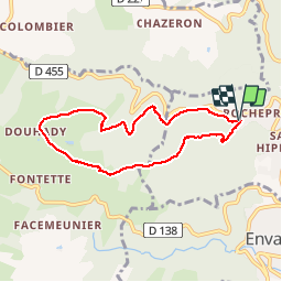
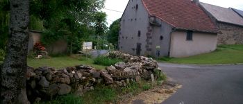
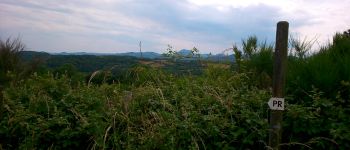
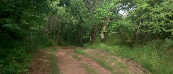
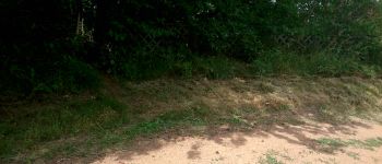
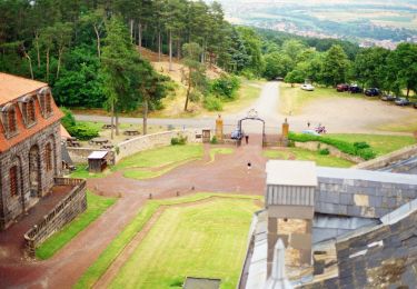
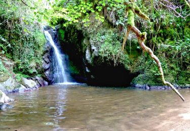
Randonnée Marche de 6,7 km à découvrir à Auvergne-Rhône-Alpes, Puy-de-Dôme, Châtel-Guyon. Cette randonnée est proposée par Gegetop.

Description

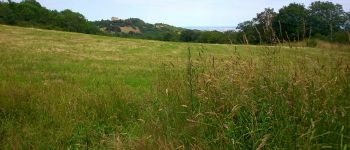
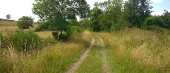
Balade facile la plupart en sous bois à faire en famille.

Profil altimétrique

Photos

Points d'intérêt

Point d'intérêt Charbonnières-les-Varennes - Point 1 - Photo
Gegetop
CHARBONNIÈRES-LES-VARENNES 
Point d'intérêt Charbonnières-les-Varennes - Point 2 - Photo
Gegetop
CHARBONNIÈRES-LES-VARENNES 
Point d'intérêt Charbonnières-les-Varennes - Point 3 - Photo
Gegetop
CHARBONNIÈRES-LES-VARENNES 
Point d'intérêt Charbonnières-les-Varennes - Point 4 - Photo
Gegetop
CHARBONNIÈRES-LES-VARENNES 
Point d'intérêt Charbonnières-les-Varennes - Point 5 - Photo
Gegetop
CHARBONNIÈRES-LES-VARENNES 
Point d'intérêt Charbonnières-les-Varennes - Point 6 - Photo
Gegetop
CHARBONNIÈRES-LES-VARENNES 
Point d'intérêt Charbonnières-les-Varennes - Point 7 - Photo
Gegetop
CHARBONNIÈRES-LES-VARENNES 
Point d'intérêt Charbonnières-les-Varennes - Point 8 - Photo
Gegetop
CHARBONNIÈRES-LES-VARENNES 
Point d'intérêt Charbonnières-les-Varennes - Point 9 - Photo
Gegetop
CHARBONNIÈRES-LES-VARENNES 
Point d'intérêt Châtel-Guyon - Point 10 - Photo
Gegetop
CHÂTEL-GUYON 
Point d'intérêt Châtel-Guyon - Point 11 - Photo
Gegetop
CHÂTEL-GUYON 

Localisation

Pays :
France
Région :
Auvergne-Rhône-Alpes
Département/Province :
Puy-de-Dôme
Commune :
Châtel-Guyon
Localité :
Unknown
Départ:(Dec)
Départ:(UTM)
503565 ; 5084357 (31T) N.

Commentaires

Veuillez vous connecter pour laisser un commentaire ou une note


Excellent. !


Randonnées à proximité

Randonnée A pied Loubeyrat - La Vallee des Prades - Photo
A pied
PRO

A pied

Facile
(1)
Loubeyrat, Auvergne-Rhône-Alpes, Puy-de-Dôme, France
11,1 km | 15,6 km-effort
3h 33min
Oui
Randonnée Marche Enval - Enval_Gorges - Photo
Marche
GUIDE
jagarnier

Marche

Moyen
(1)
Enval, Auvergne-Rhône-Alpes, Puy-de-Dôme, France
9,1 km | 13,2 km-effort
2h 45min
Oui
Randonnée Marche Loubeyrat - Le roc du diable - Prompsat - Photo
Marche
Gegetop

Marche

Moyen
(1)
Loubeyrat, Auvergne-Rhône-Alpes, Puy-de-Dôme, France
9,5 km | 13,4 km-effort
2h 20min
Oui
Randonnée Marche Teilhède - Teilhede - Photo
Marche
Gegetop

Marche

Facile
(1)
Teilhède, Auvergne-Rhône-Alpes, Puy-de-Dôme, France
6,5 km | 8,7 km-effort
1h 38min
Oui
Randonnée Marche Gimeaux - Chemin de Fontête - Photo
Marche
Gegetop

Marche

Facile
(2)
Gimeaux, Auvergne-Rhône-Alpes, Puy-de-Dôme, France
8,6 km | 11,9 km-effort
2h 6min
Oui
Randonnée Marche Châtel-Guyon - Les Briffons-Bois d'Agnat - Photo
Marche
Gegetop

Marche

Facile
(2)
Châtel-Guyon, Auvergne-Rhône-Alpes, Puy-de-Dôme, France
10,6 km | 14,8 km-effort
3h 14min
Oui
Randonnée Marche Châtel-Guyon - Chazeron sans souci - Photo
Marche
Gegetop

Marche

Facile
(1)
Châtel-Guyon, Auvergne-Rhône-Alpes, Puy-de-Dôme, France
6,6 km | 9,7 km-effort
1h 45min
Oui
Randonnée Marche Châtel-Guyon - Le tour de Montaclier - Saint Hippolyte - Photo
Marche
tracegps

Marche

Difficile
(1)
Châtel-Guyon, Auvergne-Rhône-Alpes, Puy-de-Dôme, France
14 km | 19,6 km-effort
3h 30min
Oui
Randonnée V.T.T. Volvic - Tour du Puy de Dôme en VTT - Photo
V.T.T.
tracegps

V.T.T.

Très difficile
(1)
Volvic, Auvergne-Rhône-Alpes, Puy-de-Dôme, France
62 km | 85 km-effort
5h 30min
Oui


Fermer
Mes abonnements