Randonnée Marche Cairanne - Cairanne - Photo
 legios84
legios84

Utilisateur

© OpenStreetMap contributors
Longueur
Longueur
22 km
Altitude max
Altitude max
363 m
Dénivelé positif
Dénivelé positif
511 m
Km-Effort
Km-Effort  
28 km
Altitude min
Altitude min
136 m
Dénivelé négatif
Dénivelé négatif
512 m
Boucle
Boucle
Oui
Date de création :
2014-12-10 00:00:00.0
Dernière modification :
2014-12-10 00:00:00.0

(1 Avis)

Marche
Marche
4h32
Difficulté : Moyen

Scannez ce code QR pour ouvrir la randonnée dans l'application SityTrail

Application GPS de randonnée GRATUITE

Logo SityTrail SityTrail

IGN / Instituts géographiques

Télécharger SityTrail sur l'App Store Télécharger SityTrail sur Google Play

Logo SityTrail SityTrail World

Le monde est à vous

Télécharger SityTrail sur l'App Store Télécharger SityTrail sur Google Play Télécharger SityTrail sur Huawei AppGallery

À propos

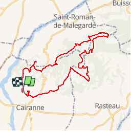
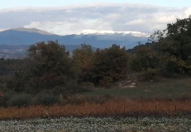
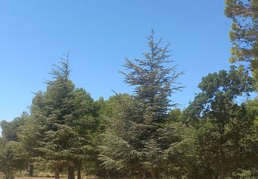
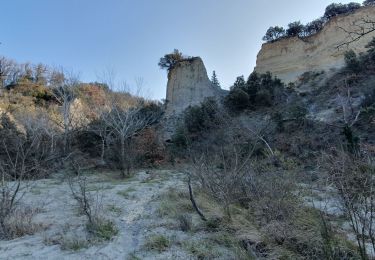
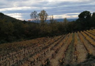
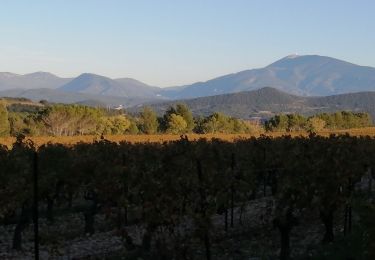
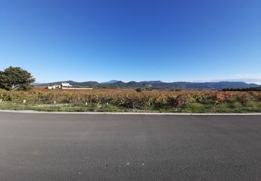
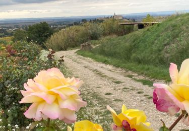
Randonnée Marche de 22 km à découvrir à Provence-Alpes-Côte d'Azur, Vaucluse, Cairanne. Cette randonnée est proposée par legios84.

Description

Le 02 11 2014

Profil altimétrique

Photos

Localisation

Pays :
France
Région :
Provence-Alpes-Côte d'Azur
Département/Province :
Vaucluse
Commune :
Cairanne
Localité :
Unknown
Départ:(Dec)
Départ:(UTM)
654001 ; 4899894 (31T) N.

Commentaires

Veuillez vous connecter pour laisser un commentaire ou une note


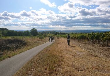
belle marche et bien ombrage


Randonnées à proximité

Randonnée Marche Cairanne - 170919 EnCours - Photo
Marche
MarcheEtReve

Marche

Très facile
Cairanne, Provence-Alpes-Côte d'Azur, Vaucluse, France
7,9 km | 11 km-effort
2h 19min
Oui
Randonnée Vélo Sainte-Cécile-les-Vignes - Circuit Vélo - Circuit Aygues Ouvèze -  Ste Cecile les vignes - Photo
Vélo
tracegps

Vélo

Moyen
Sainte-Cécile-les-Vignes, Provence-Alpes-Côte d'Azur, Vaucluse, France
26 km | 28 km-effort
2h 30min
Oui
Randonnée Marche Cairanne - cairanne sentier bouteille - Photo
Marche
Vero7684

Marche

Facile
Cairanne, Provence-Alpes-Côte d'Azur, Vaucluse, France
5,8 km | 8 km-effort
1h 38min
Non
Randonnée Marche Saint-Roman-de-Malegarde - Serre de la Garde - Photo
Marche
counoise

Marche

Facile
Saint-Roman-de-Malegarde, Provence-Alpes-Côte d'Azur, Vaucluse, France
9 km | 11,6 km-effort
2h 3min
Oui
Randonnée Marche Cairanne - Les Terrasses de l'Aygues - Photo
Marche
MarcLEBARON

Marche

Facile
Cairanne, Provence-Alpes-Côte d'Azur, Vaucluse, France
11,5 km | 15,3 km-effort
3h 4min
Oui
Randonnée Marche Saint-Roman-de-Malegarde - le serre de la garde  - Photo
Marche
Vero7684

Marche

Facile
Saint-Roman-de-Malegarde, Provence-Alpes-Côte d'Azur, Vaucluse, France
4,3 km | 5,3 km-effort
1h 37min
Oui
Randonnée Marche Rasteau - rasteau  - Photo
Marche
Vero7684

Marche

Facile
Rasteau, Provence-Alpes-Côte d'Azur, Vaucluse, France
9 km | 11,3 km-effort
2h 29min
Oui
Randonnée Marche Rasteau - Rasteau - Photo
Marche
ARPF2

Marche

Très difficile
Rasteau, Provence-Alpes-Côte d'Azur, Vaucluse, France
17 km | 22 km-effort
6h 55min
Oui
Randonnée Marche Cairanne - Cairanne  - Photo
Marche
aitkhedache

Marche

Très facile
Cairanne, Provence-Alpes-Côte d'Azur, Vaucluse, France
4,9 km | 7 km-effort
2h 10min
Non


Fermer
Mes abonnements